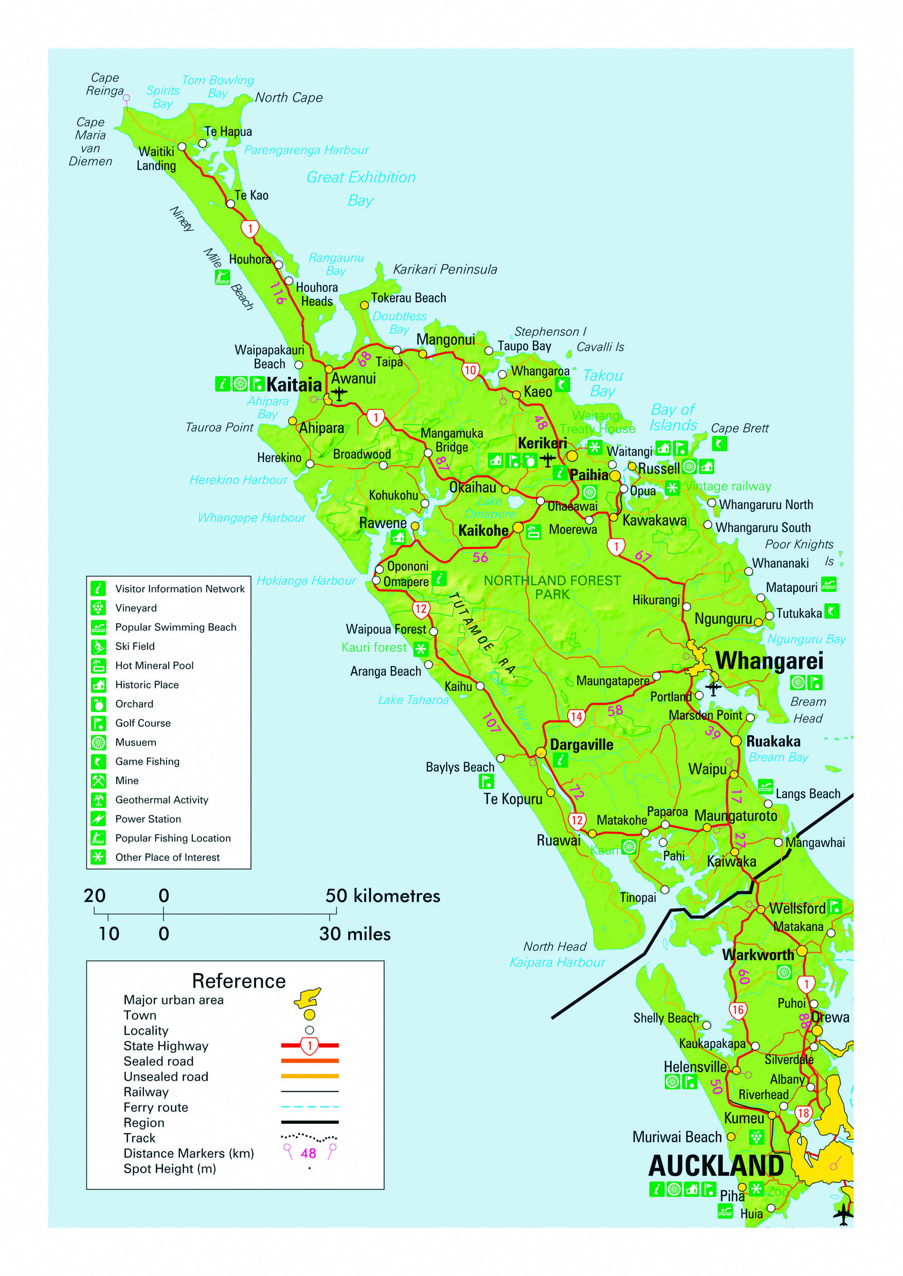
Reaching out towards the rest of the world, the 330 km long Northland Peninsular was the first part of New Zealand that arriving Maori and European settlers encountered. This results in much fascinating history, from the house at which the nation’s founding document - the Treaty of Waitangi - was signed in 1840 to the sites where some of the earliest subsequent battles of the New Zealand Wars over land acquisition were fought. Erosion prone soils of a relatively low quality in a country where farming and forestry have traditionally been important industries resulted in the region long remaining something of a poor cousin to the rest of New Zealand subsequent to the arrival of Europeans. Northland continued to rely upon coastal trading vessels for reliable connection with the rest of the country until as late as the 1930s. Known as the Winterless North, the climate is maritime sub-tropical and only experiences light frosts in sheltered areas on a handful of nights each year. Typical daytime temperatures range from 12 degrees during winter months to 20 during the summer, with occasional warm days reaching the high 20s. The mild climate resulted in extensive ancient Kauri forests covering much of Northland in pre European times, providing a valuable resource for early settlers. Remnants of the original forests remain where trees with trunks in excess of 10 m in diameter can be easily viewed.
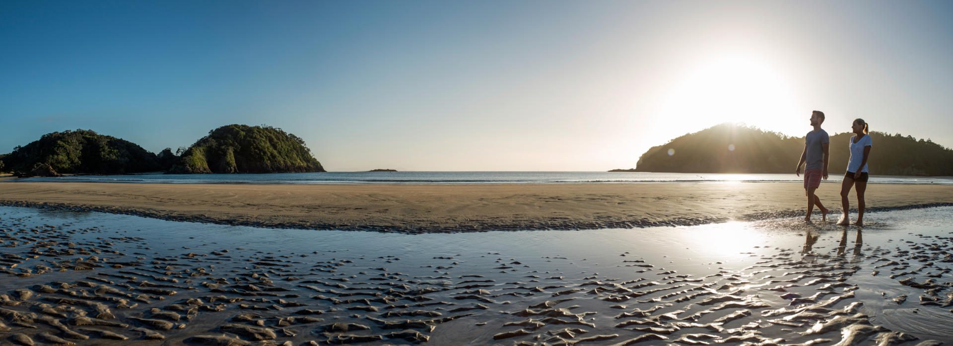
The absence of climatic extremes also ensures that horticulture has been added as a significant industry these days and opportunities abound for independent travelers touring in the comfort of their own motorhome to purchase fruit directly from growers throughout the region. Northland is also known for its many fine beaches, ranging from long exposed stretches of sand up to 107 km in length on the west coast, to photogenic sheltered coves in the east. The region’s waters are home to game fish and world class diving locations around offshore islands, with water temperatures reaching the low to mid 20s during summertime. Northland is often overlooked by visitors from abroad with limited time schedules. However, it is not unheard of for New Zealand Frontiers’ clients on longer duration itineraries to spend a leisurely week or more north of Auckland, covering over 1000 km before heading off to see the rest of the country. For those with less time, a shorter visit of one or two nights venturing only as far north as the Bay of Islands is well worth considering. Not surprisingly, Northland’s attractions and close proximity to the Auckland region’s population make it a popular destination for domestic tourists, particularly during the summer months.
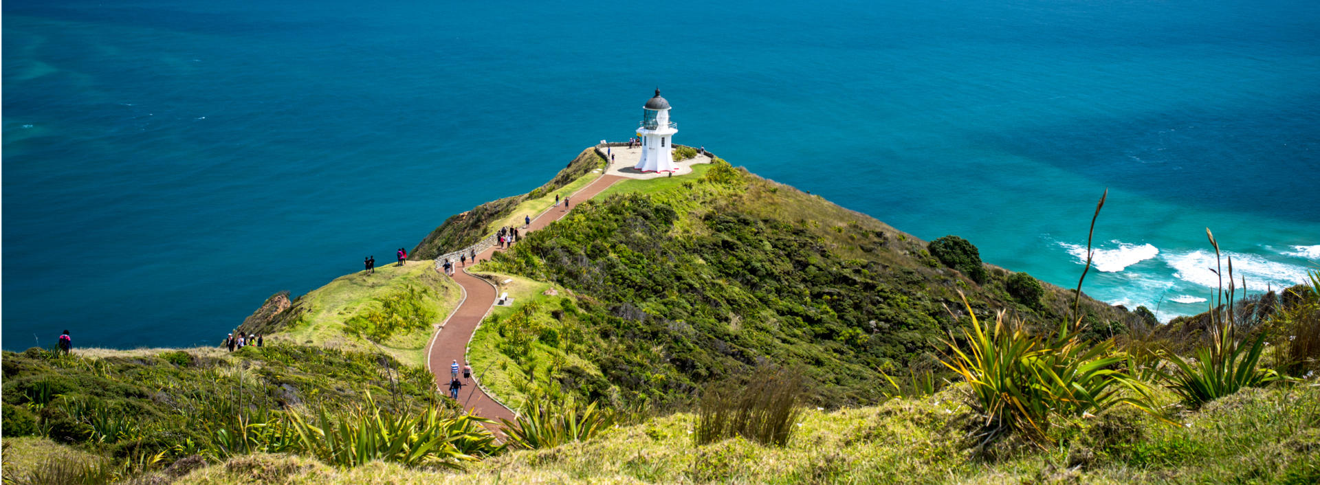
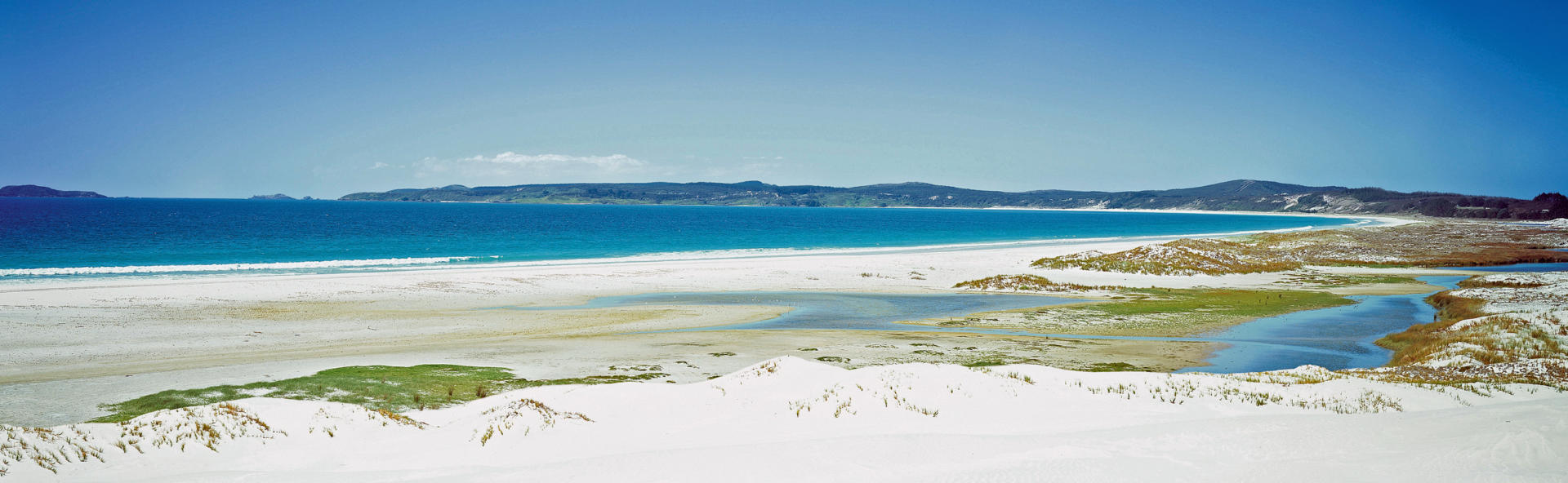
Northland’s Cape Reinga is the northern most terminus of SH1 that runs the full length of New Zealand. From Cape Reinga it’s over 100 km southward to the nearest town of Kaitaia, and a 2048 km drive to Slope Point in Southland. A panoramic (though not always tranquil) view one of the few places in the world where two oceans can be seen meeting is gained from the easy walk to the cape’s prominent lighthouse. The name Reinga means underworld in our native Maori language and is a reference to the sanctity of the locality, from where the spirits of the dead are believed to depart our shores on their return journey to the ancestral Pacific homeland of Hawaiki. Although the true northernmost point of New Zealand’s mainland reaches out a further three kilometres towards the rest of the world 30 km to the east, at 34.43 degrees south Cape Reinga does represent the most northerly point to which public access can be achieved by vehicle. Spectacular coastal walks are available and the contrasting currents of the Tasman Sea and the Pacific Ocean, combined with a shallow sandbar ensures that one actually witnesses the meeting of the two bodies of water. The cape lies near the top of the 10 km wide Aupouri Peninsular, the western coast of which is formed by an 88 km long beach misleadingly named 90 Mile Beach. Other scenic attractions in the area include the Te Paki sand dunes that tower to over 250 ft in height and the glistening Parengarenga Harbour, from where kuaka (bar-tailed godwits) take flight at the end of each summer for Alaska and Siberia on one of the world’s longest migrations. Nearby vehicle accessible DoC campsites offer the opportunity to linger should your self-drive itinerary provide the time to overnight in a fascinating, culturally significant area seen by less than five percent of visitors to the country.

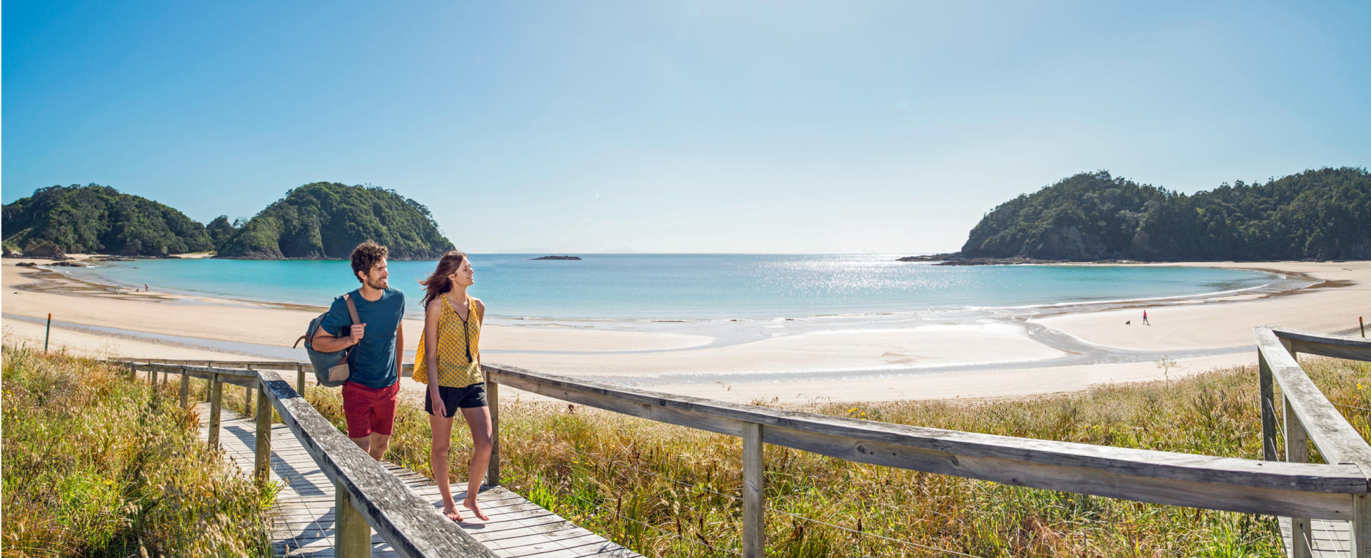
The almost 30 km long Karikari Peninsular is a scenic gem that is universally complimented by New Zealand Frontiers clients. The peninsular is sufficiently remote to enjoy ‘peaceful backwater’ status for all but the peak summer months, a key feature of its appeal. Like much of the warmer north of the country, the area featured widespread pre-European settlement and remains culturally significant to the local Maori guardians. Popular activities include chilling out on gorgeous white sanded beaches, with Karikari Beach and Matai Bay rating among the finest you’ll experience anywhere. Rotopokaka (Coca Cola Lake), named for its remarkable colour, and bird watching opportunities at the neighbouring Waimango Swamp wetland are other attractions. Golf can be enjoyed at an exclusive resort and dive gear can be hired to explore the coastal marine life. Idyllic overnighting opportunities for those travelling by campervan are available in both DoC and commercially operated campgrounds at Matai Bay and Whatuwhiwhi.
Doubtless Bay is well known among locals as a great place to relax in the subtropical climate that prevails in New Zealand’s Far North. Located on SH10, the area offers a string of seaside settlements with interesting pre and post-European history centred upon the sheltered access to coastal resources. Taipa Beach, Cable Bay, Coopers Beach and Mill Bay offer everything from holiday parks to icecreams, while the fishing village of Mangonui claims one of the country’s most popular fish and chip shops.
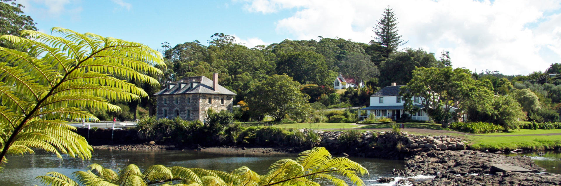
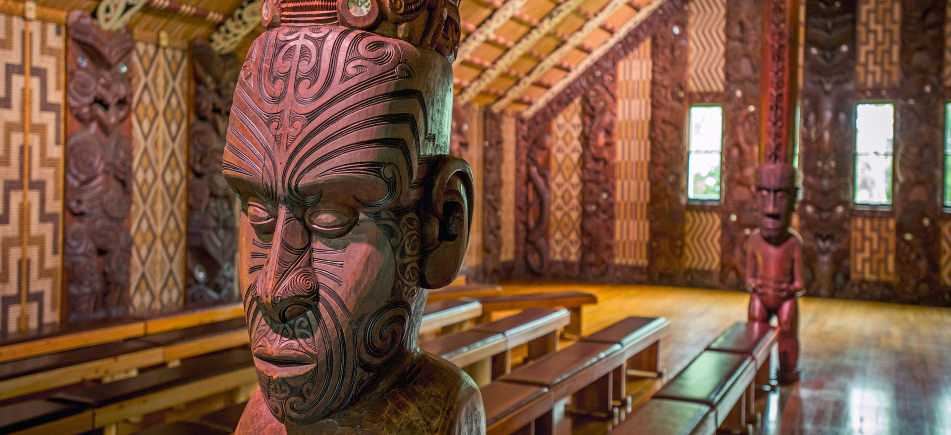
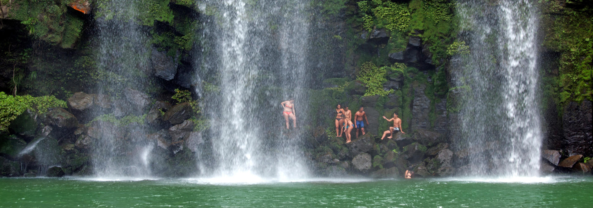
Kerikeri’s subtropical climate has ensured that it has long had a strong local horticultural industry. Indeed an early missionary planted grapes here as early as 1819 – believed to be the first in the country. Recent internal migration away from Auckland’s inflated property prices has seen the locality blossom as a popular home for retirees who boast of moving to place that’s “so nice they named it twice”. The quaint town centre and appealing temperatures are equally attractive to visitors. The area boasts interesting history with the country’s oldest building, the Mission House, dating from 1822 only a short drive away. Right next door is New Zealand’s oldest stone building, the Stone Store, which was completed in 1836 – still four years before the nation’s founding Treaty of Waitangi was signed. Other attractions include Rewa’s Village, a re-creation of a Maori village, and the nearby Rainbow Falls are well worth the pleasant walk required to reach them.
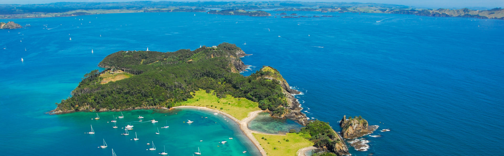
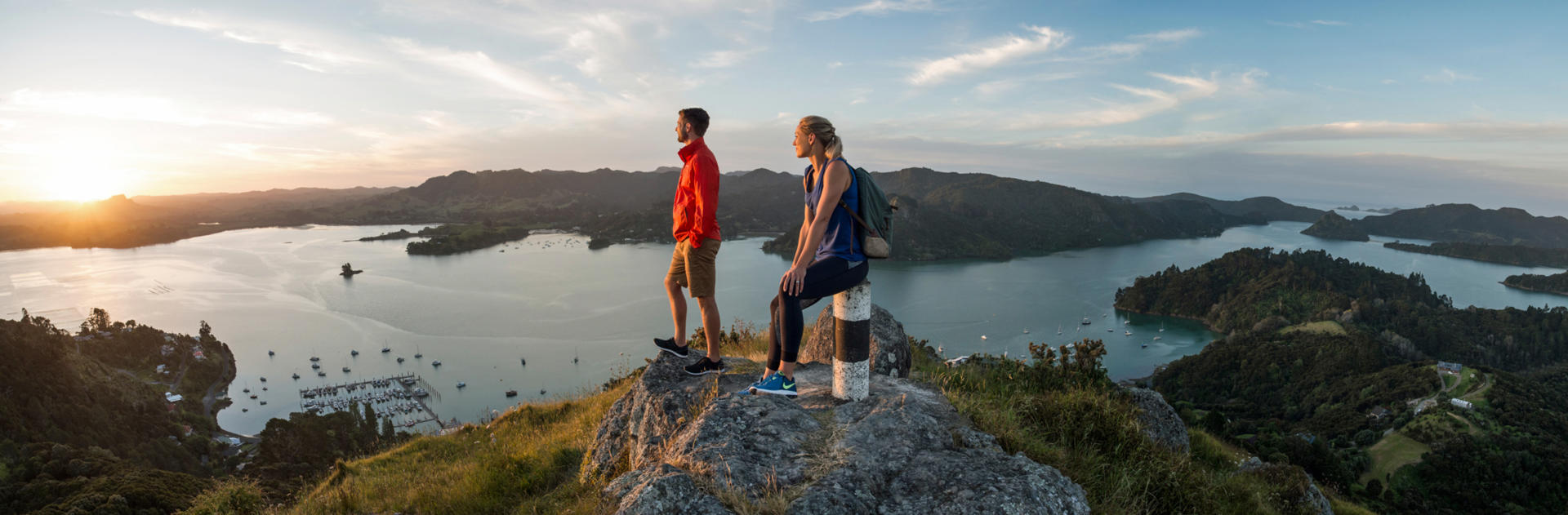
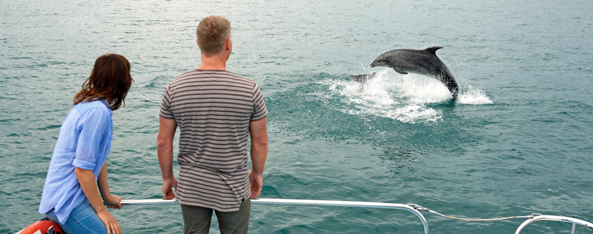
This aptly named sparkling bay embraces 144 islands within its 260 sq km and a cruise among them is one of the key attractions of the region. Situated a four hour drive north of Auckland, the Bay of Islands is famed for its beaches, as home to settlements that constitute the cradle of the nation’s European heritage, and for its boating and fishing allure. As one of New Zealand’s scenic gems it was a popular destination for the Californian writer and big game fisherman Zane Grey in the 1930s - whose publicity sealed the area’s success as a destination. Sea temperatures reach 22 degrees in January and February and opportunities abound to swim with dolphins, go kayaking, sail aboard a tall ship, see if can catch a marlin for your motorhome’s fridge, and retrace the route of mail delivery boats. Wonderful local walks and short ferry rides beckon those unable to accommodate the time or the budget of a day long cruise. The adjacent settlements of Russell, Paihia and Waitangi bustle with activity during the summer months and each tempts a lingering stay with a range of holiday parks for independent travellers.
Waitangi holds a special place in the history of New Zealand as the location for the signing of a treaty regarding the sovereignty of the country, at a time when the European population of the entire country was likely limited to around 1000 and the Maori population numbered as many 100,000. The locality was a natural choice as it was a place at which local chiefs had long met, and at which a home had been established for an official British Resident in 1833. Regarded as the country’s founding document, the Treaty of Waitangi superseded an earlier Declaration of Independence when it received its first 40 signatures after much debate on the 6th of February 1840. By the end of the year the document had been signed by 500 chiefs during a tour of the country. The fact that there were subtle but important variations between the Maori and English language translations of the document has complicated the interpretation of its intentions ever since, and ongoing reservations about compliance with its articles often results in the annual Waitangi Day celebrations attracting protests. The official residence, known as the Treaty House, remains beautifully restored as an important piece of our heritage. The surrounding grounds are immaculately maintained and, together with the associated visitor centre, make for a fascinating visit. In the immediate vicinity are a superbly located golf course and mountain-bike park, and an excellent board walk through a mangrove forest takes walkers to the nearby Haruru Falls.
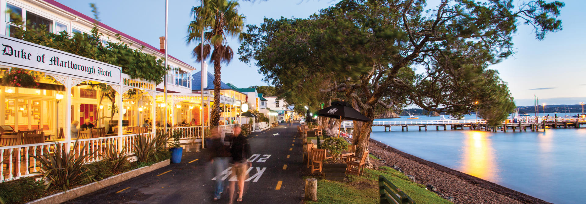
Paihia serves as the departure point for many of the Bay of Islands’ most popular cruises and other water-based activities, and is the beautifully located commercial hub of ‘The Bay’. The tranquil location makes a leisurely waterfront stroll an attractive proposition. A ferry awaits to cross the bay at regular intervals to the historic town of Russell, and Waitangi is an easy walk away along the foreshore. A supermarket is available to stock up your camper and gift galleries display quality souvenirs. Legend has it that the name Paihia has the distinction among New Zealand’s place names as combining the Maori word for ‘Good’ and a corruption of the English ‘Here’. Visitors agree without exception.
Russell, or Kororareka by its original name, is an absolute gem of a village where time passes at a more leisurely pace. Cafes with magnificent views are hard to resist, and in the evening you may even get to watch big game fishing boats return with marlin to be weighed on the wharf. Like the wider Bay of Islands, Russell’s sheltered setting has resulted in it being populated since early Maori arrivals, likely as long as 800 years ago. The same appeal also made it a popular locality for early European settlers, many of whom brought unruliness to a land that lacked the type of governance they were familiar with, such that for some time Russell was known as the ‘Hell Hole of the Pacific’. By the time the nation’s first capital was founded here in 1840 upon the signing nearby of the Treaty of Waitangi, Auckland had already grown to rival the early population of the Bay of Islands, and the seat of government was transferred within a year of being established. A nearby hilltop flagstaff survives, though it is noted for having had to be resurrected four times in its early history following axe-wielding protests by disenchanted local Maori. The town can be reached either on a day trip by passenger ferry from nearby Paihia, or driven to via a vehicular ferry from Opua - or by way of a significantly longer coastal route. Russell has two holiday parks and makes an idyllic base from which to explore the attractions of the wider Bay of Islands.
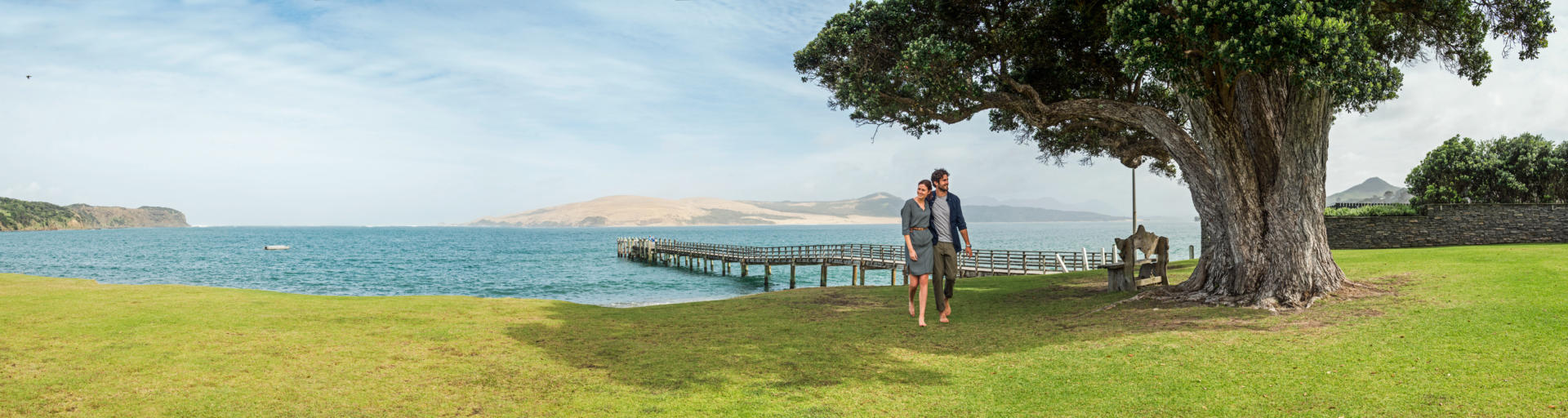
Any tour of the Northland region that lies to the north of Auckland will include a full circuit itinerary. Regardless of whether your road trip takes you to the top of the country or only as far as the Bay of Islands, your travels will traverse the Hokianga region. The area offers opportunities to pass through picturesque sleepy rural and harbour side townships, learn about some of our earliest European history, and to experience New Zealand’s economic diversity in a region popular with people seeking unsophisticated lifestyles. Opononi earned itself a place in New Zealand’s folklore when a friendly dolphin took up residence over the summer of 1955/56 and a statue to mark the event remains on the waterfront. Activities include walks from SH12 to the spectacular heads of the Hokianga Harbour, from where views to extensive sand dunes can be enjoyed. The harbour itself is crossed at Rawene by a small vehicular ferry for those continuing to or returning from the Far North.
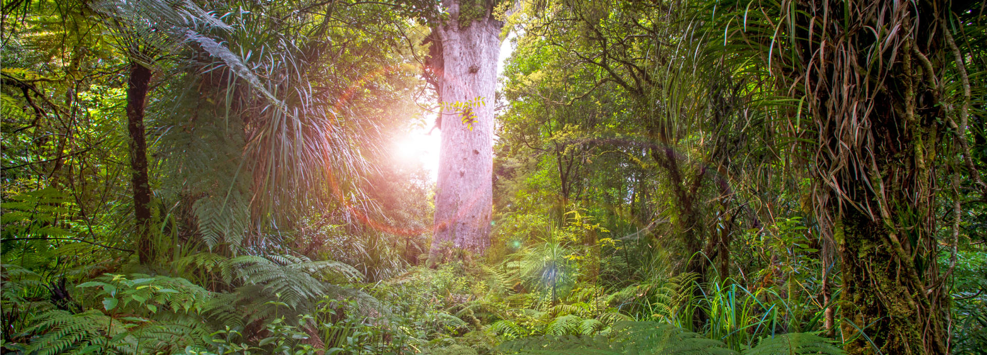
The 80 sq km Waipoua Forest is located on SH12 near Northland’s west coast and is home to some of the country’s largest remaining kauri forest. Truly extraordinary for their size, the revered Tane Mahuta and Te Mahuta Ngahere trees are both within easy walking distance of the road and are estimated to be in excess of 1500 years old. Both have trunks more than 15 m wide and over 200 m3 in volume. Bird life is abundant and sightings of kereru, the world’s largest pigeon, are routine. Guided nocturnal tours can also be taken to see the flightless kiwi. Holiday parks can be found both within the forest and at the nearby Kai Iwi Lakes. Felling and milling of the once abundant kauri forest in the north of New Zealand, as well as the collection of kauri gum, were important early industries and a superb museum on this pioneering chapter of New Zealand’s history is located 130 km south at Matakohe. Access can also be found to the 107 km long Ripiro Beach at several locations on the Kauri Coast. Driving on the beach should be avoided as bogged vehicles are frequently inundated by incoming tides, providing such regular entertainment for the locals that insurance cover does not extend to beach use of your motorhome.
The coastal circuit from Whangarei out through the peaceful seaside villages of Ngunguru, Tutukaka and Matapouri and back to SH1 at Hikurangi is one of New Zealand’s best kept secrets. Rated by National Geographic as one of its top three coastal destinations in the world, and with the nearby Poor Knights Islands being a favourite dive spot of the late Jacques Cousteau, this routinely overlooked area is highly recommended to independent travellers with the time to head north of Auckland. The quaint school in Ngunguru has some of the best views in New Zealand and was where the founder of New Zealand Frontiers and author of this guide watched dolphins from his childhood classroom windows. Although they didn't have it in my day, the school now boasts a dolphin bell that excuses children from class to assemble on the beach front! A marvelous beach walk through a string of bays is available from here, and dive trips to the Poor Knights can be taken from the marina at Tutukaka. A small, little publicised holiday park is also located in Tutukaka. Nearby a side road takes explorers to the idyllic strand of sand at Whangaumu Bay. A short drive north brings visitors to the horseshoe shaped gem of Matapouri and its sheltered beach that looks out upon a famed scuba diving and game fishing stretch of the South Pacific Ocean. Whale Bay, often quoted as among the finest secluded forest shrouded beaches in the world is accessible via another short walk. The further popular surf beaches of Sandy Bay and Wooley’s Bay are passed through on quiet roads before heading inland again.
Growing up in a largely undiscovered neighbourhood like the Tutukaka Coast in an era when the local school only needed three classrooms to cope with the district’s young folk was a true privilege. Lifelong friendships and respect were generated in a community where involvement created a healthy environment. Dad ran the volunteer fire brigade, Mum was the librarian and everybody else’s parents were involved in other aspects of community life - while the youth helped out when not sailing, swimming, fishing, horse riding or generally running around in bare feet.
Whangarei is located on SH1 158 km north of Auckland. The population of its urban area is around 60,000, with 90,000 people living in the rapidly growing wider area. It is the only city north of the Auckland region and serves as an important service town. The town centre lies at the head of a 30 km long navigable harbour and the central Town Basin, with a relaxing collection cafes, galleries and a notable clock museum is host to a fleet of nomadic cruising yachts that fly flags from around the globe. Shadowing the city centre is the prominent Mt Parihaka which, in addition to wonderful hiking trails, features the benefit of a road to the viewing platform on its 241 m high summit. The popular 26 m Whangarei Falls can also be visited in your campervan on the road to the Tutukaka Coast, or reached via a worthwhile walk from the city centre. As well as the highly recommended Tutukaka Coast, other pleasant local sights include the spectacular volcanic outcrops, surrounding beaches and sleepy harbourside villages at the Whangarei Heads - from where views of the important port, the country’s only oil refinery and nearby offshore islands can be enjoyed.