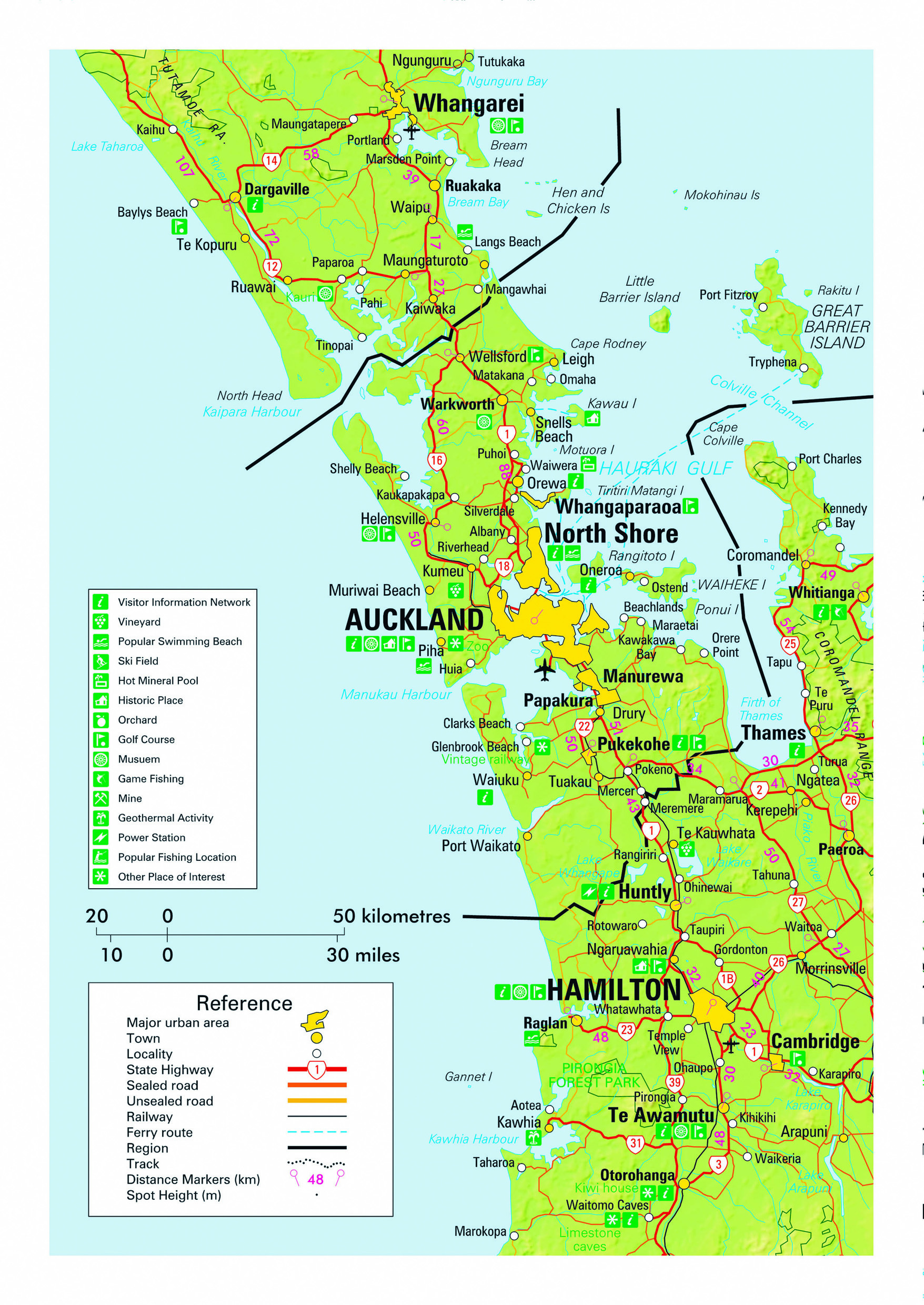
Auckland’s location between two large sheltered harbours has made it a popular centre of population since pre-European times. The 394 sq km Manukau Harbour on the western Tasman Sea coast and the 180 sq km Waitemata Harbour (and the 4000 sq km Hauraki Gulf beyond) on the Pacific Ocean coast provided ideal access to the resources of the sea for the indigenous Maori people. It is believed there may have been as many as 20,000 living in the region by the early 1800s. A rapid increase in the European (Pakeha) population in the mid-1800s saw the fledgling nation’s capital moved here from the Bay of Islands for a period of 25 years soon after the signing of the Treaty of Waitangi in 1840. These days the area administered by the Auckland Council stretches 120 km from north to south and is home to 35% of New Zealanders - with a population approaching 1.7 million people. Auckland Airport is the point of entry for over 70% of the country’s arrivals from abroad and, prior to the new era for international travel that was ushered in by the Covid-19 pandemic, was handling in excess of 20 million passengers each year.
The most heavily urbanised region in the country is one of a handful in the world to be built on a volcanic field and the 53 volcanoes, active from 250,000 to just a few hundred years ago, are an iconic feature of the region. Cones of 200 m in height within three kilometres of the CBD are easily climbed and reward with spectacular views from the crater rims. The twin harbours and surrounding islands remain major attractions and are the source of the city’s motto as the City of Sails. Climate is oceanic/sub tropical, with typical summer and winter temperatures of 20 degrees and 11 degrees respectively. Warm days during the summer months occasionally reach 30 degrees, while overnight frosts during winter months can fall to a few degrees below zero in rural areas. The region offers a fine range of activities for independent travellers, from invigorating harbour cruises to nearby islands and an abundance of superb beaches, to peaceful parks and a range of excellent galleries and museums.
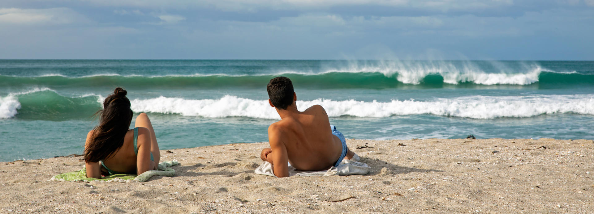
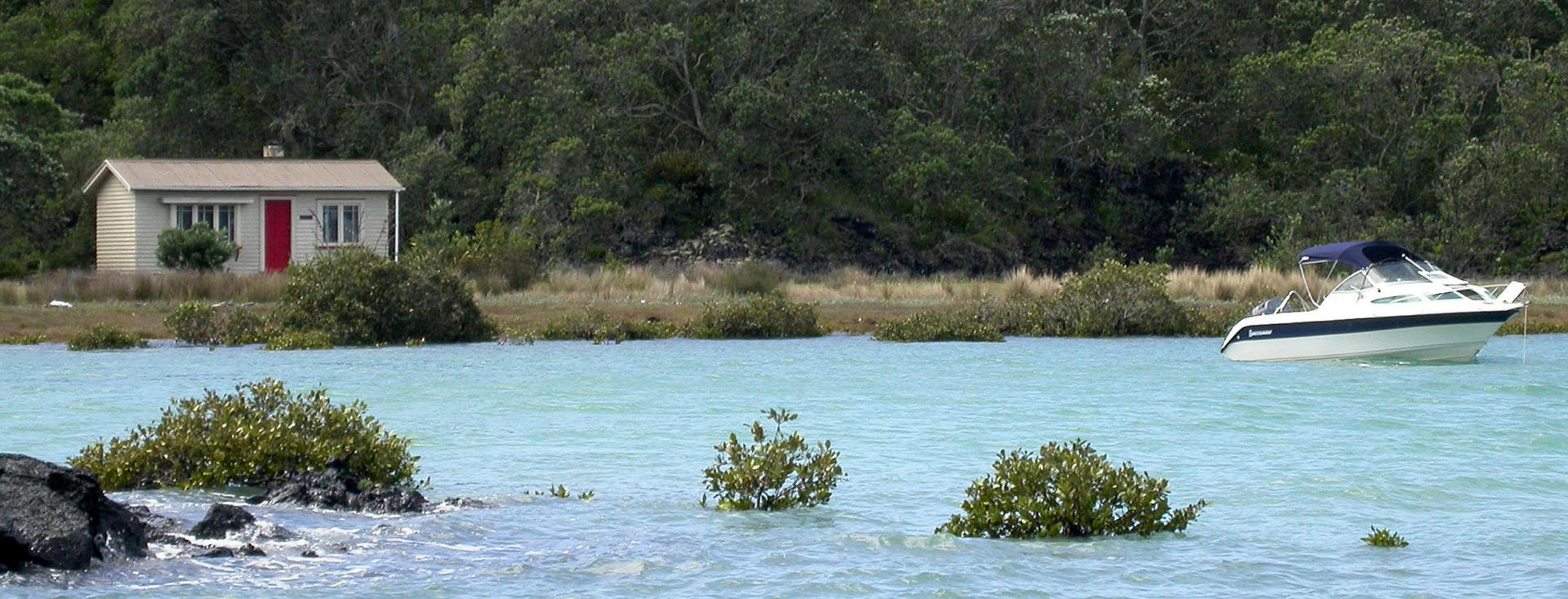
The northern coastal suburb of Orewa has one of Auckland’s most picturesque east coast beaches with nearby overnighting opportunities for independent travellers. The township is located on the Hibiscus Coast and its relaxed atmosphere has been further enhanced by extensions to Auckland’s expressway network that now passes by further inland. The old coastal SH1 route north from here is particularly scenic, carrying self-drive visitors to the Northland region. For those preferring to return to the expressway, all New Zealand Frontiers rentals feature prepaid access to toll roads. The three kilometre long Orewa Beach provides an enjoyable stroll and often affords the spectacle of kite boarders dancing across the waves. Lingering here also provides the opportunity to visit two of Auckland’s most spectacular regional parks. To the south lies the Shakespeare Regional Park at the end of the Whangaparaoa Peninsular with extensive vistas from its hiking trails and a ferry service to the nearby predator-free bird sanctuary of Tiritiri Matangi island, while to the north is the tranquil Wenderholm Regional Park with more superb beaches and great views from trails through native forest, along with a fine restored villa that British Prime Minister Anthony Eden recuperated from illness in. Both parks offer superb freedom camping facilities for motorhomes.
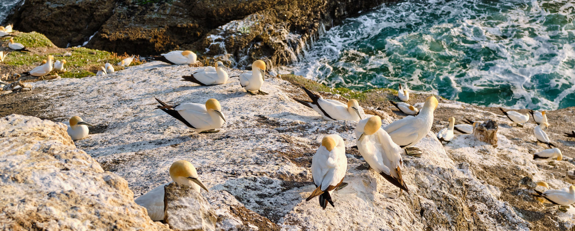
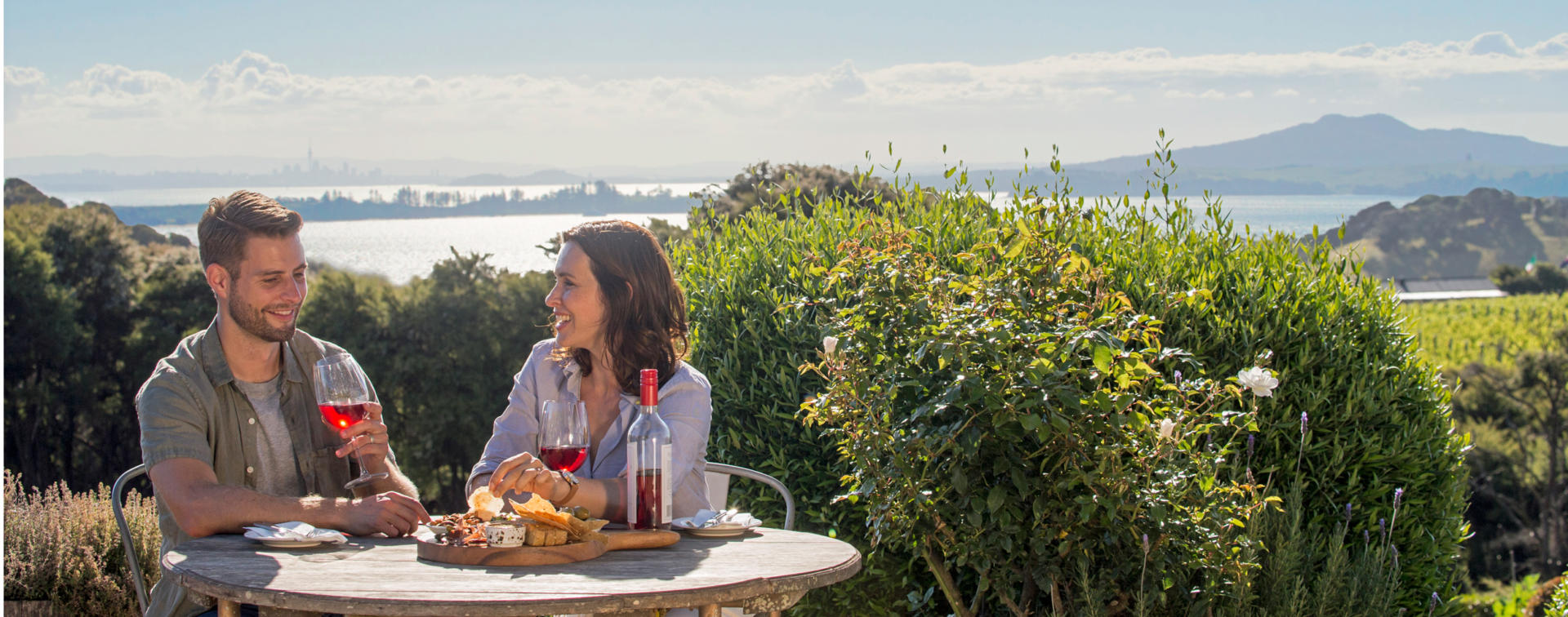
The settlement of Muriwai Beach lies 42 km northwest of Auckland’s central business district, at the southern end of a 50 km long beach. It provides excellent views of one of the seemingly endless stretches of sand that form several hundred kilometres of the upper North Island’s west coast, and is a great overnighting point for those travelling by campervan around the 800 km Twin Coast Discovery Highway that completes a scenic circuit of the Northland region. Muriwai is perhaps best known for hosting a gannet colony with over 1000 pairs of this graceful roaming oceanic seabird with its distinctive yellow head and wingspans of up to two metres. These amazing birds, known as takapu in Maori, have the ability to dive from heights of up to 30 m and enter the water at speeds as high as 100 km/hr. Juvenile New Zealand gannets routinely cross the Tasman Sea to explore the eastern Australian coastline before returning to New Zealand waters at four to five years of age. The colony is easily reached via a short trail and represents a photographer’s dream location. Muriwai marks the point where the endless west coast beaches transition from being fringed with dunes to meeting steep, forested landscapes with rocky shorelines. Between Muriwai and Auckland one passes through the Auckland region’s premiere wine country and there are several opportunities to stop by to enjoy a relaxing meal and perhaps purchase a bottle of the local nectar.
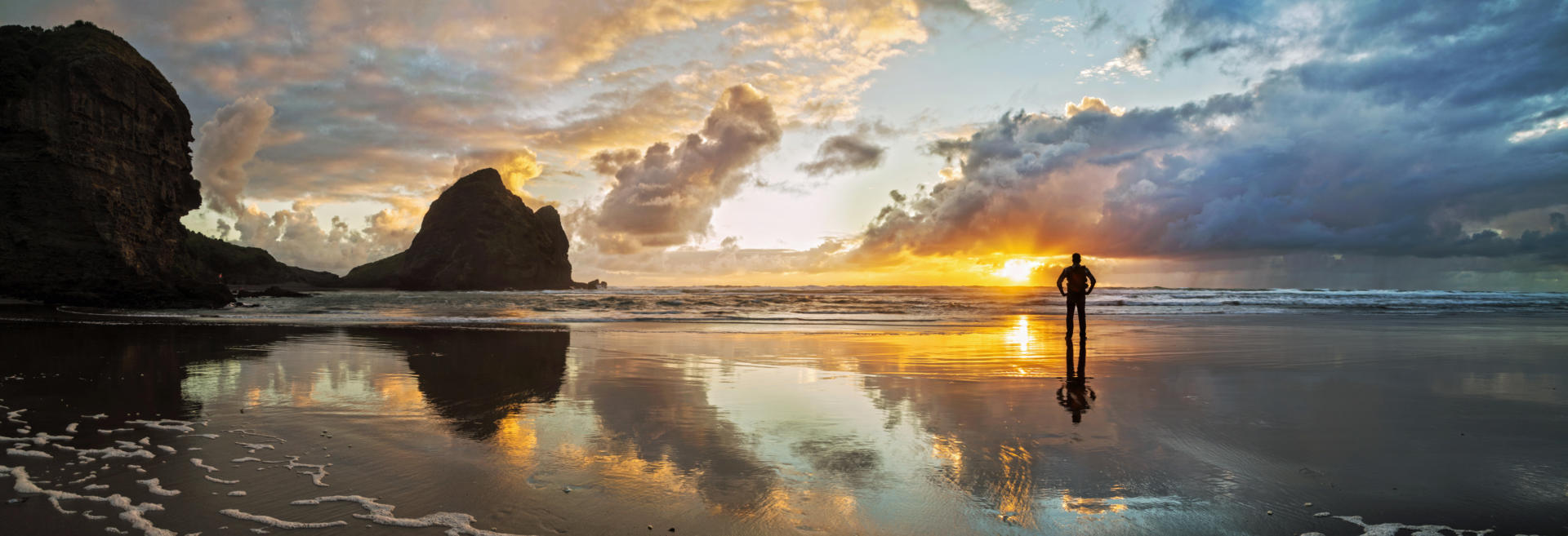
Piha is a popular west coast beach reached via a 40 km drive from downtown Auckland that meanders through the dense forest of the extensive Waitakere Regional Park. The small village here on the shores of the Tasman Sea is home to a mix of hardcore surfers and office workers who are happy to retire from the hustle and bustle of city life at the end of each day. New Zealand’s west coast is renown for being exposed to approaching weather and the fact that residents here have chosen a home that isn’t always tranquil is reflected in the windblown trees. The popularity of the beach ensures the local surf lifeguards are kept busy even on calm days, with their exploits filmed for the internationally syndicated Piha Rescue TV series. A pleasant two kilometre walk inland takes explorers to the 40 m high Kitekite Falls. Nearby Karekare Beach is reached via the same road from Auckland and is just as spectacular as Piha, without as many residents. It offers its own walks and the splendid scenery was featured extensively in the popular 1993 movie The Piano that saw 11 year Anna Paquin win one of the film’s three Academy Awards.
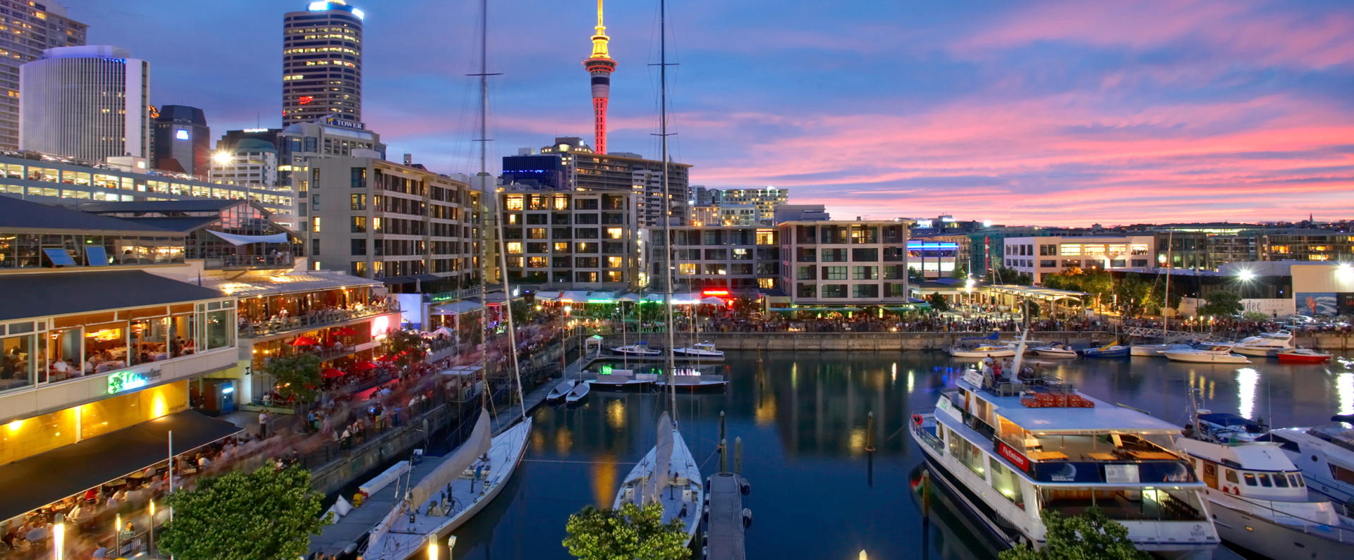
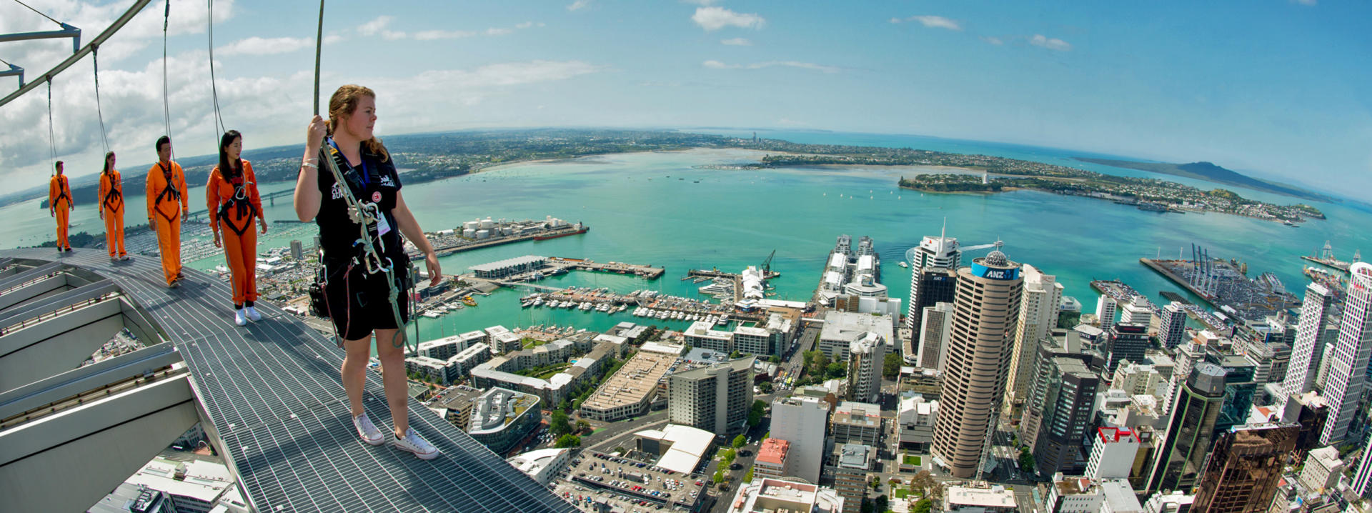
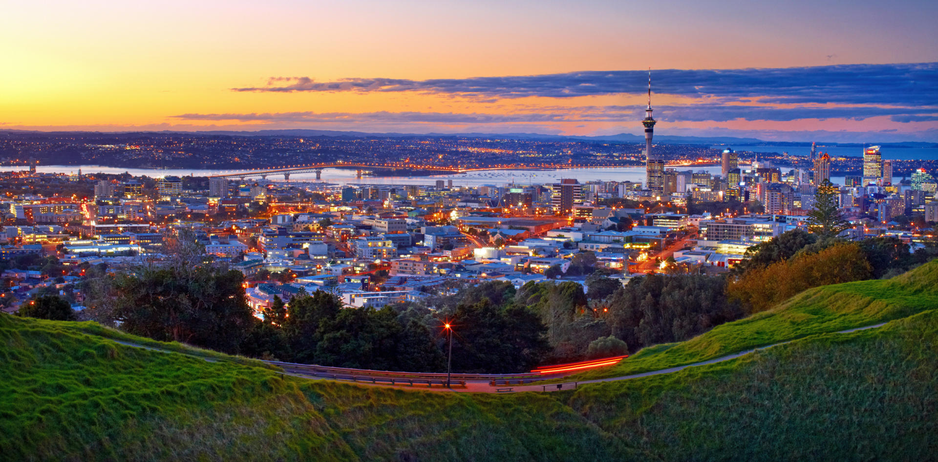
Auckland is New Zealand’s largest city with the population of 1.7 million accounting for a little over 35% of the nation’s inhabitants. While the city’s northern and southern boundaries lie 120 km apart and span a region blessed with a spectacular coastline, extensive parks and community spirited satellite townships in rural settings, the more densely populated inner city within a 10 km radius of the CBD is also well worth exploring if time permits. This central region lies on a relatively narrow volcano dotted isthmus between the Waitemata and Manukau harbours, with inlets between the two harbours coming to within two kilometres of meeting each other at one point. The city is famed as a mecca for water lovers with the favoured sheltered Waitemata Harbour on the Pacific coast translating to ‘Sparkling Water’. There are around 100 beaches within a 30 minute drive of downtown and the region’s estimated 100,000 boats give rise to the motto ‘City of Sails’. For those exploring on foot, the CBD's Viaduct Harbour and Wynyard Quarter have both benefited from major redevelopment in support of hosting multiple defences of the America’s Cup yachting event. The 328 m tall Sky Tower affords a bird’s eye view of the entire region and islands of the neighbouring Hauraki Gulf. The Maritime Museum, Auckland Museum, Auckland Art Gallery and Auckland Zoo are all thoroughly modern facilities offering locally themed exhibitions. From 1840 until 1865 the fledgling settlement of Auckland served as New Zealand’s second capital and the Government Buildings remain an impressive feature of the centrally located historic university precinct. The seaside village suburb of Devonport offers a pleasant stroll, great cafes, the country’s only Navy Base with a small museum, and two of Auckland’s volcanic peaks to climb - just a short ferry ride across the harbour from downtown. Stretching eastward from the CBD is Tamaki Drive, a 10 km harbourside road along which you can meander in your motorhome. The route takes you past Kelly Tarlton’ s Underwater World with its perspex tunnels through aquariums and an Antarctic exhibition complete with penguins, then onward through the pristine beach suburbs of Mission Bay, Kohimarama and St Heliers with their relaxing cafes. Great views are afforded from Bastion Point and Archilles Point along the way. The Auckland Domain features the museum, 100 year old glass houses and a café among its 180 acres. The larger 670 acre Cornwall Park is another major asset within the central urban area, easily reached by vehicle and offering superb walks within its lush grounds, including to the summit of the volcanic cone of the One Tree Hill that U2 sing about (but which is popularly referred to by locals as None Tree Hill these days with its once lone windswept pine now gone). Opportunities also abound to visit neighbouring islands such as Rangitoto and Waiheke by regular ferry services. Auckland’s dining districts are fragmented, with quality dining available in the Viaduct and Wynyard Quarter, on Ponsonby Rd, in Parnell (which also features a superb rose garden), and in the North Shore suburb of Takapuna which beckons with another fine beach and seaside holiday park set amidst premium real estate. Like many cities world wide, Auckland is often overlooked in a land better known for its stunning scenery away from urban areas. However, rated as one of the most liveable cities in the world, it is well worth exploring should time on your itinerary permit.
Rangitoto Island’s iconic symmetry forms an ominous backdrop for Auckland when it is considered that it only formed 600 years ago from a volcanic field that is unlikely to have fallen permanently asleep. The island is an easy 10 km ferry ride from the terminals in the central business district or Devonport (both with nearby outdoor parking for motorhomes) and the hiking trails and splendid views make for a superb day out from Auckland for those whose itineraries facilitate spending a highly recommended day or two in the city. From the wharf on Rangitoto it is a steady climb along a well formed 2.5 km trail to the 260 m summit of the island with its viewing platform and WWII radar station. The two and a half cubic kilometres of lava ejected during the creation of the circular island is thought to roughly equal the total lava flows from all of the remaining 52 volcanoes in the Auckland volcanic zone. The island is home to New Zealand’s largest pohutukawa forest – a native tree known for its multiple trunks, its abundance in coastal locations and the brilliant crimson flowers in early summer that give rise to its nickname as New Zealand’s Christmas tree.
Waiheke Island is the second largest island in the Hauraki Gulf that lies to the east of Auckland. Its 92 sq km is home to 10,000 permanent residents and hosts roughly another 3500 who maintain holiday homes there, making it the third most populated island in New Zealand (after the North and South islands). Waiheke is easily accessible via regular 21 km ferry services and is well worth considering as a day trip destination for those on more leisurely visits with multiple days to explore Auckland. Buses and short term hire vehicles are available upon arrival at the ferry terminal. The island boasts a slightly drier and sunnier climate than the adjacent mainland and, in addition to its fine beaches, has around 30 vineyards and wineries. Several of these have dining opportunities that rate as popular attractions for visitors and locals alike. At 20 km in length Waiheke is more heavily populated at its western end, with the largely rural eastern half of the island featuring a preserved WWII coastal defence gun emplacement.
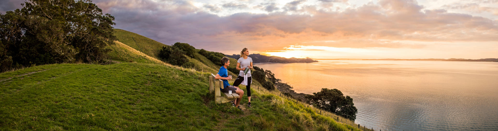
Auckland’s regional parks are one of its best kept secrets. With 27 to choose from covering approximately 500 sq km, they remain overlooked by many visitors to the city. Popular with us at New Zealand Frontiers as places to hike, camp and relax, all lie within an hour’s drive of the CBD. Featuring great views and wide open spaces that often support farming operations, they rate among some of Auckland’s finest gems. Many offer superbly peaceful places to overnight in motorhomes right beside beaches, and some even have limited numbers of basic holiday homes – known as baches to the locals. Larger parks, such as Waitakere and Hunua, are densely forested, rise to as high as 688 m and include hundreds of kilometres of hiking trails each. Bird life ranges from coastal waders to some of our most endangered forest species and is encouraged by rigorous control of introduced pests such as rats, stoats and opossums. A great place to start are the Auckland Regional Botanic Gardens situated barely one minute from the Manurewa motorway exit when southbound to the Waikato region. The helpful visitor centre and inviting café make this park a great place to research the region’s wider network of parks, and it has easily accessible walks within varied gardens if time is limited. Among our favourites with campsites for motorhomes for those heading north are the Shakespeare, Wenderholm and Tawharanui parks. If heading southeast via the Pacific Coast Highway scenic route to the Coromandel Peninsular, the Waitawa Regional Park is a great place to park up for the night. For those seeking parks with overnighting facilities out west, Waitakere Regional Park has camps at several of its isolated beaches on the wild Tasman Sea coast. The uninhabited Rotoroa and Rangitoto islands in the Hauraki Gulf are both serviced by ferry services and, although administered outside the Regional Parks network, feature wonderful beaches and hiking opportunities that ensure they are thoroughly enjoyable day trip destinations. Pack your sunscreen and some hearty nourishment, venture forth and enjoy some of the best parkland you’ll find in any city in the world!