Named by Captain James Cook during his visit in 1769 for an apparent abundance of natural resources, the Bay of Plenty region stretches along about 260 km of the North Island’s east coast and reaches inland for a little more than 100 km. The name rings well with the region’s reputation among locals as having one of the country’s warmer and sunnier climates. Much of the coast is made up of sandy beaches, with a transition to a rocky shore in the more remote east of the region. Several prominent volcanic cones offer hiking trails with expansive views, and the active White Island can often be seen emitting steam clouds 50 km offshore. Horticulture is a major industry in coastal area. Inland lies the Rotorua Lakes area with extensive geothermal attractions, while the southern-most areas of the Bay of Plenty are occupied by the 2900 sq km Kaingaroa plantation forest. A temperate maritime climate ensures that more than 10,000 Ha of mainly kiwifruit and avocado crops are grown, with 10-15 degree daytime temperatures during the winter months and 22-26 degrees being typical in summer. Occasional overnight frosts are generally light in the coastal belt and more severe and frequent in the region’s interior during winter.
The Tauranga-Mt Maunganui-Papamoa Beach urban area is home to half of the region’s 305,000 population, making it the fifth largest city in New Zealand. Although often omitted by visitors from abroad due to time considerations, for those on more leisurely road trips the SH2/SH35 route that spans the entire bay is highly recommended for the splendid beaches encountered and the opportunity to venture out along around the rugged coastline encountered around the sparsely populated East Cape of the country. The journey forms part of the Pacific Coast Highway scenic route and connects with the Gisborne and Hawkes Bay regions, affording a wonderfully scenic drive for those travelling on independent vacations by motorhome.
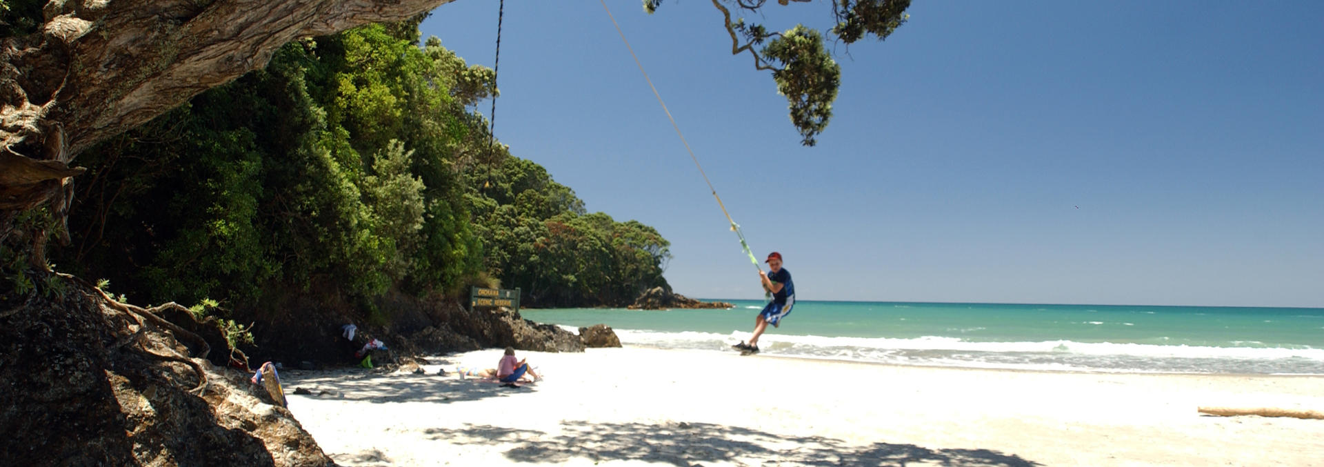
Waihi Beach is situated at the western end of the Bay of Plenty and at the southern end of the Coromandel Peninsular. It is easily accessible from SH2. The seaside township is known for its spectacular 10 km long beach and its popularity as a summer holiday destination results in the permanent population of approximately 2000 people swelling to over 10,000 during the peak Christmas / New Year period. An enjoyable walk from the northern end of the beach takes one to the secluded Orokawa Beach, notable for being fringed with the native pohutukawa trees that blaze a crimson display of blossom during December and January. At the southern end of the beach lies the settlement of Bowentown with its thermal hot pools, while the nearby town of Waihi hosts a major gold and silver mining operation. Beachfront holiday parks are available for independent travellers with time to relax and linger. Despite the festive season crowds, the locality offers an excellent opportunity to visit a sleepy oceanfront settlement with an extensive uncrowded beach for most of the year, all within an easy two hour drive of Auckland.
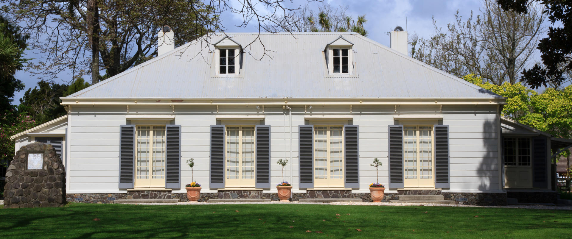
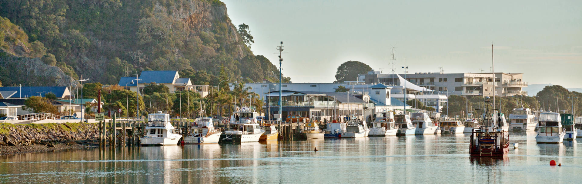
The meaning of Tauranga as a safe anchorage or landing place for canoes ensured that the area was a centre for Maori population since the earliest days of their arrival in New Zealand around 700 years ago. As was often the case upon European colonisation of the country, relations between local Maori and the newly arrived Pakeha were not always harmonious and the one of the deadliest battles of the New Zealand Wars took place at nearby Gate Pa in 1863 with loss of dozens of lives during a British defeat. These days Tauranga’s reputation for having a mild climate, along with the increasing population density in Auckland has resulted in rapid growth of the city, to the point where it is now our fifth largest with 142,000 inhabitants. Several large companies from the horticultural, agricultural, transport and investment sectors maintain their head offices here and the Port of Tauranga is the country’s busiest for export tonnage. The city has some wonderful beaches and the Pacific Ocean-front suburbs of Mt Maunganui and Papamoa both rate as popular holiday destinations among Kiwis. Tauranga’s city centre also hosts a fine example of an early colonial residence with the Elms Homestead completed in 1847 and remaining set in an extensive garden.
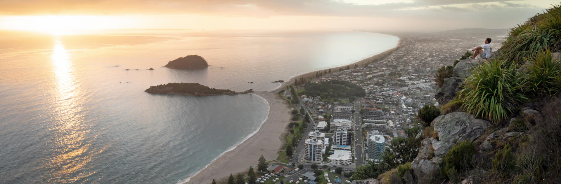
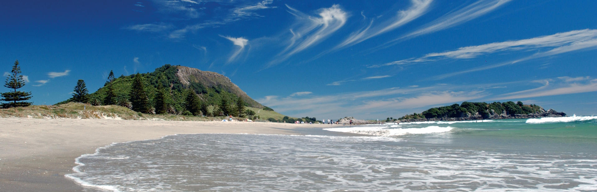
Mt Maunganui is a seaside suburb of Tauranga situated on a spit of land that protects the city’s harbour from the Pacific Ocean. It features one of the country’s premiere beaches on its ocean side and a busy shipping port on the harbour side. At the tip of the spit is the 232 m lava dome from which the area takes its name – though it is also increasingly referred to by its original Maori name as Mauao. Easy walks around the base and to the summit of ‘the Mount’ are essential activities for visitors and reward with superb views. A conveniently located holiday park at the base of the hill includes the bonus of thermal pools in which one can rejuvenate weary legs. Mt Maunganui Beach itself is a thoroughly enjoyable stretch of sand and rates as a particularly favoured locality at which to experience the revelry of New Year’s Eve. Real estate here is among the most expensive in New Zealand and is serviced by a popular restaurant and café precinct.
Whakatane is a picturesque seaside service town of 20,000 located 89 km east of Tauranga on SH2. The area boasts more of the extensive, largely deserted sandy beaches that are a feature of the Bay of Plenty coastline. The neighbouring Ohope Beach is particularly accessible and popular as a holiday destination. Clearly visible 48 km distant on the horizon is White Island. The island is currently New Zealand’s most frequently active volcano and, dependent upon activity levels, was a popular excursion destination until a small eruption in 2019 claimed the lives of over 20 visitors. Despite its modest size, Whakatane has provided the country with a Prime Minister, several multiple Olympic medalists, and was also the birthplace of Lindy Chamberlain who was played by Meryl Streep in the movie A Cry in the Dark that portrayed her tragic conviction for the 1980 murder of her baby in Australia when it had in fact been carried away by a dingo during a family camping trip. 58 km east of Whakatane is the township of Opotiki where SH2 turns inland on a 143 km journey that passes through the Waioeka Gorge to eventually reach Gisborne. However, for those fortunate enough to be travelling on a particularly leisurely itinerary, the 330 km route out around East Cape via SH35 is well worth considering. The journey, described in the Gisborne region, offers some of the country’s most sparsely inhabited coastal scenery with tiny villages, locals who can still be seen getting around on horses, and multiple overnighting opportunities along the way.
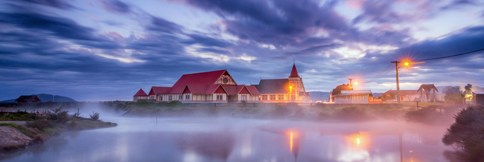
Located amidst an area of abundant geothermal activity that includes thermal springs, boiling mud pools, erupting geysers and crater lakes, Rotorua is New Zealand’s original tourist town. Promotion of the curative properties of local mineral waters and of the Pink and White Silica Terraces at nearby Lake Tarawera commenced as early as 1883. In 1886 an enormous eruption at Mt Tarawera could be heard hundreds of kilometres away and created a 17 km long rift, destroyed the terraces, buried villages and killed an estimated 120 people. The event disrupted establishment of the tourism industry, but by 1901 the Department of Tourist and Health Resorts had been established as the first such organisation in the world operated by a central government. Prior to the disruption caused by Covid-19 Rotorua hosted over three million visitors annually, with about 30% coming from abroad. Many still include a visit to the hot springs or one of the varied thermal parks. In addition to the thermal activities that result in competing nicknames of Sulphur City and Rotovegas, the city is a popular conference destination and centre for display of the indigenous Maori culture of New Zealand. There are multiple opportunities to visit marae, witness cultural performances and indulge in a traditional feast cooked by natural thermal heat or in a fire pit that has had food placed of top and been covered by earth – known as a hangi. Complementing the traditional attractions are a bewildering array of highly recommended activities that range from farm shows and wildlife conservation parks to white water rafting, jet boating, luge riding, zorbing, flight seeing, trout fishing and hiking. Rotorua has also developed mountain-biking trails that have an international reputation. For those with more genteel intentions, dining opportunities (both lakeside and elevated on surrounding hill sides) and strolls along the lake front or through the Whakarewarewa redwood forest beckon. The original bath house is splendidly maintained – housing a fascinating museum these days – and resides amidst immaculate grounds still known after their creator as the Government Gardens. The city and its 80 sq km lake lie at 280 m altitude in a large caldera. Roads radiating out into the surrounding district encourage further exploration of the neighbouring lakes Rotoiti, Tarawera and Tikitapu (Blue Lake) along with numerous thermal parks. In addition to the tourism industry, Rotorua also serves as a service town for major dairy farming and forestry industries. The geothermal activity creates a further industry with both domestic and commercial use of the energy source being widespread throughout the active area. The district’s altitude results in cooler winter temperatures with heavy frosts and occasional brief snowfall on surrounding mountains. Rotorua is conveniently located on SH5, one of the main north-south options for travel through this part of the country. Dependent upon the tempo at which you are pedaling your campervan, a memorable couple of days can easily be spent checking out the scenery and attractions of this city of 55,000 people.
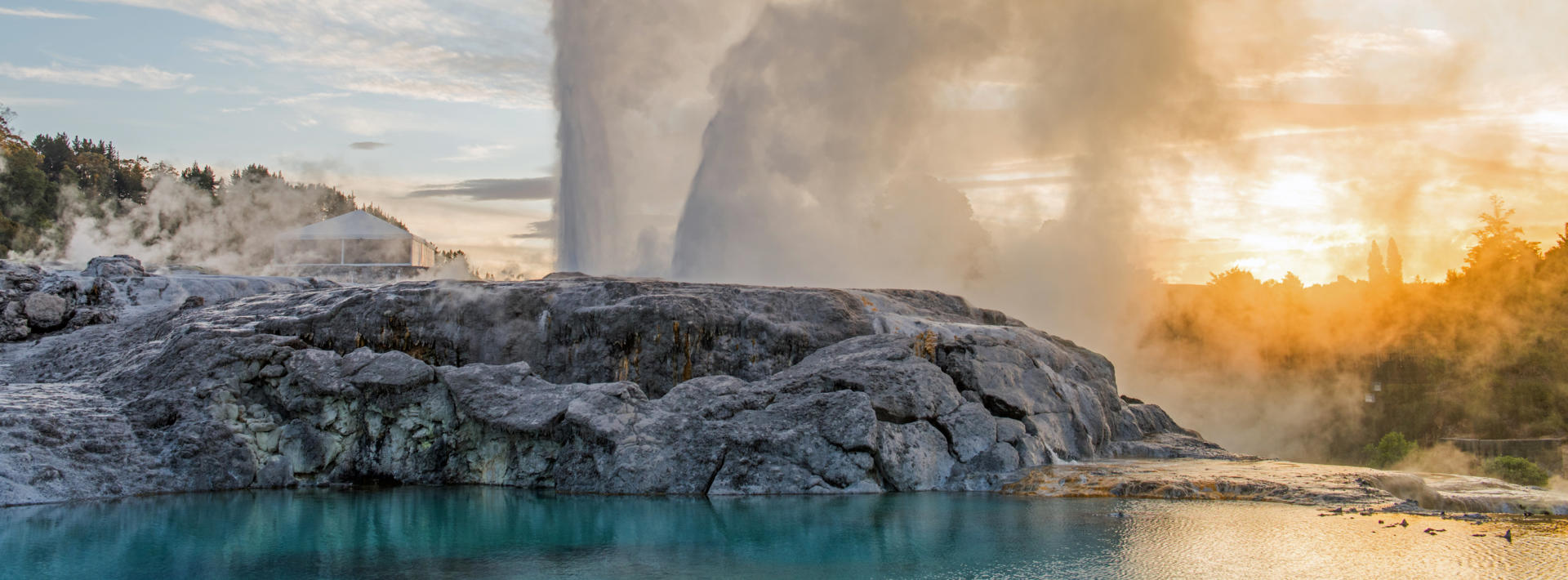
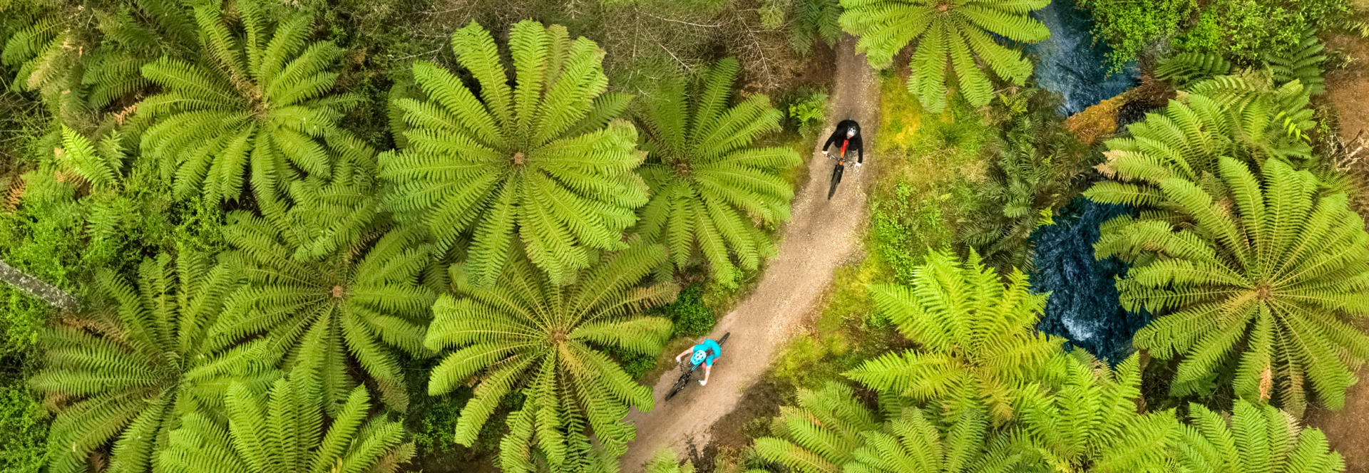
Whakarewarewa is a semi-rural suburb three kilometres south of Rotorua’s central business district that features some the city’s original geothermal attractions, a tranquil redwood grove and a world class mountain-bike park. The area features regularly active geysers and its accessibility provided guiding and hosting opportunities for the local Maori people as long as 200 years ago. The neighbouring Whakarewarewa and Te Puia attractions embrace the enduring reputation for hospitality among the local people and include the New Zealand Maori Arts and Crafts Institute, kiwi viewing and walks through the thermal activity that pass by geysers and mud pools. The 5600 Ha Whakarewarewa Forest includes a six hectare grove of 120 year old Californian Redwoods that have reached 70 m in height and can be enjoyed via hiking and jogging trails and a canopy walk. The wider forest also features over 100 km of superb mountain-bike trails with bike hire available on site and from the multitude of operators who service this major local draw card throughout Rotorua.
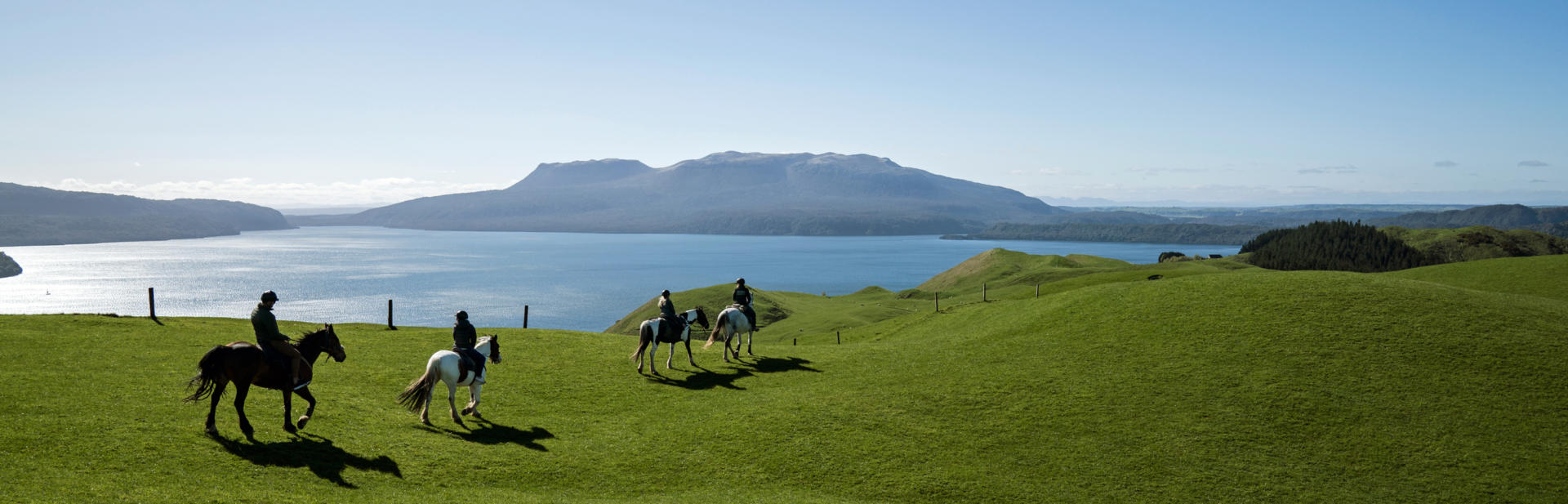
At 41 sq km Lake Tarawera is the second largest of the Rotorua Lakes. It is reached via a pleasant 15 minute drive from Rotorua that passes along the shores of Tikitapu and Rotokakahi (the Blue and Green lakes) and past the Te Wairoa village that was largely buried by the 1886 eruption of Mt Tarawera and is now able to be visited. A holiday park at the Blue Lake offers an appealing alternative to staying in Rotorua when visiting the area. Lake Tarawera lies in the shadow of the barren 1111 m mountain of the same name that erupted violently for several hours on the 10th of June 1886. An estimated two cubic kilometres of material was ejected (about twice the volume of the Mt St Helens event in 1980) in an eruption that was heard as far away as the South Island and created a 17 km long rift. Several villages were completely buried and the death toll is variously quoted as somewhere between 120 and 153 people. Among the spectacular walks on the shores of Lake Tarawera is the 15 km Tarawera Trail to the lake’s own Hot Water Beach springs, from where a water taxi can be caught back to the start point.