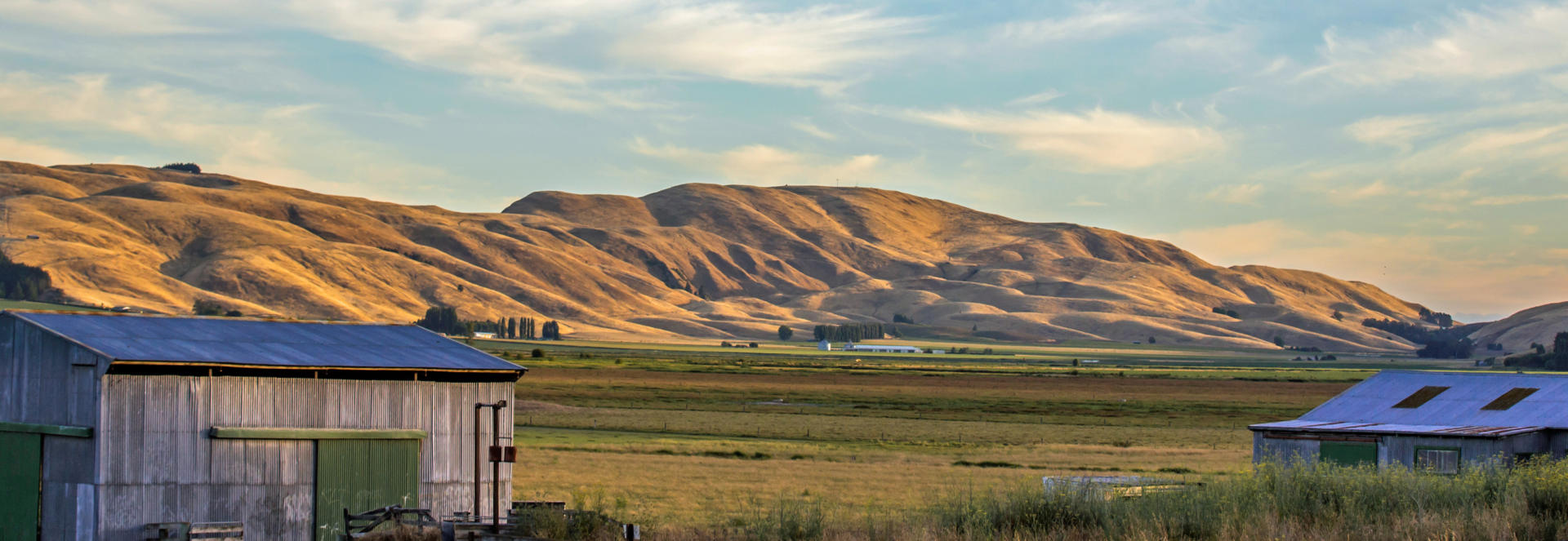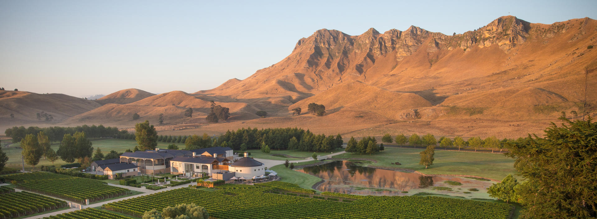
Hawke’s Bay maintains a reputation as having a warm and dry climate, sunny beaches and vineyards that produce fine wines. The region’s name is a popular corruption of the 100 km wide Hawke Bay that dominates the coastline and was named by Captain James Cook after Admiral of the Fleet Edward Hawke. Its location on the east coast places it on the prevalently leeward side of North Island, resulting in the favourable climate. Summertime temperatures in the mid-twenties and even into the low thirties are not uncommon. The region stretches approximately 250 km from the Mahia Peninsular in the north to Waipukurau in the south and includes an extensive area of flat and undulating land around the Hawke Bay itself. When combined with the climate, the plains ensure the region is ideal for the significant horticultural industry that provides much local employment. Inland rugged hill country and mountainous terrain prevails, rising to 1733 m and experiencing snow during the winter months.
In the south of the region the Napier-Taihape road through the high country rates as one of New Zealand’s best wilderness driving experiences, connecting with the Manawatu-Whanganui region to the west, while in the north of the region lies the extensive, remote Urewera National Park. The Hawke’s Bay’s proximity to the North Island’s major fault line has resulted in the region being rocked by more than a dozen quakes of magnitude six or more on the Richter scale in the last 200 years, with the 1931 Napier Earthquake rating as the country’s deadliest. The major cities of Napier and Hastings neighbour each other closely and are commonly known as the Bay Cities or the Twin Cities, accounting for 80% of the region’s population of 166,000 people. In the north the Mahia Peninsular is home to one of the world’s most successful small payload satellite launch facilities. New Zealand founded and now American owned company Rocket Lab rockets carry payloads of up to 150 kg into orbit for less than five million dollars, with launch frequency on track to achieve weekly after a first launch in 2016. The region is a popular destination for domestic tourism with the opportunity to wobble around vineyards on an extensive network of sunny cycle trails proving to be an irresistible bucket list item. For independent travellers SH2 passes through the entire length of the region and is a popular option among the three north-south choices available when completing an Auckland based round trip of the country.
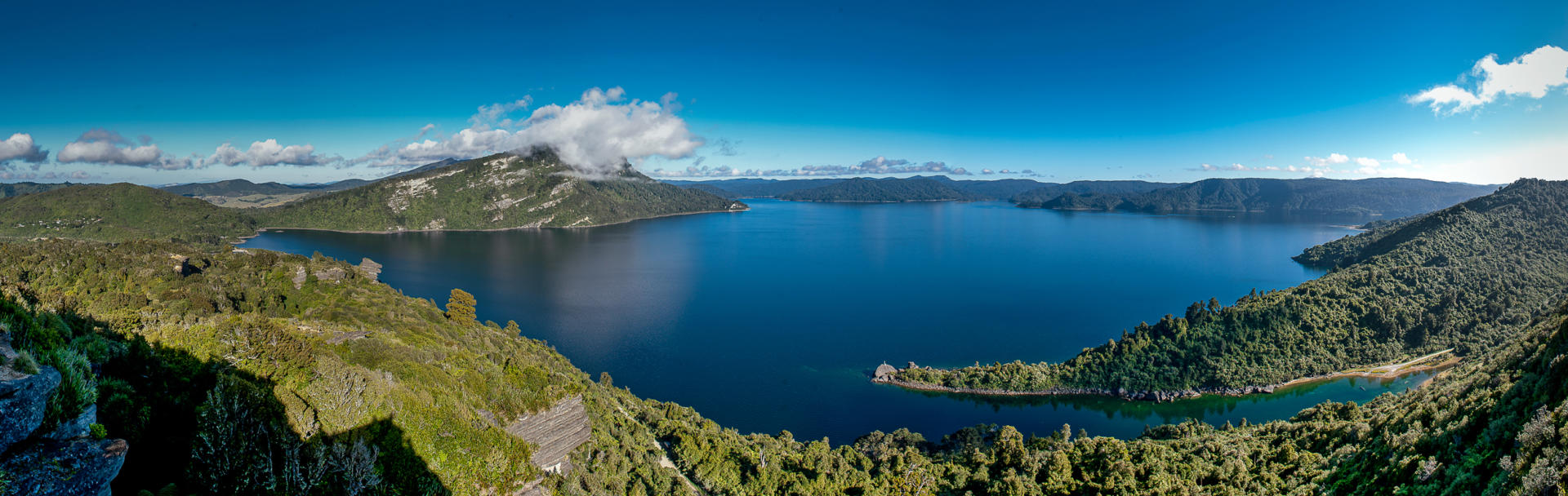
Lake Waikaremoana lies within Te Urewera, an extensive 2127 sq km area of pristine wilderness in the north of the Hawkes Bay region. The area was administered as a national park until 2014 when it was passed from Crown (government) ownership back to the guardianship of the local Tuhoe tribe, who are noted for never having become signatories to the 1840 Treaty of Waitangi. Compensation of $170 m and continued management partnership with the Department of Conservation was included in the deal which was typical of the agreements reached to address land grievances in recent decades. Although bypassed by many due to the 80 km of gravel road travel required for access, and the multiple other routing options available to those visiting this part of New Zealand, the lake is regarded as one of the most attractive in the country. Its isolation also ensures that visitor numbers are significantly less hectic than those encountered in Piccadilly Circus or Times Square. The 54 sq km lake sprawls among a rugged, densely forested landscape at 600 m altitude, its name meaning a sea of rippled waters. One of New Zealand’s finest hiking trails, the Waikaremoana Great Walk, encompasses 46 km of the shoreline. The track is typically completed as a three or four day expedition, with one night spent in a hut at the Panekiri Bluffs, high point of the walk at 1178 m and from where the views rate as one of life’s exquisite experiences.
Please note that the rapid changeability of weather in New Zealand means that all hikes require responsible preparation. It is no exaggeration to say that a cloudless morning can transform to falling snow within 30 minutes, at any time of the year. Advice should be sought from the Department of Conservation, where intentions should be registered and overnight accommodation in huts can be paid for and booked if required. Sturdy footwear should be worn, warm clothing packed and food carried even for short walks in sunny weather. On any walk of several hours in duration, hikers are well advised to travel prepared to overnight and carry supplies accordingly.

Napier is a sunny coastal city located towards the southern end of the horseshoe shaped shoreline of Hawke Bay. The city has a population of approximately 63,000 and is 300 km north of Wellington on SH2 and 150 km from Taupo on SH5. It lies on a 300 sq km alluvial plain that rates as one of New Zealand’s major horticultural regions with over 10,000 Ha in production growing apples, grapes, squash and vegetables. The region was struck by a 7.8 magnitude earthquake in February 1931 that was centred just 15 km from the central city and resulted 256 deaths – a toll that is only surpassed as one of the country’s greatest disasters by the loss of an Air New Zealand sightseeing flight in Antarctica in 1979 that cost 257 lives. The earthquake reclaimed large swamps and lagoons in the area, raising land by more than two metres in some areas and enabling the building of Napier’s airport in its current location. Much of the city was either reduced to rubble or destroyed in the ensuing fire. Rebuilding work coincided with the short-lived Art Deco architectural era of the 1930s and as a result Napier is regarded as one of the finest Art Deco cities in the world. A hugely popular Art Deco Festival is held in February each year and walking tours of the city’s highlights are available year round. Napier’s excellent centrally located museum also covers the topic. Superb views over the region are available from the top of Bluff Hill that is a short drive from the CBD in your motorhome. A splendid ocean-front walk also beckons and passes by the National Aquarium of New Zealand and the much photographed statue of Pania, a maiden featured in Maori mythology. The wider area’s vineyards and flat land combine to promote pedal touring of wineries along an extensive network of cycle trails as another popular activity for visitors. 20 km south of Napier lies the twin city of Hastings. With a population of approximately 70,000 Hastings is the larger of the two cities and serves as an important processing and service centre for the region’s horticultural industry. Nearby Te Mata Peak features a good road to its 399 m summit that rates as one of New Zealand’s better view points.
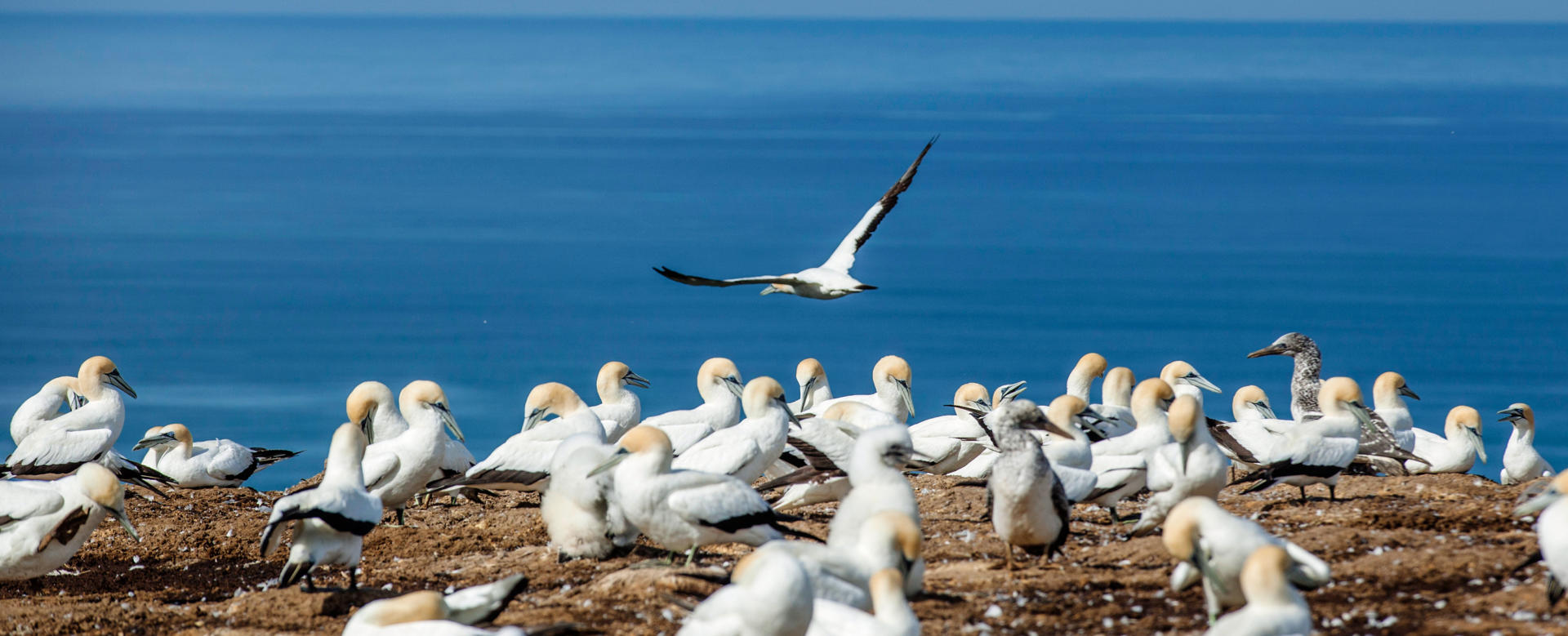
Cape Kidnappers is a spectacular promontory on a peninsular that marks the southern end of Hawke Bay. Like many coastal features in New Zealand, the cape was named by Captain James Cook following an incident where a waka (canoe) of Maori approached the Endeavour offering to trade fish. Instead they captured a crew member who was in the water and attempted to flee before being fired upon. The cape is best known for hosting the largest mainland colony of Australasian gannets in the world. While gannet colonies are more accessible elsewhere in New Zealand, the sheer size of the Cape Kidnappers colony (approximately 20,000 birds) and its magnificent location make a visit truly rewarding. Situated across a large coastal farm, the colony is best reached via one of the numerous beach or overland tours offered. A bonus of the colony is the very close proximity from which one can observe these majestic wandering oceanic birds with wingspans of up to two metres.