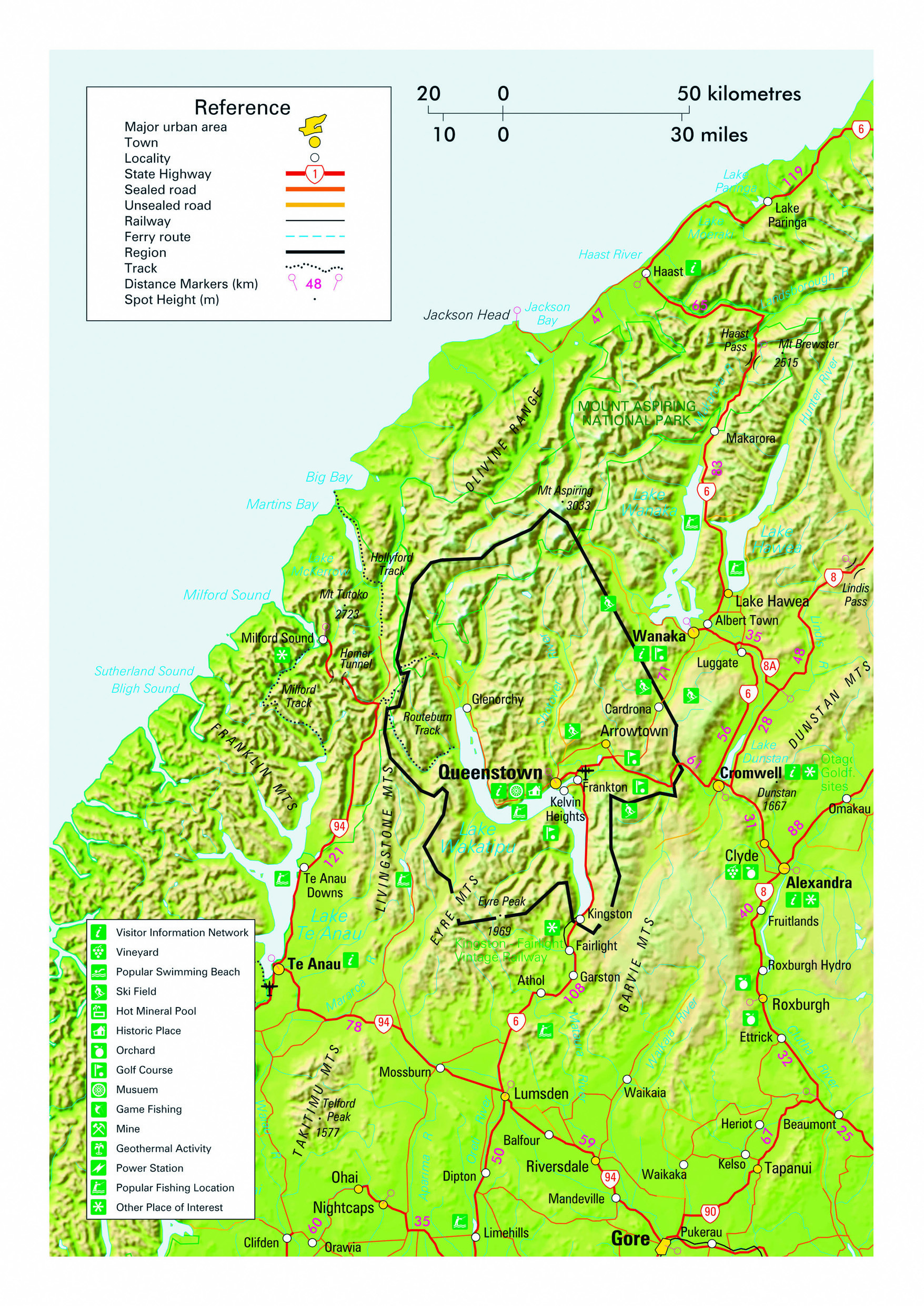
One of New Zealand’s largest regions, Otago is situated in the lower South Island and is renown for showcasing the diversity of landscapes that typifies New Zealand. It stretches approximately 300 km from its alpine northern extremity to the south coast and almost as far from west to east. Within its boundaries lie a relatively sparse population of just 232,000 people, almost half of whom are in the major city of Dunedin. The interior of the region is referred to separately as Central Otago and is one of the few areas in New Zealand to enjoy a continental climate. Sunshine hours are generally above the national average and rainfall well below in most areas throughout the region – ranging from around one metre annually on the coast to as low as 300 mm inland. While summertime temperatures are renown for moderation in coastal areas, inland temperatures can be both warm during January-February and harsh in winter months. The country’s record low temperature of -26 degrees was recorded at Ranfurly, where the sport of curling is often able to be practiced during winter. Although temperatures are not as cold along the coast, snow falls to sea level most years and can be accompanied by gales that breed hardy individuals.
Combined with the alluvial nature of soils in the interior, the region is famed for its production of fine merino wool and wine - which has been winning international awards since the 1880s. Coastal areas, that include the New Zealand mainland’s most southerly point and have little between themselves and Antarctica in places, are famed for wildlife viewing opportunities and spectacular drives. Inland soaring snow-capped mountains and glistening rivers nestled deep within ravines are the subjects of the finest coffee table books of photographic splendour. Highways are unhurried for those travelling by motorhome with New Zealand Frontiers and the contrast in landscapes is as breath-taking as the opportunities for adventure. Alpine areas of Otago have some of New Zealand’s most highly rated hiking trails. The Central Otago Lakes District offers stunning ski fields during winter months, and the canyons where bungy jumping was established and some of the most exhilarating jet boat tours on the planet are available.
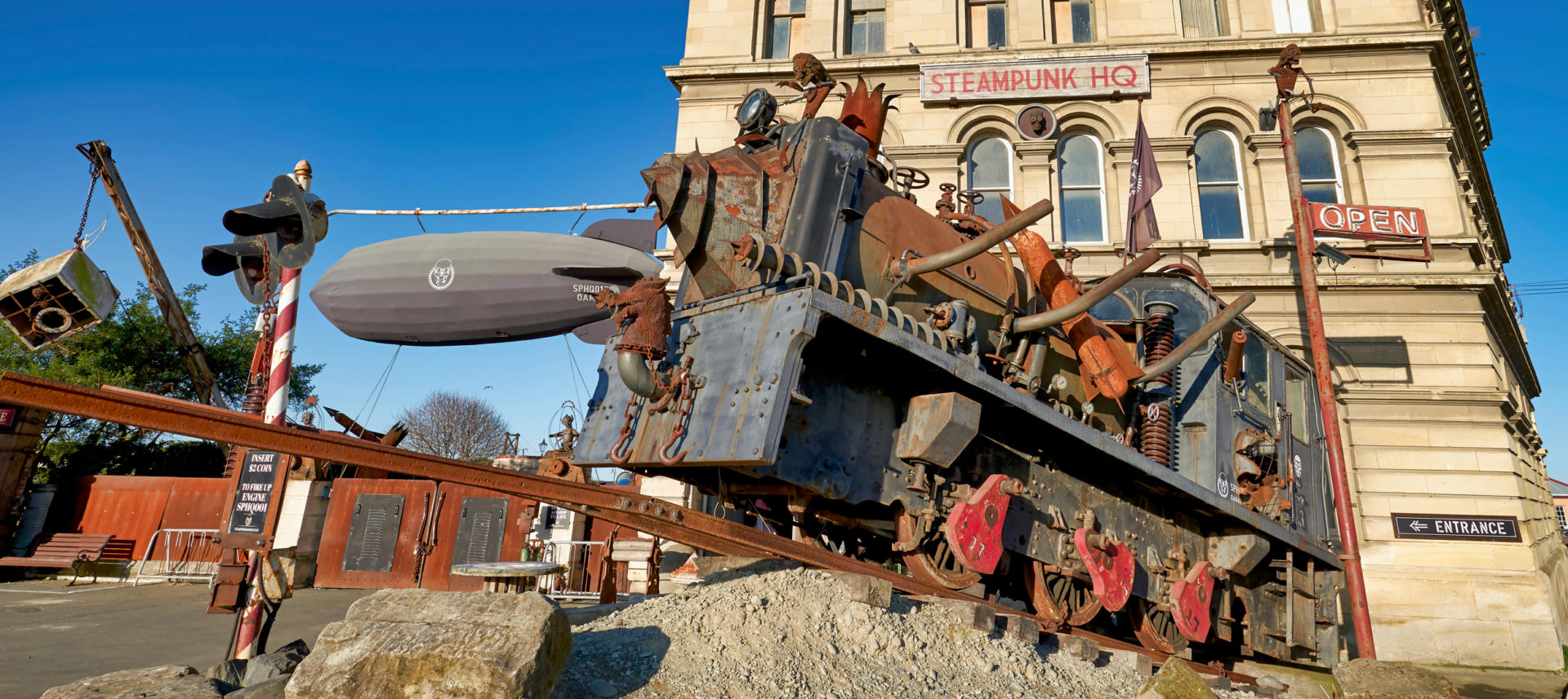
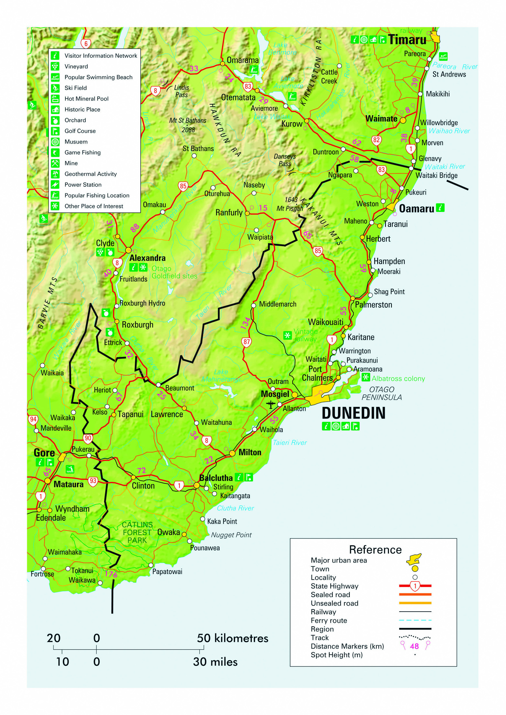
Oamaru is a fine example of a town whose legacy as an economic powerhouse during former boom times has left it endowed with a remarkable collection of heritage buildings that far exceed the standard normally found in provincial centre of just 14,000 people. The Victorian precinct of the commercial district is regarded as one of New Zealand’s most impressive streetscapes and is filled with buildings constructed from the distinctive local Oamaru whitestone in the 1870s and 80s. Many are now owned by the Oamaru Whitestone Civic Trust and enjoy historic places category one or two listing. An annual Victorian Heritage Festival held in November is a highlight of celebrations of the remarkable local history, as is the popular Steampunk HQ that showcases a creative alternative version of the Victorian Era. Walking tours guided by local historians are the perfect introduction to such a fascinating heritage. The town’s waterfront is renown for hosting a colony of little blue penguins (korora) which, at just 30 cm in height, are the smallest penguin species in the world. Oamaru was also the focal point of an often overlooked key event in New Zealand’s history when the country’s first refrigerated shipment of meat departed from the local port in 1882. This marked a turning point for the country’s agricultural exports which had previously been confined to wool and subsequently embraced the meat and dairy exports that have remained a mainstay of New Zealand’s economy. Oamaru is located on SH1 112 km north of Dunedin and just south of the Waitaki River that forms the boundary between Otago and Canterbury. SH83 that travels inland along the Waitaki river passes by a rare example of Maori rock art near Duntroon and through the farmland that legendary former All Black captain Richie McCaw hails from. Countryside here is home to a burgeoning population of Australian wallabies. South of Oamaru near the seaside settlement of Moeraki a curious and much photographed collection of giant spherical boulders lie strewn along the beach.
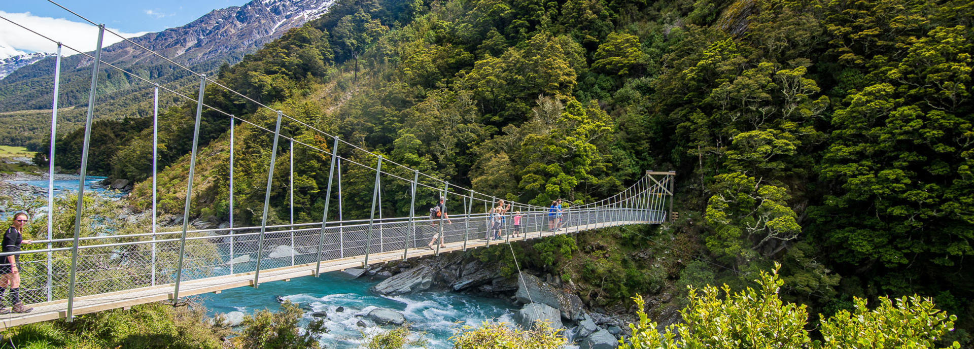
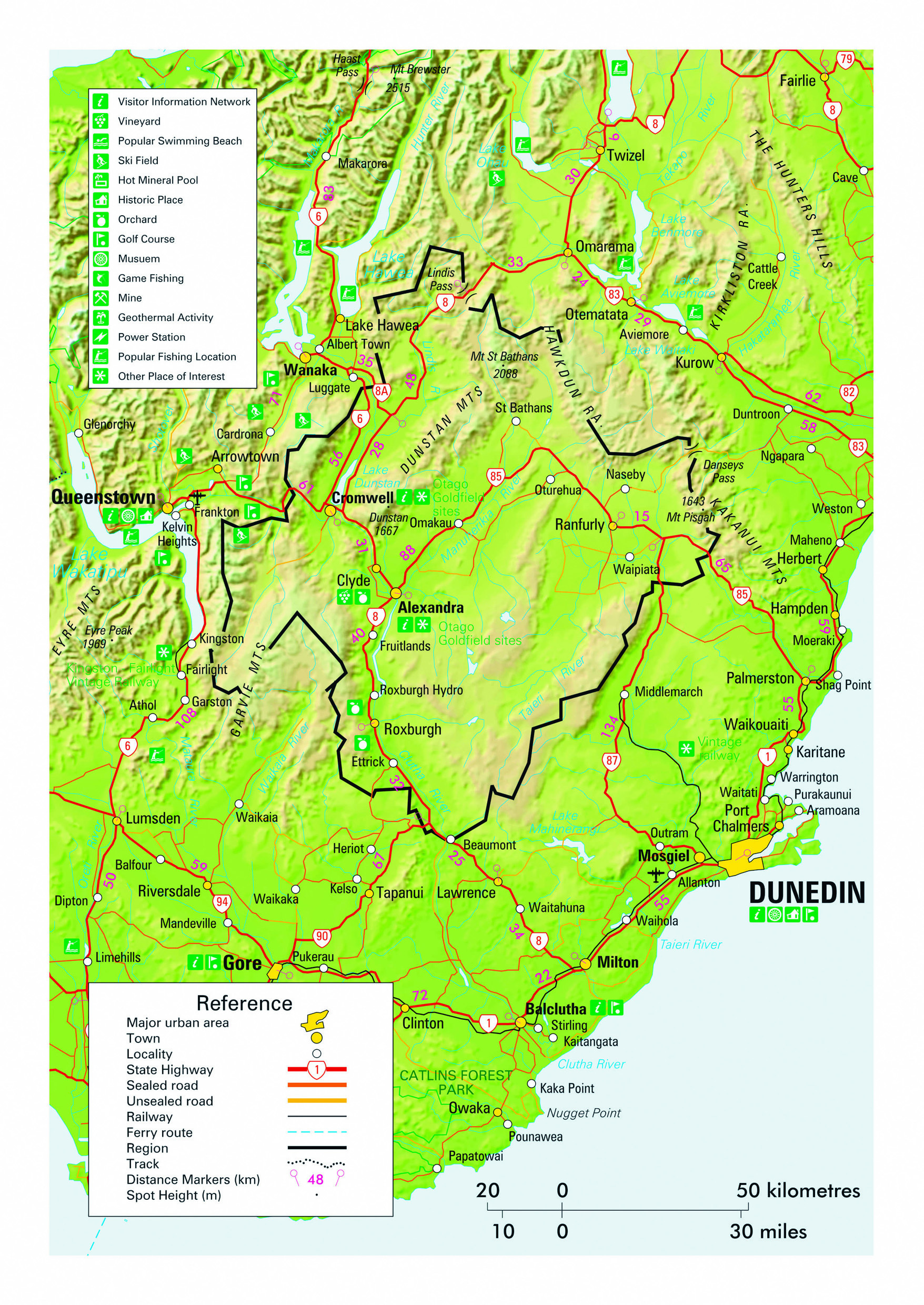
The Mount Aspiring National Park is New Zealand’s third largest at 3562 sq km. The peak from which it takes its name, while only the 23rdhighest in the country at 3033 m, is notable for its spectacular silhouette and for being the tallest peak outside of the Mount Cook National Park. Often referred to as the Matterhorn of the South, its Maori name of Tititea describes a glistening peak. The national park borders the Fiordland National Park to the south and, together with the Westland and Mount Cook national parks that lie 40 km to the north, forms the Te Wahipounamu World Heritage Area that covers a total of 26,000 sq km. The park is largely alpine and remote, and includes significant glaciers. However several opportunities exist for convenient access, including the numerous short walks from the SH6 Haast Pass route which travels the park’s northern extremity. The Matukituki River valley near Wanaka provides the closest road access to Mt Aspiring and also offers excellent day hike options for independent visitors travelling by campervan. Glenorchy, at the head of Lake Wakatipu is the access point to the park’s highly popular Routeburn track.
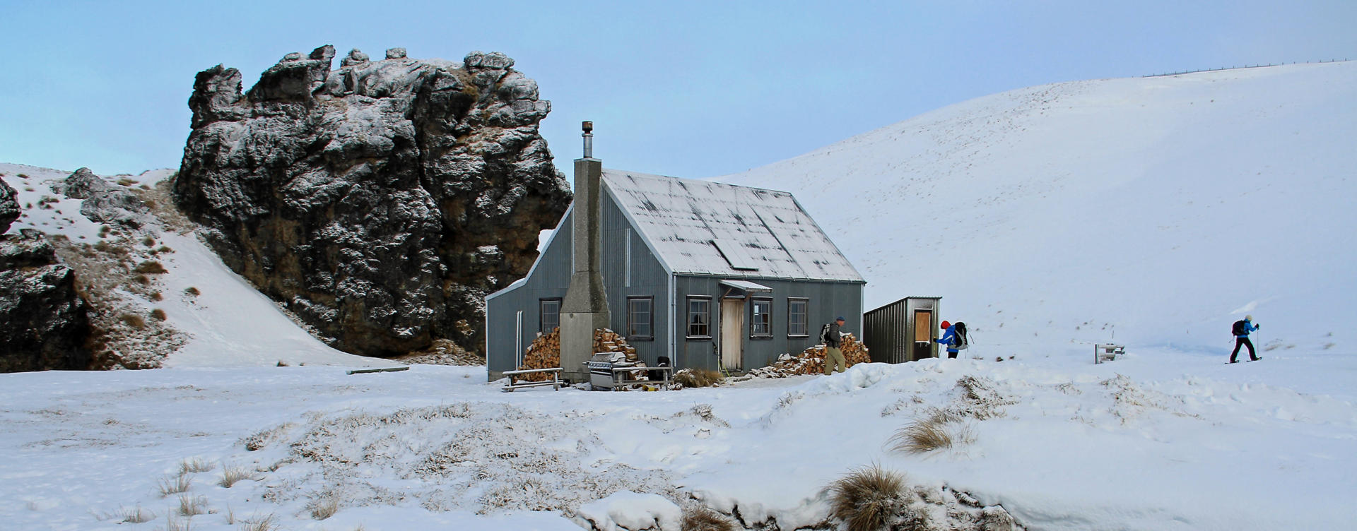
As always, walkers should note that the rapid changeability of weather in New Zealand means that all hikes require responsible preparation. It is no exaggeration to say that a cloudless morning can transform to falling snow within 30 minutes, at any time of the year. Advice should be sought from the Department of Conservation where intentions should be registered and overnight accommodation in huts can be paid for and booked if required. Sturdy footwear should be worn, warm clothing packed and food carried even for short walks in sunny weather. On any walk of several hours in duration, hikers are well advised to travel prepared to overnight and carry supplies accordingly.
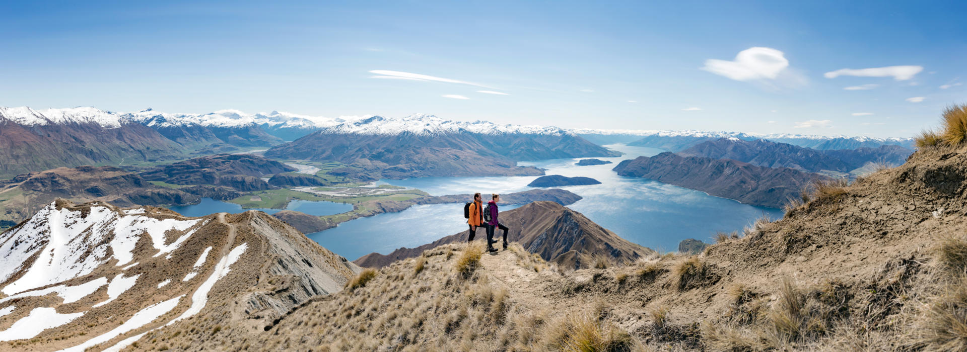
Wanaka is a resort town of approximately 9000 people situated at 290 m elevation on the southern shores of a lake of the same name. Despite 200% population growth since 2001, the town remains a pleasantly relaxed place to visit and is regarded as a peaceful alternative to the more glitzy Queenstown, 67 km to the south. The site of the present day township was used as a seasonal base by Maori in pre-European times, followed by early settlers chasing gold in the 1860s and subsequently establishing farming operations. By 1867 the thoroughly agreeable scenery ensured the first hotel had been built. In the same year the locality also had the distinction of holding the world’s first competitive sheep dog trials – a now international sport where farmers direct working dogs to move sheep through a series of obstacles to a holding pen in open hill country. Lake Wanaka is the country’s fourth largest at 192 square kilometres and is over 300 m deep. The lake has four small islands, one of which can be visited and features the novelty of having its own lake that is reached by way of a brisk hike from the wharf. Iconic and highly Instagrammed local activities include photographing the Wanaka Tree that stands on the lake edge at Gendhu Bay, and the 16 km return hike to the magnificent view from Roy’s Peak. Wanaka’s Airport features the excellent Warbirds and Wheels Museum, along with an adjacent transport museum and nearby popular Puzzling World. A biennial Warbirds Over Wanaka airshow is held over Easter of even numbered years and is internationally recognised for its setting and collection of local and visiting aircraft. During winter months superb skiing can be enjoyed at the Cardrona and Treble Cone and fields, with the later rating as the largest in the South Island and boasting a 700 m vertical drop. Both fields host competitive skiers for northern hemisphere off-season training. Nearby Snow Farm features New Zealand’s premiere cross country skiing and is used by vehicle manufacturers as a winter testing facility. For those looking for a relaxing night out with the locals and a glass of local nectar, Wanaka’s quirky classic Cinema Paradiso is often rated as a national treasure. Although located a short side trip from the SH6 route between the West Coast region and Queenstown, Wanaka offers a thoroughly enjoyable option for independent wanderers travelling by motorhome to the hustle and bustle of Queenstown.
Drivers intending to travel southward from Wanaka via the Cardrona Valley are advised that descent from the Crown Range is one of a handful of prolonged steep gradients in New Zealand where brake pad heating is a safety issue. Drivers should ensure they are familiar with selecting a lower gear to utilise engine braking and should employ this technique accordingly.
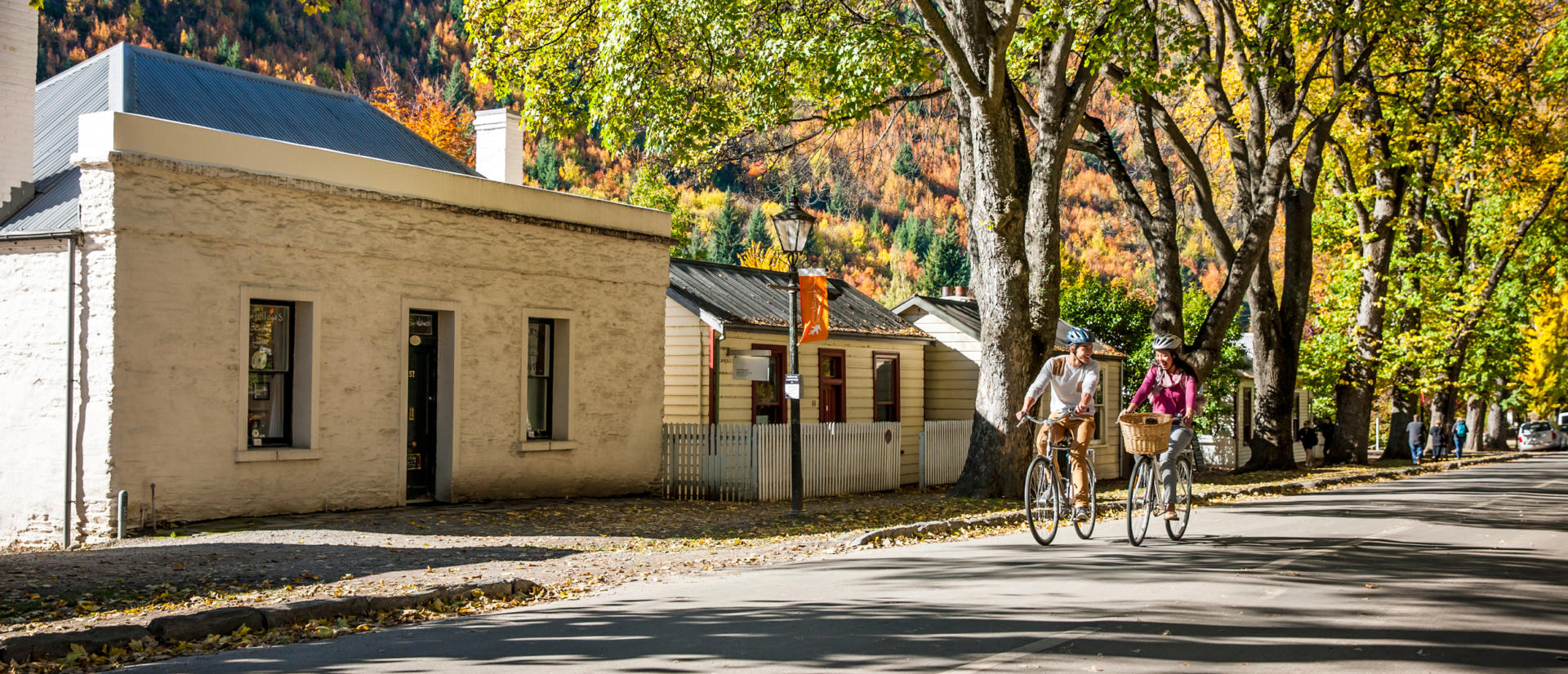
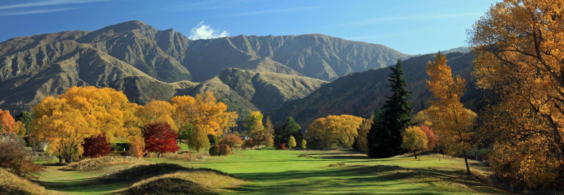
In a region renown for its picture postcard perfect scenery, the quaintly photogenic historic village of Arrowtown rates as one of New Zealand’s pinnacles. The town sits on the banks of the Arrow river, in which ‘the colour’ was discovered in 1862 – quickly attracting a rush of fortune seekers who numbered over 7000 at the peak of its heyday. Today 3000 people call Arrowtown home in one of the most idyllic landscapes imaginable. The main street retains a splendid line up of original businesses and miner’s dwellings filled with quality souvenirs and a museum to the locality’s heritage. The area is a treasure at any time of the year – whether snowed in during winter or sweltering in summer. And in a country renown for its predominantly evergreen trees, Arrowtown is famous for the beautiful autumnal hues that light up both surrounding hillsides and the town centre. 4x4 tours are available into precipitous canyons to visit old gold mining sites and ghost towns. Tucked away in the mountains lie luxury lodges used by quests who park their Gulfstreams at nearby Queenstown Airport. Actor Sam Neil quietly tends the vines and animals on his slice of paradise and jeweller Michael Hill welcomes guests to the violin concerts held at his world-class golf course. The 20 minute drive to Queenstown passes over the historic Edith Cavell Bridge that stand almost 50 m above the Shotover River and looks directly down upon the Shotover Jet base for adrenaline filled boat tours through the sheer rock walls of the gorge of the same name.
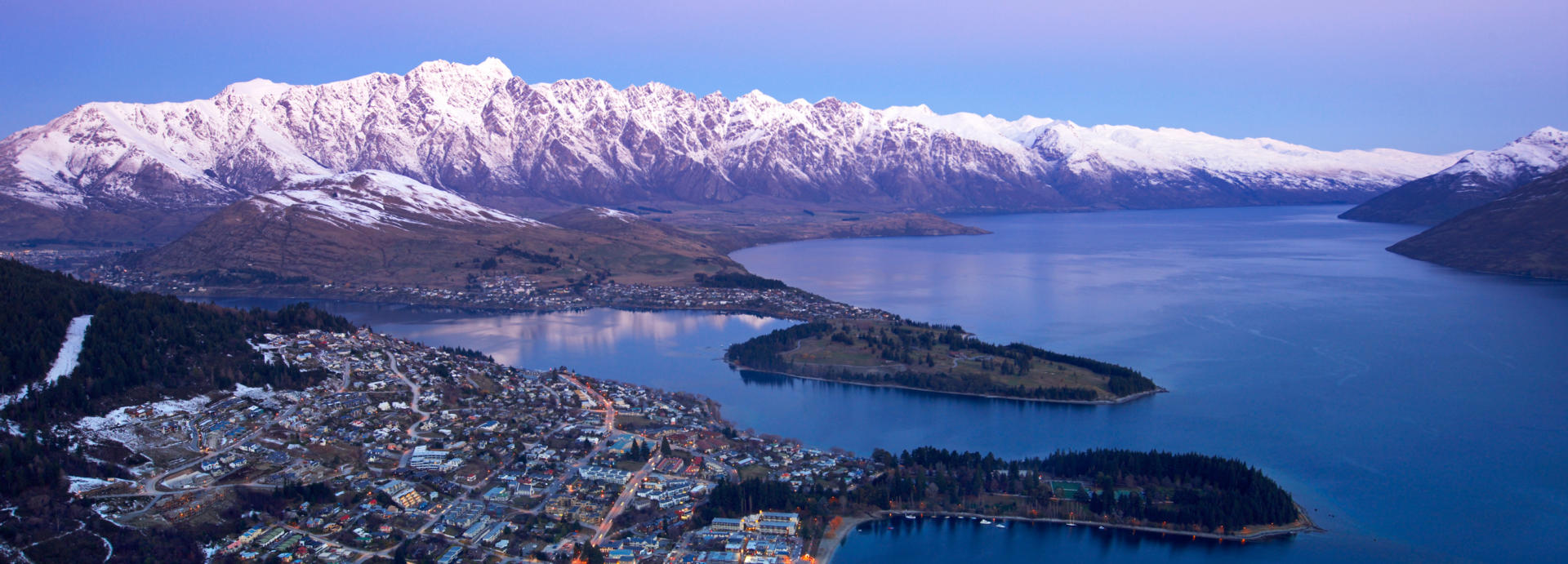
In a country where superlatives are routinely employed to describe the scenery, many would argue that Queenstown’s surrounding grandeur is hard to surpass. Set at 310 m altitude midway along the shores of the 84 km long / 292 square kilometre Lake Wakatipu – the country’s third largest – this is a haven that will keep any visitor happily gazing for hours. While thought to have been named by early Irish settlers in 1863 after a town in their homeland, a more popular explanation is simply that the place is fit for a queen. Recent decades have seen the reputation as both a scenic gem and a centre for adventure tourism result in exponential growth and the Queenstown-Lakes district is now the only place in New Zealand where property values are higher than those in Auckland. With an international airport the town is unrecognisable from the sleepy local holiday destination visited by the founder of New Zealand Frontiers on a childhood family holiday in the 1980s. As recently as the turn of the century, when I spent time-mountain biking along the lake shore during regular agreeable days off while tour driving, the town had yet to even see the arrival of a supermarket. Today the lakefront walk still passes by historic cottages built by the original European settlers and remains a highly recommended way of walking off any extravagant cuisine encountered in mountainside restaurants or nearby vineyards. Population of the urban precinct is rapidly headed towards 20,000 people, with twice this number living in the greater Queenstown area. In addition to the lively atmosphere and outstanding scenery, weather also features as a drawcard for inhabitants with a near continental climate providing barely half the national average rainfall along, with warm summers and crisp winters that occasionally see snowfall descend the surrounding mountainsides and enter the township for several days at a time. During winter months, which are heralded by a popular winter festival in mid June, direct flights from Australia ensure it is common the encounter more overseas visitors than locals on the surrounding Remarkables and Coronet Peak ski fields. During summer months activities on offer range from exhilarating jet boat tours through narrow gorges or pristine alpine valleys, white water rafting, lake cruises aboard a locally built 110 year old Edwardian steamship, balloon rides and outback 4x4 tours to name but a few. Nearby Kawarau Gorge hosts the world’s first commercial bungy jumping operation, established by entrepreneur A J Hackett in 1988 following a rogue publicity jump the previous year from the Eifel Tower. Vineyards in the Gibbston Valley are some of the most popular in the country and can be visited by campervans or on fascinatingly informative wine tours. Lunch or dinner after taking the gondola to Bob’s Peak high above Queenstown Bay can be enjoyed while marvelling at one of New Zealand’s most breath-taking views. Queenstown also serves as an excellent base from which those on tighter itineraries can take day tours by coach or aircraft to Milford Sound. While the hustle and bustle of this St Moritz of the South Pacific may no longer be to everyone’s liking, its location on the popular SH6 touring route still makes at least an overnight stopover thoroughly recommendable – with the invigorating setting guaranteed to provide you with memorable photos to cherish.
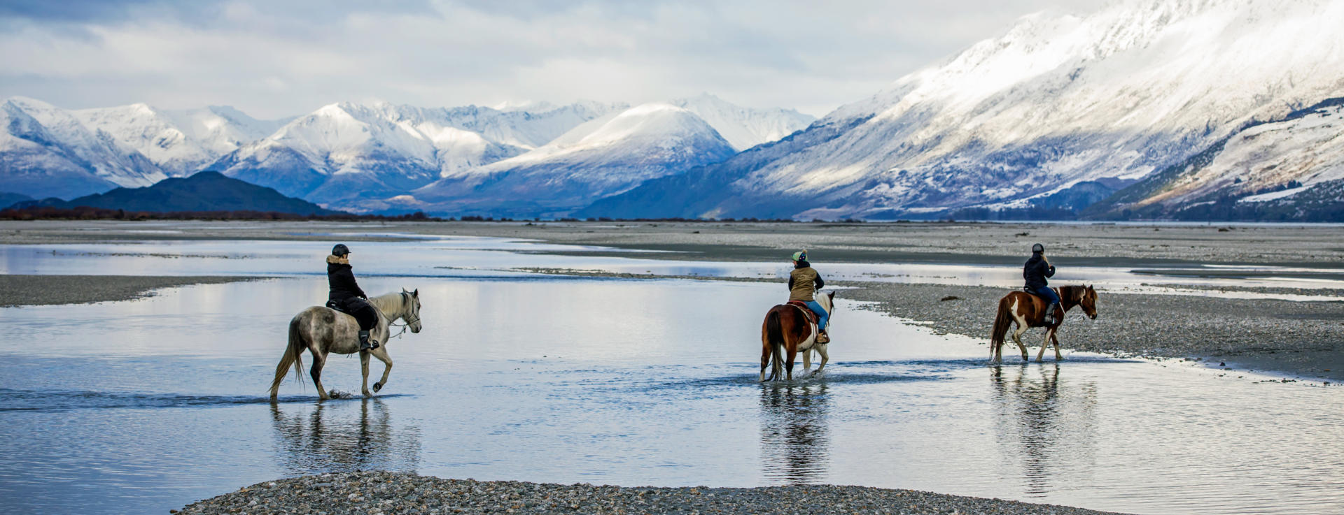
Glenorchy is an appealingly sleepy settlement set among spectacular alpine scenery at the head of Lake Wakatipu. Although a 90 km round trip from Queenstown, the magnificent lakeside road affords some of the most stunning scenery in New Zealand and there are opportunities to overnight upon arrival and prolong appreciation of the location. Several Lord of the Rings filming locations lie nearby. Jet boat safaris carry visitors further into the wilderness on boats that use the locally developed water jet propulsion system to skim at speed over the shallows of braided alpine streams. The area is a paradise for those with a sturdy pair of legs – so much so that a nearby settlement is simply called Paradise. Lake Sylvan offers a great opportunity for those seeking a half day hike, while a realistic opportunity also presents to experience the 32 km Routeburn Track that passes through both the Mt Aspiring and Fiordland National Parks. The Routeburn track is regarded as one of New Zealand’s most outstanding alpine hikes and can be completed as a strenuous day walk or broken up into shorter days with nights at superbly located huts along the way. Although the hike is a one way journey like most in New Zealand, New Zealand Frontiers insurance packages include having your motorhome relocated from one end of the trail near Glenorchy to or from the other end on the SH94 Milford Sound Highway with the highly rated Trackhopper vehicle transfer service.
Please note that the rapid changeability of weather in New Zealand means that all hikes require responsible preparation. It is no exaggeration to say that a cloudless morning can transform to falling snow within 30 minutes, at any time of the year. Advice should be sought from the Department of Conservation where intentions should be registered and overnight accommodation in huts can be paid for and booked if required. Sturdy footwear should be worn, warm clothing packed and food carried even for short walks in sunny weather. On any walk of several hours in duration, hikers are well advised to travel prepared to overnight and carry supplies accordingly.

Alexandra is a pleasant township of 5000 inhabitants set in semi arid countryside that makes it, along with neighbouring Cromwell and Roxburgh, the centre of one of New Zealand’s most important stonefruit horticultural districts. The area’s relatively harsh climate sees summer temperatures regularly climb into the mid-thirties and fall well below freezing during winter. Nearby Ophir is often the coldest place in the country during winter months, where temperatures of below minus 20 degrees have been recorded. Coupled with average annual rainfall of only 360 mm, the climate ensured that the thousands who responded to a local gold rush in the 1860s were a hardy breed. These days a spring blossom festival held in September is a major attraction and there are ample opportunities for independent travellers to purchase cherries, apricots and wines direct from orchards and some of the most southerly vineyards in the world. Alexandra lies on SH8 beside the Clutha river, New Zealand’s second longest at 388 km and boasting the country’s highest average flow rate at 614 cubic metres per second. Just upstream the Clyde dam and associated 460 MW power station contribute to the 57% of electricity generated from hydro sources nationally. Construction was completed in 1993 as the last of the Think Big projects of national infrastructure funded by eventually crippling overseas debt that were seeded in the 1970s as a response to the global 1973 and 1979 Oil Crisis and the challenges of having lost the United Kingdom to the European Economic Community as a dominant export market. The superb 150 km Central Otago Rail Trail passes through Alexandra and local operators provide opportunities to complete all or sections of this scenic gem by mountain bike, horse or human hoof.
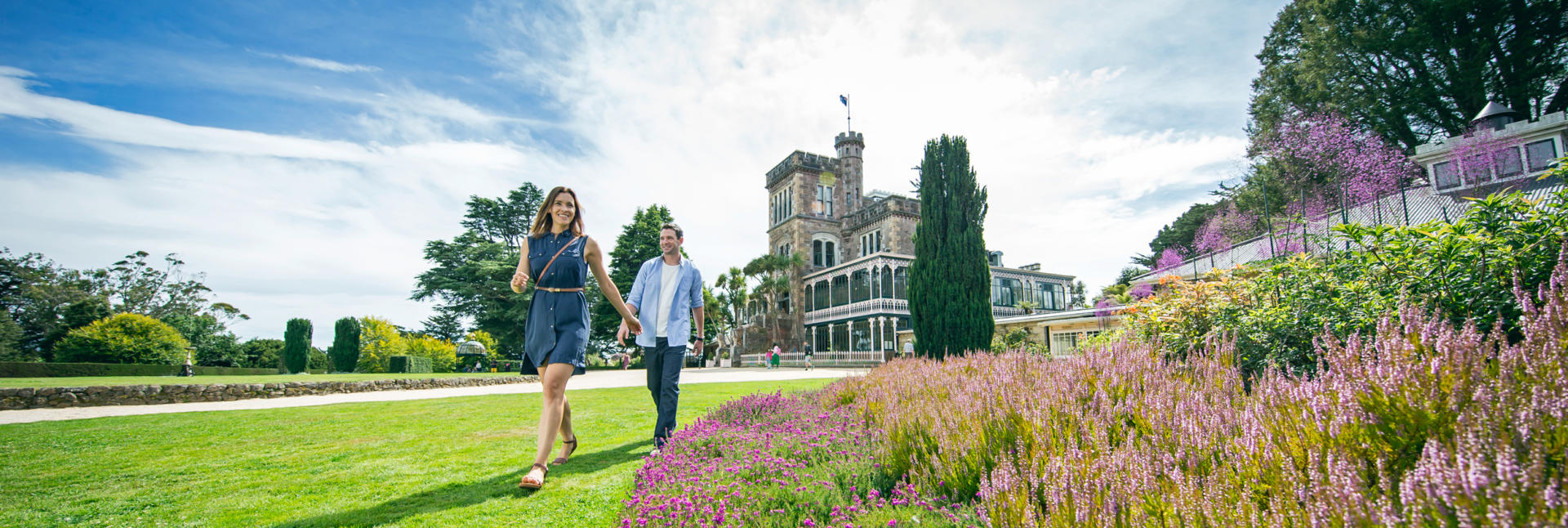
Dunedin’s climate, university and heritage all combine to ensure that its reputation as the Edinburgh of the South is both accurate and entirely appropriate. The population of roughly 120,000 people, a significant proportion of whom possess the vibrancy of tertiary students anywhere, live within an urban area that claims some of the steepest streets in the world and where roofs are occasionally dusted with snow during winter months. The sheltered harbour was favoured by Maori centuries before the arrival of settlers from the Free Church of Scotland and the contemporary name of Otago for both the wider region and the peninsular that extends from the city out into the South Pacific Ocean is an Anglicised corruption of the name Otakou used by the original indigenous inhabitants. By the 1860s an influx of Europeans and Chinese fuelled by the discovery of gold inland had swelled ranks to the point where Dunedin was New Zealand’s largest city and financial stronghold, a title it held for decades. The early economic dominance and heritage have provided a legacy of architecture beyond that typically enjoyed by comparably sized cities. During a previous life spent guiding visitors around my homeland prior to establishing New Zealand Frontiers, it was a pleasure to spend time admiring the churches and stately homes within a short walk of Robbie Burns’ permanent gaze in the city’s central Octagon. The Railway Station, built of local basalt and sandstone, earned a knighthood for its designer. St Paul’s Anglican Cathedral (where the world’s first female bishop was ordained in 1990), the First Church, Olveston Jacobean mansion, the Otago Museum and the Settlers Museum can easily claim a day for those fortunate to be on unhurried independent travels by motorhome. Short drives to the superlative views from Signal Hill and to stretch one’s legs on the famous Baldwin St (a quick visual assessment should be enough to discourage you from taking your camper up) are mandatory. Further afield on the Otago Peninsular are award winning opportunities to view an albatross colony at Taiaroa Head and the rare hoiho (yellow eyed penguin). The peninsular also features Larnach’s Castle, creation of a member of parliament who had the means to indulge his housing tastes on a grand scale. Sadly the retreat’s opulence failed to overcome his business disappointments and, having reached the lofty ranks of Finance Minister, he stunned the nation by dispatching himself with a revolver in parliament.
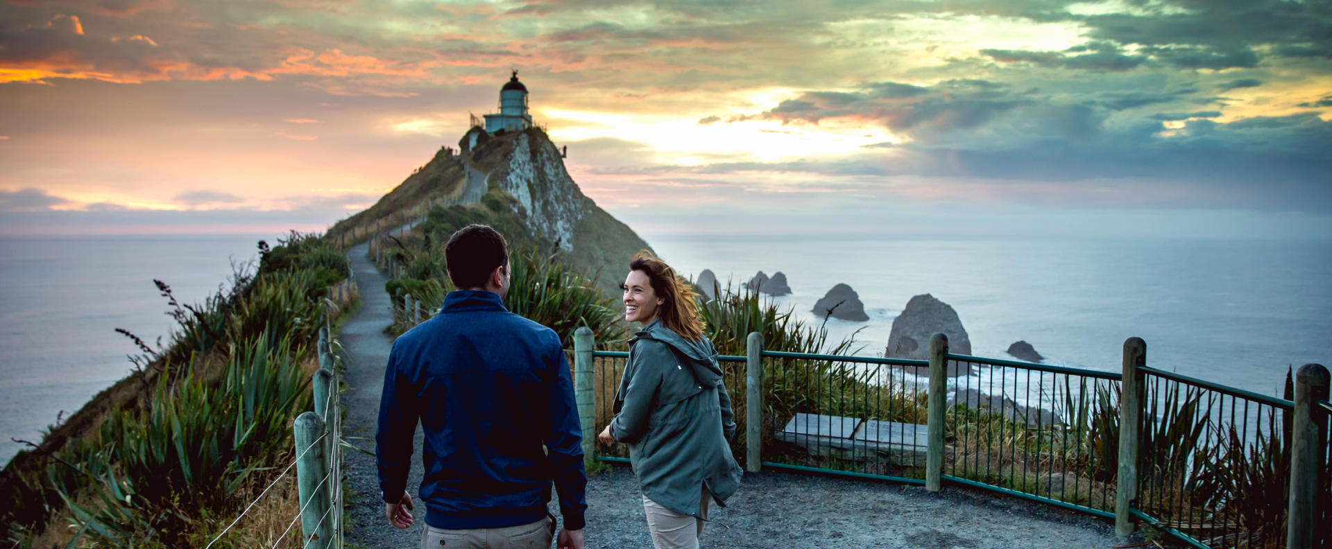
The Catlins is a sparsely populated area of invigorating isolation at the South Island’s south-eastern corner. Its extent is somewhat flexible but is generally accepted to be bounded by the Clutha river to the east and the Mataura river to the west, extending inland far enough to create a total area of 1200 sq km. Only a little over 1000 people live in the entire district, with the largest town of Owaka having around 400 inhabitants. The 100 km of coastline faces the Southern Ocean and features the New Zealand mainland’s southern-most extremity at Slope Point. The exposed nature of the shoreline contributes to the remote atmosphere where frequently large seas and misty weather resulted in many shipwrecks that claimed up to 150 lives each during the country’s early colonial history. One of New Zealand’s popular designated touring routes, the Southern Scenic Route, roughly follows the coastline through The Catlins and provides convenient access to points of interest like Slope Point, Nugget Point, Curio Bay, Cathedral Caves and Purakaunui Falls. Wildlife abounds with New Zealand fur seals (kekeno), Hookers sea lions and occasional southern elephant seals sighted on beaches. The exceedingly rare yellow eye penguin (hoiho) and tiny Hector’s dolphin are also commonly seen, with the later often found frolicking in the surf along beaches.