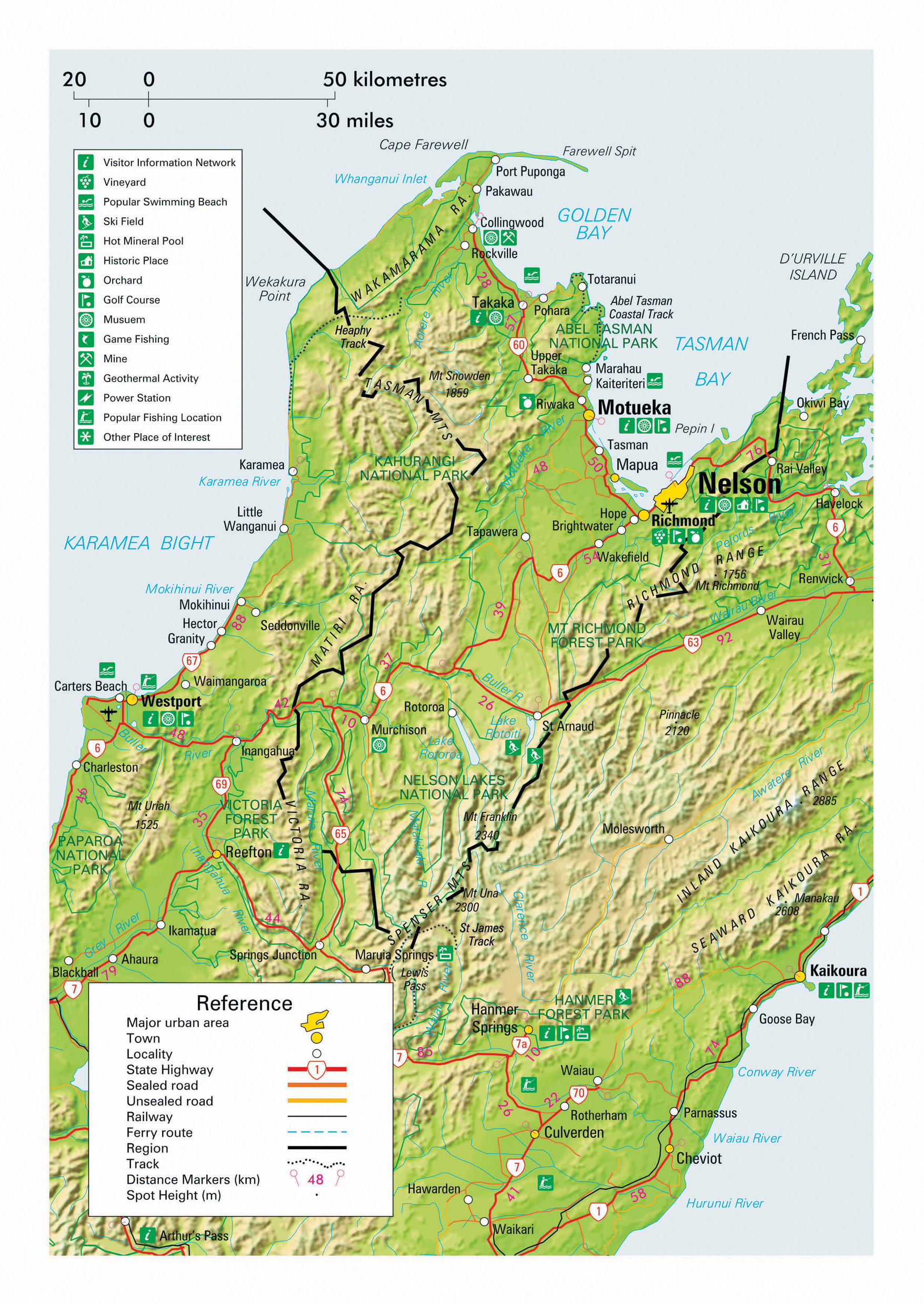
The Nelson–Tasman Region, while commonly referred to as a single region, is comprised of two separate regions under the system of regional council territorial authorities established in 1989 during a period of widespread social and economic reform throughout New Zealand. The regions occupy the geographically diverse and scenic north-western corner of the South Island, stretching approximately 200 km from Cape Farewell in the north to the SH7 Lewis Pass highway in the south. Its northernmost point is situated roughly 150 km north of the North Island’s southernmost point. The regions have a low population density across a total area of 10,000 sq km, of which the Nelson region occupies only 424 sq km as the smallest region in New Zealand. Climate is varied from alpine to coastal areas but is generally mild and among the sunniest in the country, with an absence of the harsher winter conditions encountered in interior regions or of the summer heat experienced in some other areas.
Over 50% of the Tasman region falls within the Kahurangi, Nelson Lakes and Abel Tasman national parks, and the weather is conducive to extensive horticultural activity in remaining areas, including citrus and hops. Independent travellers enjoying the freedom of road trips by motorhome on itineraries of the average 21 days or longer thoroughly enjoy the diverse and unhurried detours on offer in the region’s extremities, and even those completing circuits of the South Island on shorter trips have the opportunity to overnight in the alpine interior when passing through on SH6.
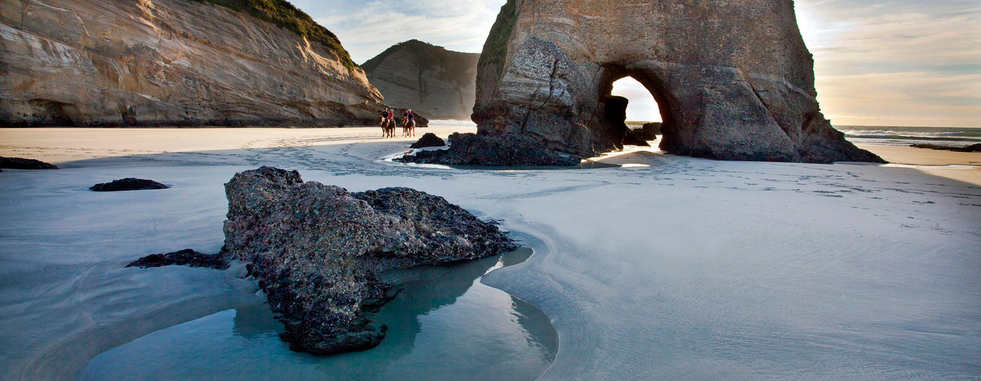
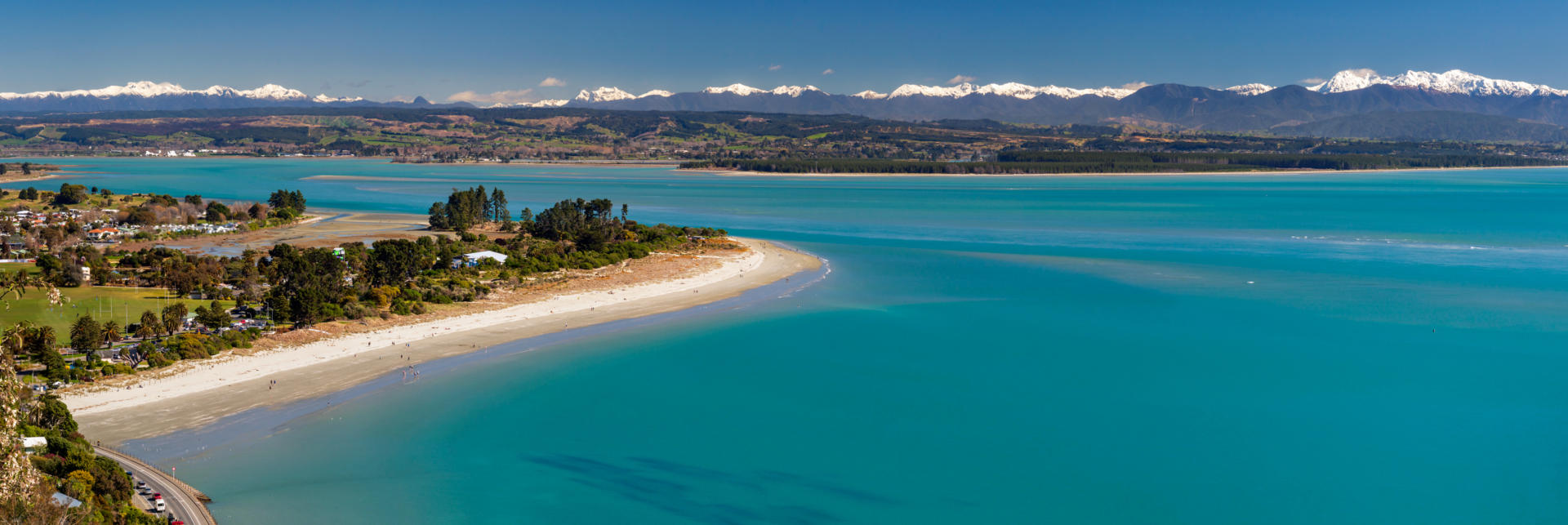
Golden Bay is a large crescent shaped bay in the north of the Nelson-Tasman region. Its relatively isolated location is renown for attracting residents seeking relaxed lifestyles. Access to the bay is via the impressive Takaka Hill on SH60. The southern end of the bay meets the Abel Tasman National Park, while the northern part of the bay is formed by the 26 km long Farewell Spit. The area offers an abundance of attractions for those on leisurely itineraries, including the remarkable water clarity of Te Waikoropupu Springs and the Aorere Goldfields where New Zealand’s first gold rush occurred in 1856. From the northern road end at Puponga, tours can be taken to the tip of Farewell Spit and rewarding walks taken to Cape Farewell and the west coast Whariki Beach.
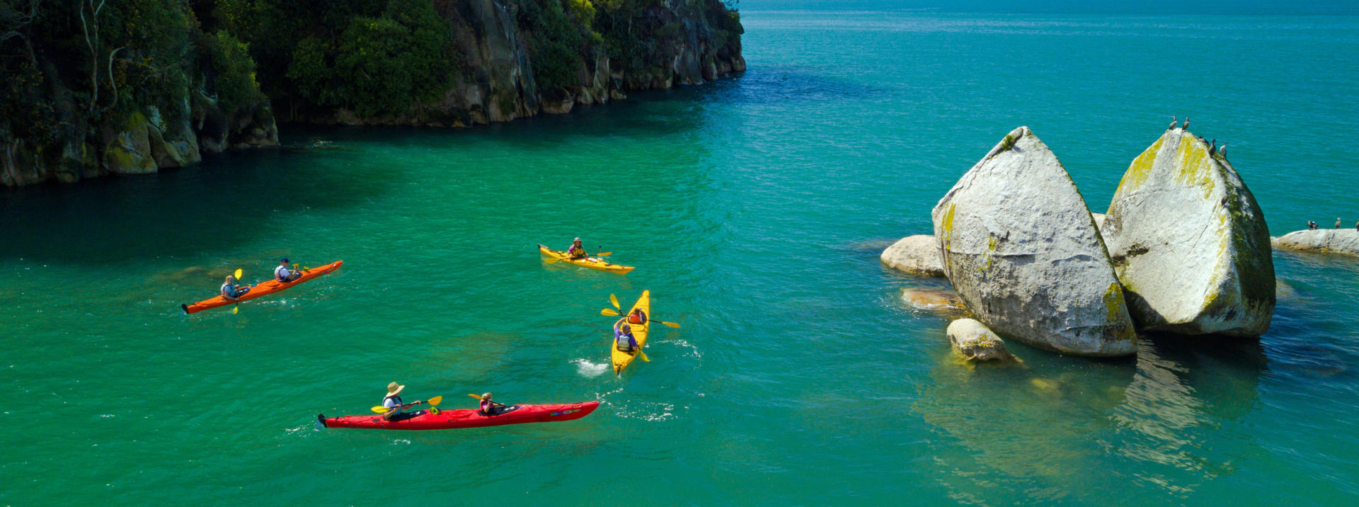
Regarded as one of the jewels of the scenic splendour to be found throughout New Zealand, the Abel Tasman National Park is understandably also one of the country’s most popular. The park is named in honour of Abel Janszoon Tasman, the Dutch explorer believed to have been the first European to sight New Zealand in December of 1642. Attempts to come ashore in the area for supplies were thwarted by aggression from alarmed local Maori whose nature was to be naturally wary of strangers. The encounter saw four of Tasman’s crew despatched by clubs and the resulting failure to land has seen his place in the history of the land he named forever overshadowed by that of Captain James Cook who stepped ashore 127 years later. The Abel Tasman National Park is New Zealand’s smallest at just 237 sq km, but its 60 km long coastal walk that strings together a succession of magical beaches typifies the pristine beauty found throughout the country and ensures heavy usage for much of the year. Options abound to walk, kayak and stay overnight, and water taxis offer the opportunity to combine transportation modes or to do sections of the track before being returned to the start point. Entry point to the track is from Marahau, a 63 km drive north-westward on SH60 from Nelson.
Please note that the rapid changeability of weather in New Zealand means that all hikes require responsible preparation. It is no exaggeration to say that a cloudless morning can transform to falling snow within 30 minutes, at any time of the year. Advice should be sought from the Department of Conservation where intentions should be registered and overnight accommodation in huts can be paid for and booked if required. Sturdy footwear should be worn, warm clothing packed and food carried even for short walks in sunny weather. On any walk of several hours in duration, hikers are well advised to travel prepared to overnight and carry supplies accordingly.
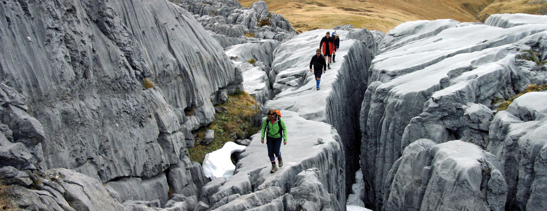
The Kahurangi National Park covers an extensive area of the South Island’s north-western corner. At 4529 sq km it is New Zealand’s second largest park and stretches over 150 km from Golden Bay in the north to its boundary with SH6 near Murchison in the neighbouring West Coast region. Although largely little-touched wilderness, the park has access points from the towns of Karamea, Murchison, Motueka, Takaka and Collingwood. The 80 km long Heaphy Track traverses the park from near Collingwood in the north to Karamea on the park’s west coast. Those open to incorporating an epic mountain biking experience into their travels will also find numerous operators offering opportunities to ride the outstanding 85 km Old Ghost Road. Flora, fauna, geology and the scenery are all widely varied across the Kahurangi National Park. The park was a major venue for filming scenes for the Lord of the Rings movies. Landscapes range from the palm fringed west coast beaches to alpine tussock lands and extensive wetlands. Bird life includes the great spotted kiwi, the largest of our kiwi species, and the exceedingly rare takahe large alpine hen. The park also encompasses limestone geology with cave networks over 30 km in length that plunge to depths of 1024 m, along with marble and granite formations. Fossils 540 million years old have been found within the park.
Please note that the rapid changeability of weather in New Zealand means that all hikes require responsible preparation. It is no exaggeration to say that a cloudless morning can transform to falling snow within 30 minutes, at any time of the year. Advice should be sought from the Department of Conservation where intentions should be registered and overnight accommodation in huts can be paid for and booked if required. Sturdy footwear should be worn, warm clothing packed and food carried even for short walks in sunny weather. On any walk of several hours in duration, hikers are well advised to travel prepared to overnight and carry supplies accordingly.
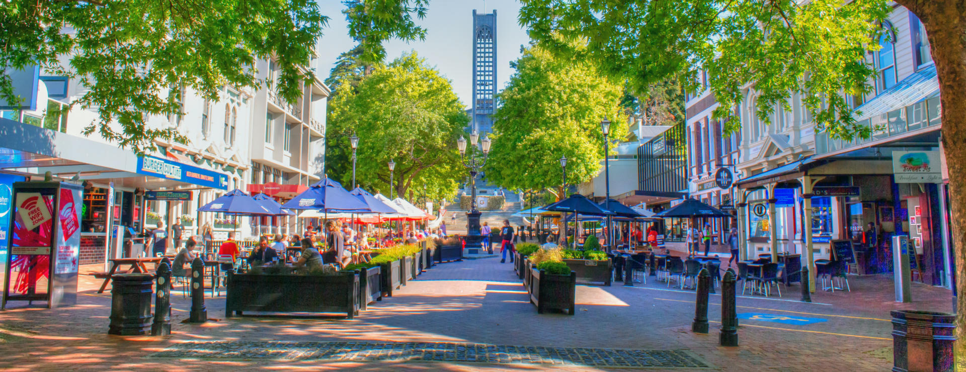
Popularly known as ‘Sunny Nelson’ on account of the local sunshine quota consistently beating the national average by 10%, Nelson has a population of 52,000 people and is the oldest city in the South Island. Established in 1841 by the Wakefield brothers’ New Zealand Company, likely 700 years after the arrival of Maori to the area, Nelson was a favoured locality for the sheltered anchorage offered by a 13 km long boulder bank that lies just offshore. The settlement was named in honour of Horatio himself and many of the streets commemorate his illustrious career as an admiral, with the main thoroughfare being Trafalgar Street. At the head of Trafalgar Street is the city’s Christ Church Cathedral, construction of which was interrupted and modified by the 1929 7.3 magnitude Murchison earthquake. An early citizen born nearby at Brightwater by the name of Ernest Rutherford gained prominence in history for work in the field of physics that saw him labelled the Father of Nuclear Physics, earning a Nobel Prize, burial at Westminster Abbey next to Isaac Newton, and a place on our $100 banknote. Nelson was also the origins of one of New Zealand’s most successful festivals, the World of Wearable Arts (now held in Wellington) that attracts entries from around 40 countries. A spectacular museum combining the garments and classic cars remains a popular local attraction. In addition to supporting the surrounding horticultural industry and one of the country’s largest commercial fishing fleets, Nelson is home to some of the New Zealand’s earliest and most successful microbreweries.
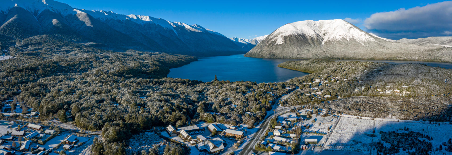
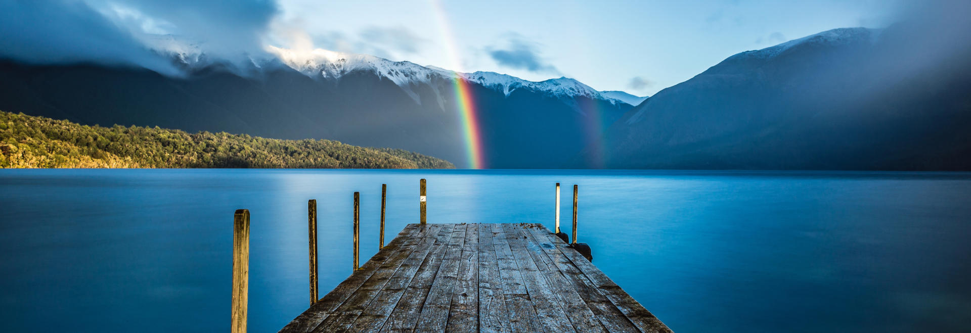
The 1019 sq km Nelson Lakes National Park lies in the south of the Nelson-Tasman region’s alpine interior. Conveniently located on the SH6 route often used by those completing circuits of the South Island on independent motorhome travels, the park has some great overnighting opportunities among breath-taking mountains. Centred upon the large lakes Rotoiti and Rotoroa, both of which have easy road access from the gateway village of Saint Arnaud, the park is about 100 km from Blenheim or Nelson. A major attraction of the park for those with robust legs is the 80 km Travers-Sabine Circuit Track that takes in both major lakes and several mountain passes, overnighting in alpine huts with truly magnificent views and offering side trip opportunities to picturesque high altitude lakes such as Lake Angelus and Blue Lake.
Please note that the rapid changeability of weather in New Zealand means that all hikes require responsible preparation. It is no exaggeration to say that a cloudless morning can transform to falling snow within 30 minutes, at any time of the year. Advice should be sought from the Department of Conservation where intentions should be registered and overnight accommodation in huts can be paid for and booked if required. Sturdy footwear should be worn, warm clothing packed and food carried even for short walks in sunny weather. On any walk of several hours in duration, hikers are well advised to travel prepared to overnight and carry supplies accordingly.