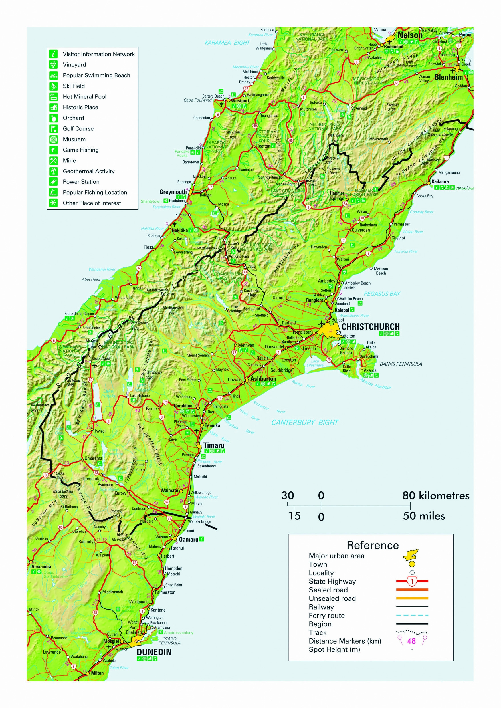
Canterbury is the largest region in New Zealand with 44,508 sq km – covering almost 30% of the entire South Island and being home to 55% of the South Island’s population. It stretches approximately 500 km from north to south and includes the South Island’s largest city of Christchurch, located about halfway along the region’s coastline. The region also features New Zealand’s largest plain which accounts for around half its total area and supports extensive horticultural (chiefly vegetables, grapes and grain) and agricultural (mainly sheep, cattle dairy and deer) industries. The climate is temperate oceanic with considerable variation between the inland Mackenzie Basin and coastal regions. Average temperatures vary between 6 degrees in winter and 18 degrees in the summer. However, as Canterbury lies in the lee of the Southern Alps, the region is also known for some continental influence in its climate and Christchurch is the driest of New Zealand’s ‘four main centres’ receiving just over 600 mm of annual precipitation. Snow falls briefly to sea level most winters, while the town of Rangiora holds the record for the country’s highest ever temperature of 42 degrees. The popular Mt Hutt Ski field is located just over 100 km from Christchurch and is often the first field in the Southern Hemisphere to open.
The region features many smaller, peaceful rural service towns and several alpine settlements, while the coastal village of Akaroa has the distinction of being the only place in New Zealand with French colonial origins. The region is as picturesque for those on a road trip as any in the country with wide open spaces, tree lined main streets in its provincial towns, a back drop of permanently snow-capped mountains, breathtakingly azure coloured lakes in is inland regions, and the unhurried atmosphere of its productive landscapes. SH1 conveniently travels the full length of Canterbury, while the SH73 Great Alpine Highway provides the most direct route to the West Coast region and SH8 heads south-westward from the plains, carrying travelers inland to Queenstown.
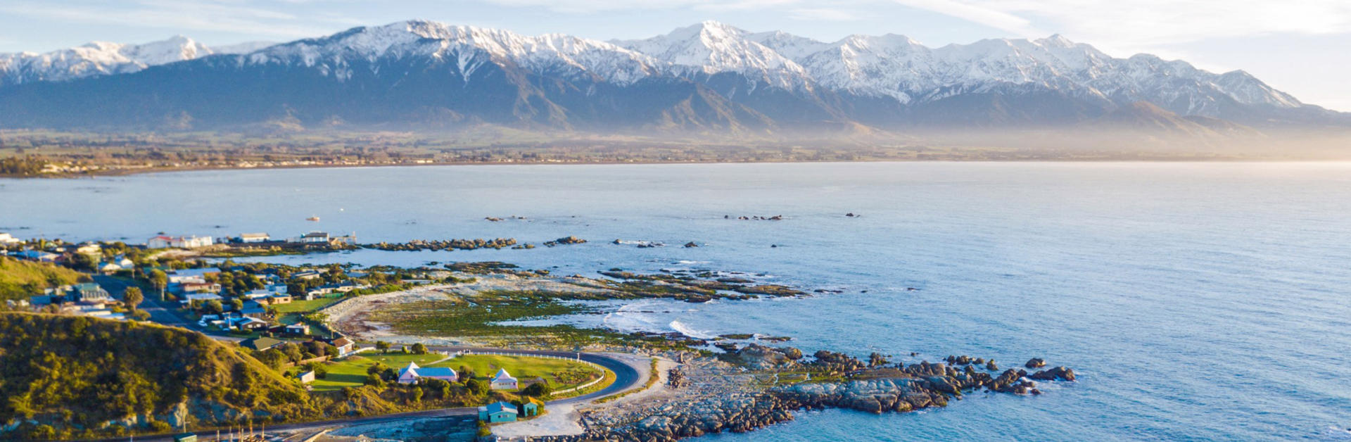
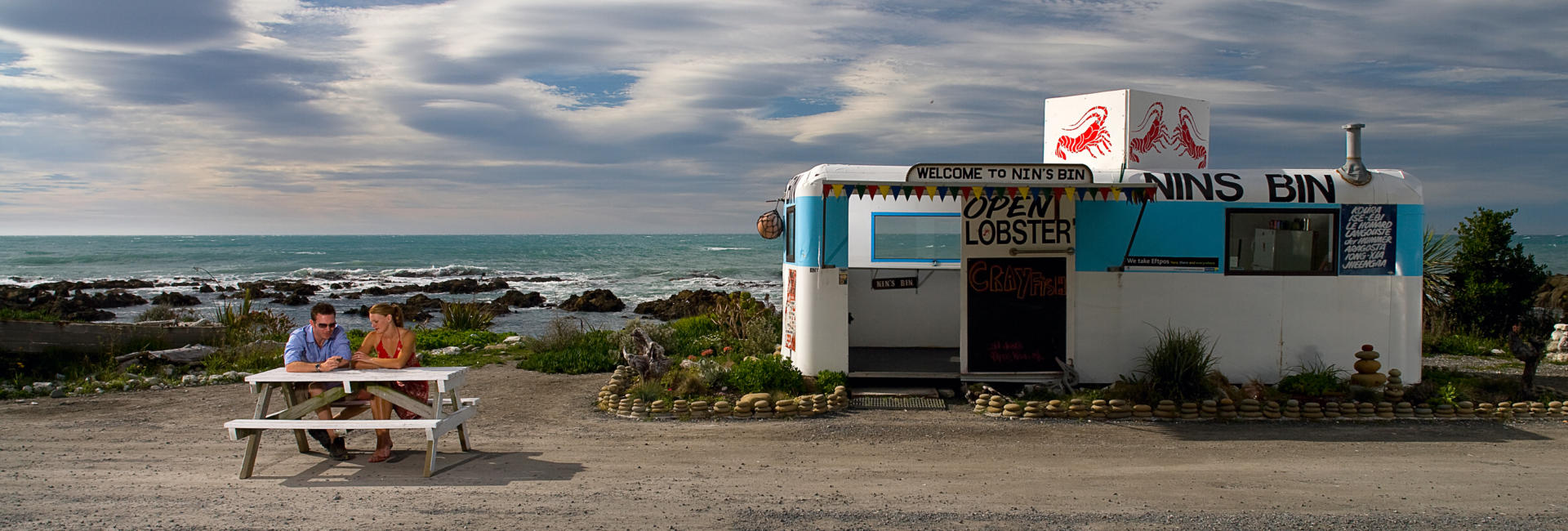
In a country renown for its scenic splendour, few towns can boast a backdrop quite as splendid as Kaikoura’s. Located on the stretch of SH1 that runs north from Christchurch to the top of the South Island, the town is well worth a full day’s visit on any road trip. To the north lie the Seaward Kaikoura Range that rises to over 8500 feet directly out of South Pacific Ocean. Offshore, a deep oceanic trench channels abundant marine life right in to the coastline, providing reliable marine and wildlife viewing opportunities. It’s hard to believe that Kaikoura existed only as a sleepy lobster fishing backwater until the 1980s when the locals figured that visitors might also quite enjoy the abundance of seals, dolphins and breeching whales that accompanied their commercial fishing crews. As well as cruises, the scenery lends itself well to appreciation from coastal walks, including around the local peninsular. A massive 7.8 magnitude earthquake in 2016 – felt as far away as Auckland – has provided impressive geological changes and much reconstruction, including a billion dollar resurrection of some of New Zealand’s most scenic stretches of coastal highway and the rail line that carries the Coastal Pacific Great Journey of New Zealand. Nearby lie the Clarence river with rafting opportunities, and the views from the café at Kekerengu take some beating.
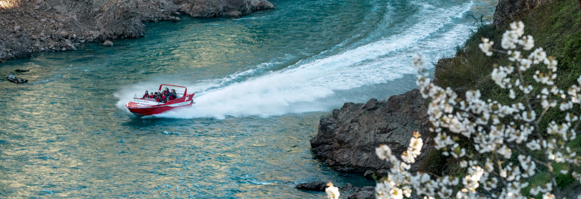
The spa resort of Hanmer Springs lies at 338 m elevation in a peaceful alpine setting, 133 km north of Christchurch. The township is reached via a short side trip across an historic bridge from the SH7 route which traverses the Southern Alps via the 903 m Lewis Pass - the northernmost of the South Island’s three alpine passes. Established as a hot springs destination as early as 1859, Hanmer Springs has long rated as one of New Zealand’s most popular holiday towns. The Hanmer Springs Thermal Pools offer therapeutic relaxation year round, from warm summer’s evenings to snowy winter’s days. Beyond chilling out or exploring the village’s quality shopping opportunities and galleries, there isn’t much you can’t do nearby. Choose from mountain biking, quad biking, horse trekking, golfing, rafting, jet boating, hiking and skiing to find a pace that meets with your approval if your itinerary permits a highly recommended break among the picturesque trees of a spa town.
Arthur’s Pass, traversed by SH73, is one of three routes to carry traffic through the Southern Alps. It takes its name from an early government surveyor who, in 1864, explored the route previously used by Maori to cross between the east and west coasts of the South Island. At 973 m it one of the country’s highest mountain passes and is occasionally affected by snow closures during winter months. The route demonstrates the stark flora variations of an island where predominantly westerly winds result in significant changes in annual precipitation each side of the dividing Alps. A township of the same name sits nearby at 740 m elevation and serves as a base from which to explore the 1185 sq km Arthur’s Pass National Park. Numerous popular walks range from the easy Devil’s Punchbowl to the more challenging Avalanche Peak trails. New Zealand’s most popular scenic rail excursion, the TranzAlpine Great Journey of New Zealand, travels close to the road on much of its 223 km route between Christchurch and Greymouth
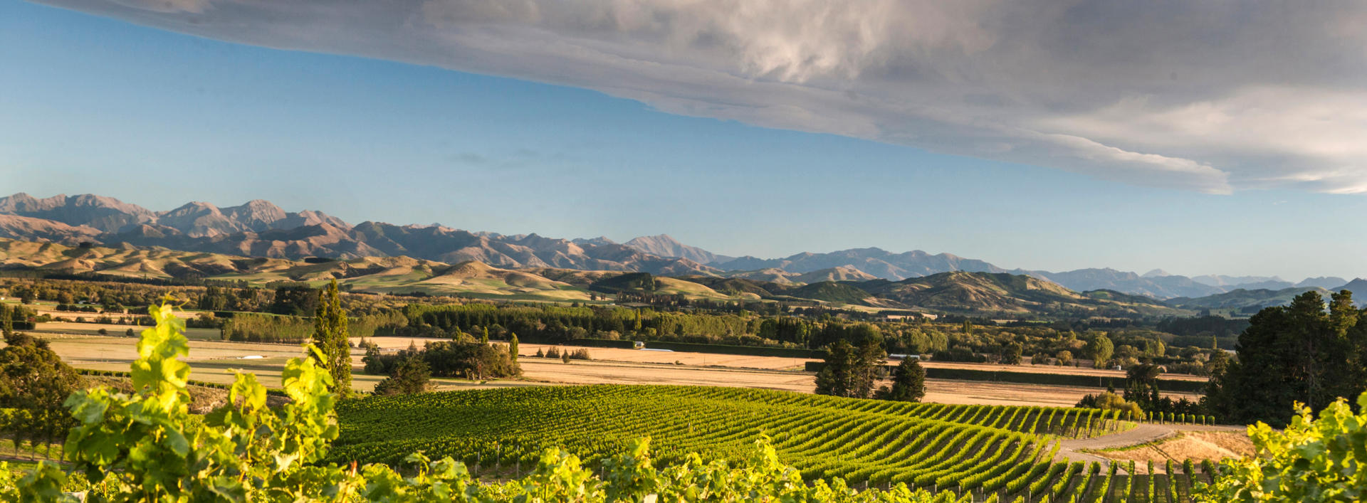
Situated just 60 km north of Christchurch on SH1, the Waipara Valley is well known as one of New Zealand’s finest wine producing areas. Local Pinot Noir, Riesling, Sauvignon Blanc and Chardonnay wines hold reputations as some of the best in the country. Hosting over two dozen wineries that are supplied by around 80 vineyards, the industry greatly enhances the scenery encountered on the drive between Christchurch and Kaikoura and offers the opportunity to drop in and purchase a bottle directly from its source. Many vineyards are located right on the main road or a short distance down quiet byways and often feature cafes or restaurants to provide nourishment for travellers.
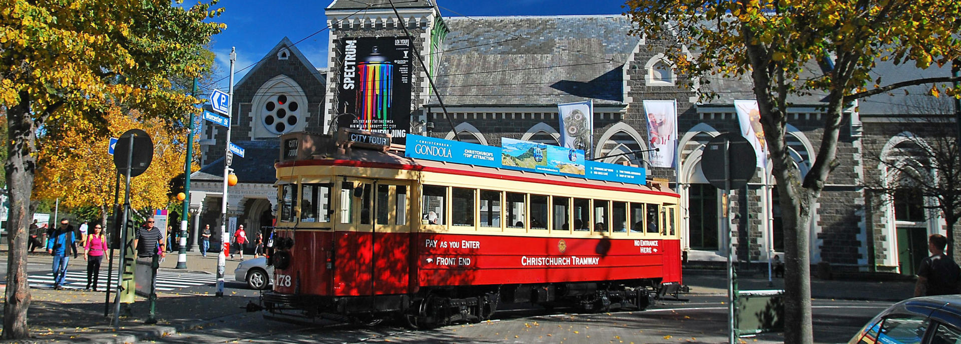
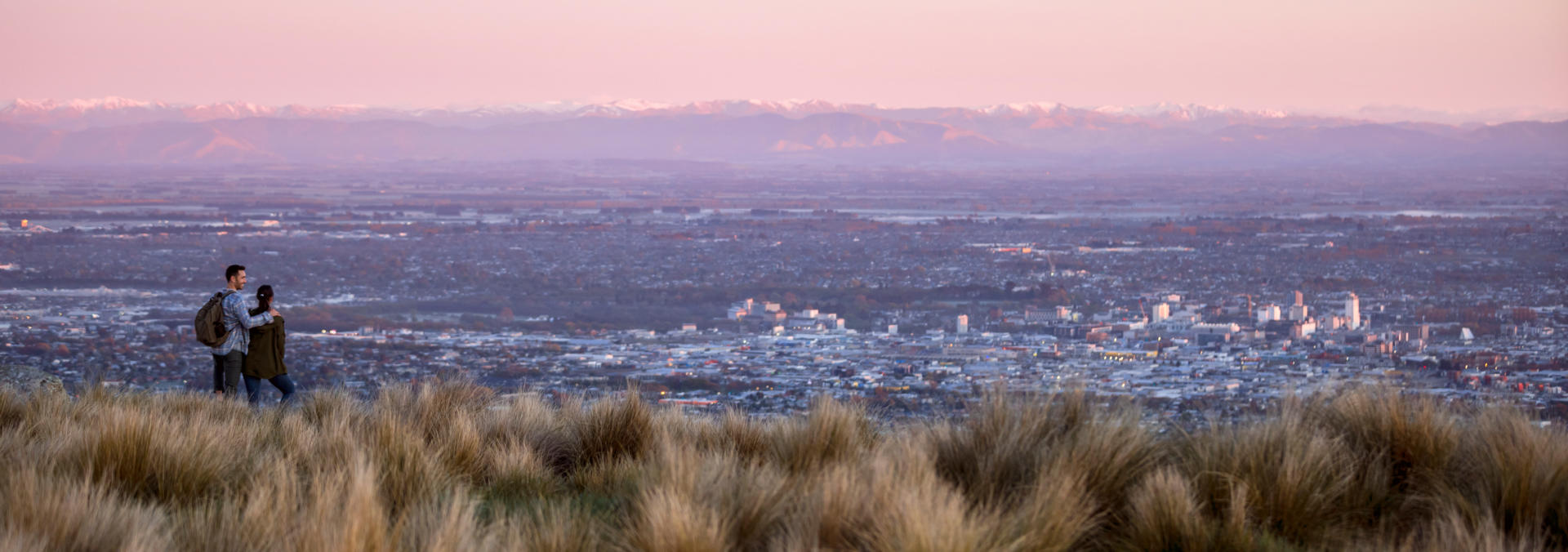
With a population of 370,000, Christchurch is rated as New Zealand’s third largest city. Combined with neighbouring districts, the greater region is home to roughly half the one million Kiwis who call the South Island home. Located mid-way down the east coast of our largest island, Christchurch is a flat city situated on our largest alluvial plain. To seaward lies the contrasting rugged Banks Peninsular of volcanic origins, while inland the seasonally snow-capped foothills to the great Southern Alps provide a picturesque western backdrop. The city was rocked by a series of major earthquakes in 2010-2011 that claimed 185 lives and resulted in around 1000 buildings having to be removed from the CBD. Several times this many homes were destroyed and some key landmarks, such as the Anglican and Catholic cathedrals remain in ruins, permanently changing the face of the city. However Christchurch continues to re-emerge as a vibrant place to visit and explore. With a warm climate in summer that benefits from a fohn wind off the Alps, and occasional snowfall during the winter months, the city is well worth devoting a day or more to during any New Zealand itinerary, regardless of the season. Activities include exploring the extensive centrally located Hagley Park, enjoying a punt ride on the Avon River as it meanders through the inner city, visiting the world class Canterbury Museum and Christchurch Art Gallery, checking out the Airforce Museum of New Zealand and taking a drive (or a cable car) to the elevated view points on the peninsular with its quaint satellite settlements. As the departure point for supply flights to the Antarctic Territories of several countries, there’s also an excellent visitor centre devoted to our icy southern neighbour at Christchurch International Airport.
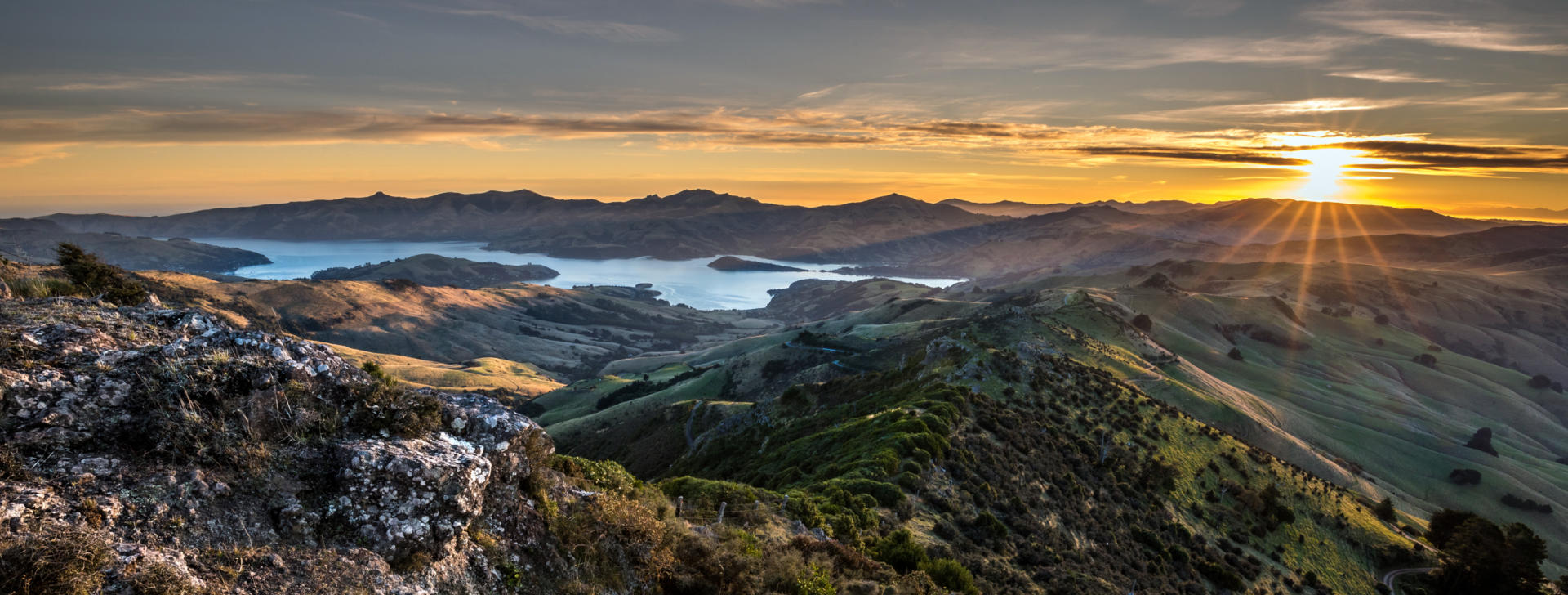
Akaroa is a sleepy harbour-side village of less than 1000 people on Banks Peninsular, a pleasant 80 km drive from Christchurch on SH75. It is unique in New Zealand in that it was settled by French colonists prior to the British signing the Treaty of Waitangi with most of the nation’s Maori chiefs in 1840. This heritage gives it a special atmosphere and ensures a fascinating local museum. Numerous historic buildings remain in the compact township and waterfront cafes encourage a relaxing visit. The Akaroa harbour and surrounding coastline is also home to endemic Hector’s dolphins, one of the world’s smallest dolphin species, and cruises to see these are a key attraction. Sailing, kayaking, vineyards and artists’ galleries also combine to create a variety of local activities on offer to visitors.
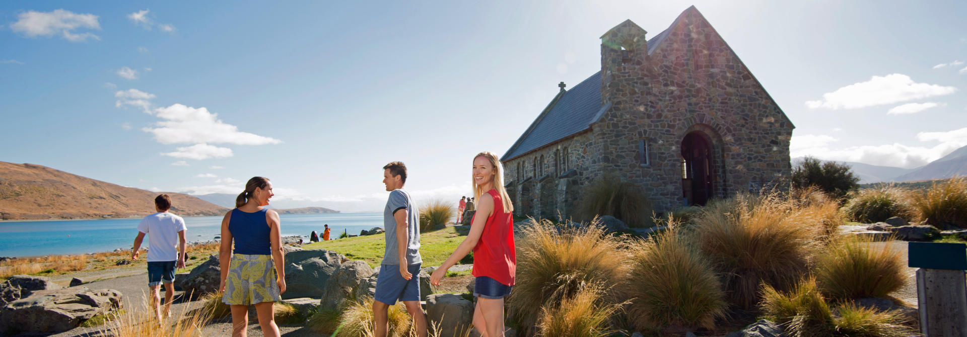
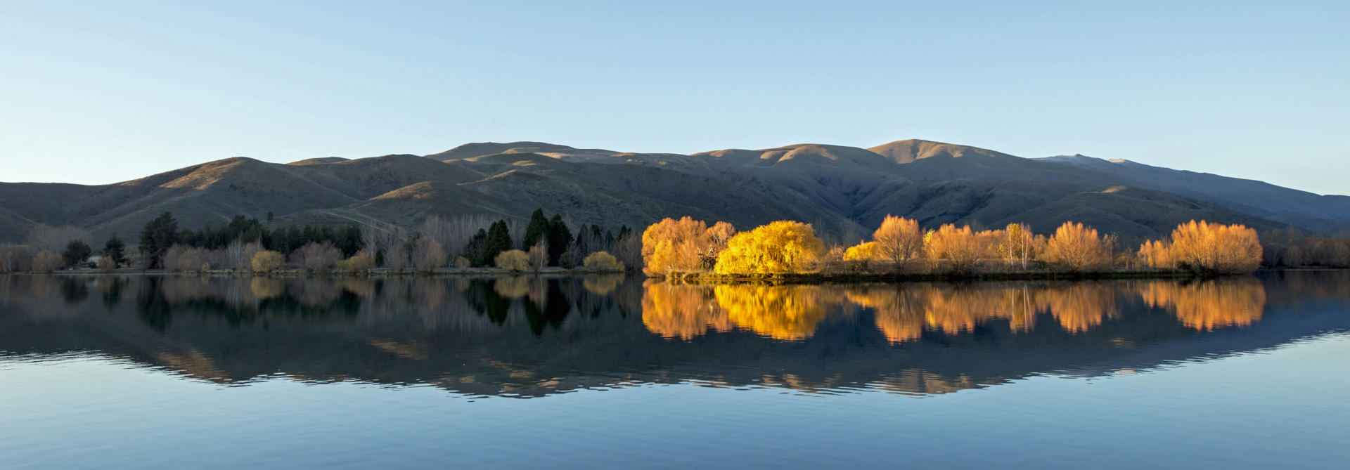
Tekapo’s spectacular location is fueling its popularity as a holiday home destination for locals from the major South Island cities. Located on the shores of a stunning turquoise lake and right on the main SH8 route from Christchurch to Queenstown, it’s hard to miss. The surrounding inland location is among the country’s more sparsely populated, supporting the local night sky’s status as the first UNESCO World Heritage Starlight Reserve. A wonderland by winter and a festival of alpine wildflower scenery during the summer months, Tekapo is a photographer’s dream by day and night. The lake’s unusual hues are created by sediment from the glaciers that supply its waters and make a wonderful back drop for one of our most photogenic chapels. Nearby attractions include the Mt John Observatory, scenic flights over the New Zealand's majestic tallest peaks and the alpine fault line, and hikes and bike rides to further quaint lakes.
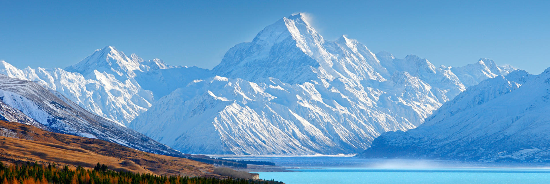
The Aoraki Mt Cook National Park is home to all but one of New Zealand’s 20 peaks that exceed 3000 m, and to eight of our 12 longest glaciers. With permanent ice covering 40% of the park's 721 sq km area that stretches along 60 km of the country’s main alpine fault, it’s understandable that the park rates as one of our premier alpine destinations, even if it is one of our smallest national parks. Mt Cook itself – increasingly referred to by its Maori name as Aoraki – is the country’s tallest at 3724 m. Amazingly, geologists estimate the mountain is growing by as much as 10 mm each year, with total growth of 25,000 m being continually balanced by constant erosion. Road access is limited to SH80 and terminates at Mt Cook Village, from where the nation’s highest peaks literally tower overhead. Temperatures range from as low as minus 13 in winter months and can top 30 degrees in the summer. A DoC campsite offers the opportunity to overnight among the alpine grandeur, while further holiday parks at Glen Tanner Station and Twizel township offer accommodation outside the park for those enjoying the independence of motorhome travels. Superb short hikes, day hikes and more challenging guided mountaineering are available from Mt Cook Village, which also hosts an excellent visitor centre and a luxurious hotel if you feel like treating yourself to a night out of your van. Sightings of the cheeky kea alpine parrot among other birdlife are common. Further activities include scenic flights and boat trips on Tasman Lake to view icebergs calving from the 23 km long Tasman Glacier.
Please note that the rapid changeability of weather in New Zealand means that all hikes require responsible preparation. It is no exaggeration to say that a cloudless morning can transform to falling snow within 30 minutes, at any time of the year. Advice should be sought from the Department of Conservation where intentions should be registered and overnight accommodation in huts can be paid for and booked if required. Sturdy footwear should be worn, warm clothing packed and food carried even for short walks in sunny weather. On any walk of several hours in duration, hikers are well advised to travel prepared to overnight and carry supplies accordingly.
Twizel is set in the Mackenzie Country region of inland Canterbury among some of New Zealand’s most iconic landscapes, on the main highway between Christchurch and Queenstown. The inland location provides among the best shelter available from the maritime influences of our climate, with warm, dry summers and winters that occasionally see temperatures remain below freezing point for extended periods. Established as a workers’ town in 1968 in support of the construction of a major series of local hydro-electric power stations, the town is today a popular local holiday destination. With a population of little over 1000, it is a shadow of its former self when 6000 people helped create the 50 km of canals and associated lakes that are now a feature of the region. Renown for its famous night sky, Twizel is also a great base from which to explore the Aoraki/Mt Cook National Park, burn off some calories on the Alps2 Ocean Cycle Trail, engage in trout and salmon fishing or guided sport hunting, or take advantage of the superb gliding conditions with a scenic flight from nearby Omarama. The local Ohau ski field operates during winter months and secluded luxury lodges will recharge your batteries year round.
Timaru is an agricultural service and port town of 30,000 people located at the southern extremity of the Canterbury Plains, 157 km south of Christchurch and roughly halfway between Christchurch and Dunedin on SH1. The town features Edwardian architecture and, for such a modest settlement, a particularly impressive Francis Petre designed Roman Catholic Basilica. Other attractions include the Caroline Bay Park, South Canterbury Museum and Aigantighe Art Gallery. Local farmer and inventor Richard Pearse is proudly celebrated as having flown a powered aircraft nine months before the Wright Brothers, while the Timaru Boys High School boasts an Oak tree that was gifted by Hitler to former student Jack Lovelock when he won the 1500 m at the 1936 Olympics in Berlin. Routes inland from here meander through thoroughly pleasant countryside and the neighbouring town of Geraldine offers a peaceful alternative overnighting opportunity for those who travel by motorhome.