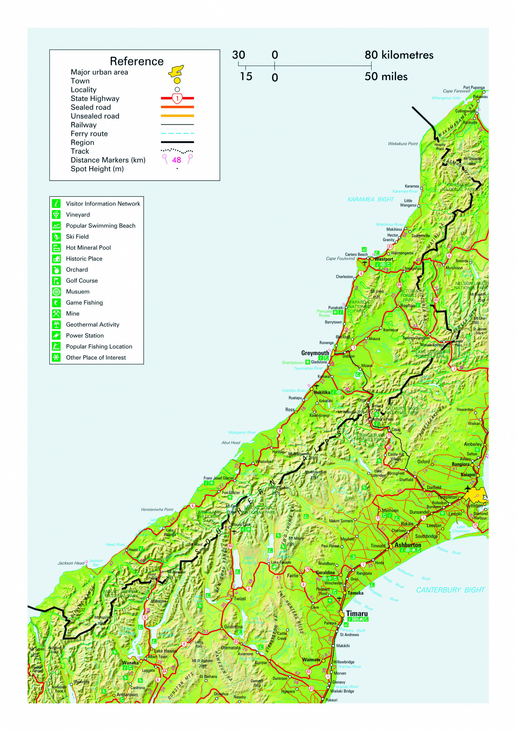
The West Coast region of the South Island is an isolated, sparsely populated and supremely spectacular part of New Zealand. Stretching almost 600 km from north to south and separated from the rest of the country by the majestic Southern Alps, road access to the region is limited to the Lewis, Arthur’s and Haast Pass alpine highways. The isolation and lowest population density in New Zealand of just over one person per square kilometre - there are only 32,000 people scattered throughout the extensive region - give the locals a reputation as hardy, capable and independent people. More than half of the population live in the townships of Westport, Greymouth and Hokitika scattered along the coast. The West Coast is one of a handful of areas in the world where moisture laden airflow is blown ashore by prevailing winds to meet the barrier of a mountain range rising to over 3500 m, ensuring truly monumental rainfall. It is not uncommon for over a metre to fall during single weather events that often embrace howling gales, and annual totals of up to 18 m have been recorded in remote areas.
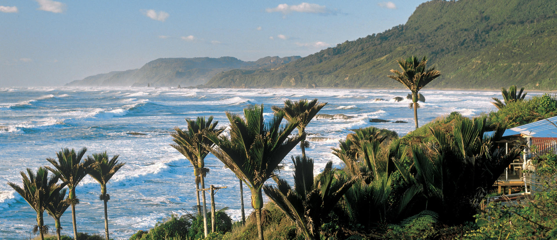
At higher altitudes the precipitation falls as heavy snow and gives rise to glaciers that flow right down into the rainforest. Despite the awe-inspiring impact such a climate has on the geography, much of the region receives rainfall on less than half the days in any given year. Opportunities abound for hikes through ancient forests, to stroll on deserted beaches, view rare bird species and to generally expose oneself to the rugged atmosphere of this special region. With scenery that ranges from native nikau palms with backdrops of snow-capped peaks to a steep rocky coastline interspersed with blowholes, and to tranquil lakes that reflect the surrounding grandeur, the West Coast is a truly memorable part of Aotearoa. For visitors enjoying the benefit of travels by the comfort of their own motorhome, a road trip along SH6 that takes in most of the length of the region is absolutely essential. Planning a southerly itinerary through the region will ensure that the vista of the progressively rising Alps remain in your windscreen throughout the journey.
Drivers are advised that the sometimes breathtakingly inclement weather of the West Coast Region does result in occasional road closures. Advice on current highway conditions throughout New Zealand can be found on the New Zealand Transport Agency’s Journey Planner website.
The township of Westport with its population of approximately 4500 lies at the mouth of the Buller River and a short distance from where SH6 emerges from the interior of the north-western corner of the South Island to commence its journey southward through the extensive West Coast region. The township serves as an important service centre for the area which supports significant farming, fishing and coal mining industries. Nearby Cape Foulwind has pleasant coastal hiking opportunities and a resident seal colony. Popular tours are also available to the former Denniston coal mine that utilised a dramatically steep incline railway to transport over 12 million tons of coal down from an altitude of over 500 m in less than two kilometres, providing both superb views and an insight into the hardships of the country’s pioneers. Inland the SH6 route passes through the scenic Buller Gorge where the 170 km long river of the same name boasts the highest flood flow of any river in the country at up to 14,000 cubic metres per second.
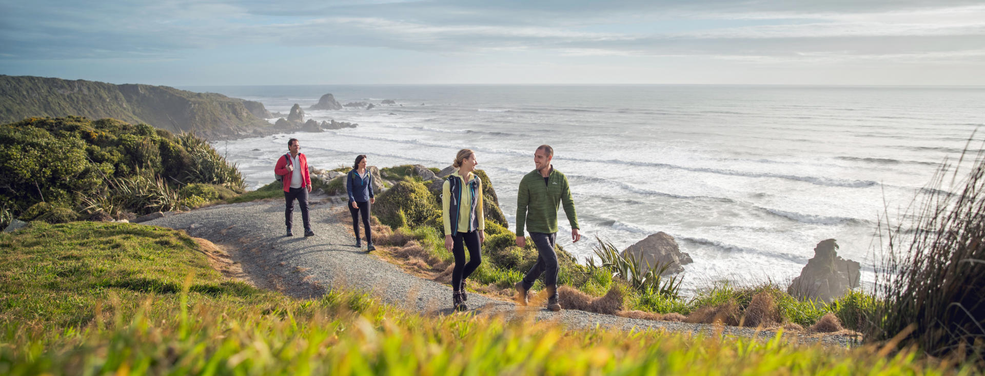
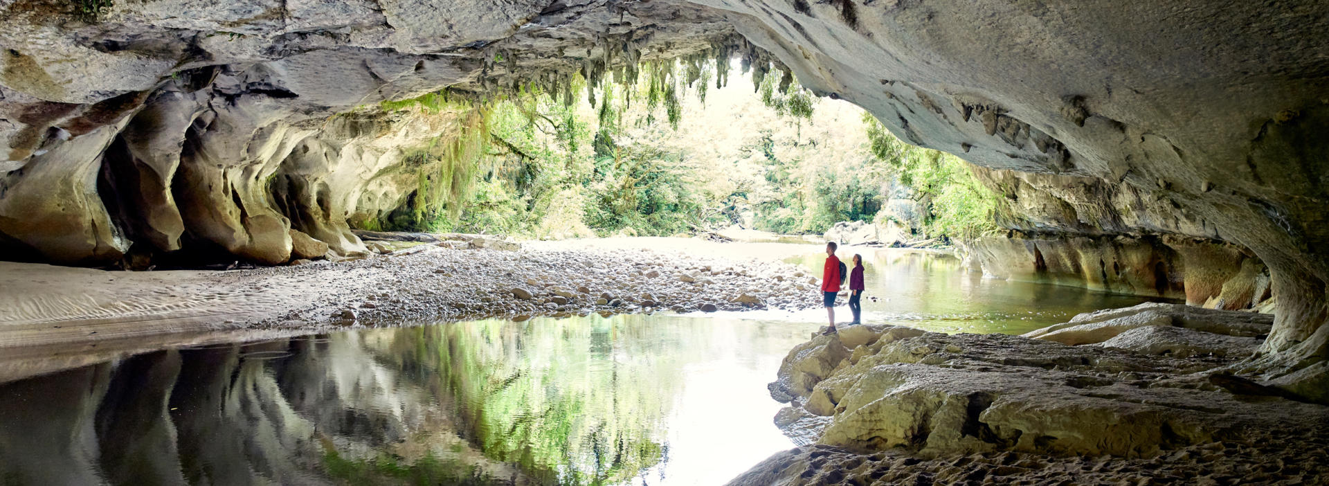
Established in 1987 and only 430 square kilometres in area, the Paparoa National Park is one of New Zealand’s smallest and newest national parks. Geology in the area ranges from granite to limestone, providing magnificent sculpting of the coastline and superb river and cave systems throughout the heavily forested park. The layered Pancake Rocks formations at Punakaiki with their spectacular blowholes and coastal views are just a short walk from SH6 and rate as one of the country’s scenic gems. Inland the wider national park beckons those with time to pause and explore. Walks range in duration from the 30 minute Truman Walk through subtropical forest to the 56 km Paparoa track that features overnight accommodation at approximately 1000 m altitude. The national park includes memorials to two tragedies in recent history with the Pike 29 Track dedicated to miners who remain entombed in the Pike River Mine following an explosion in 2010, and the Cave Creek Walk includes a memorial to 14 university students who died in a viewing platform collapse in 1995.
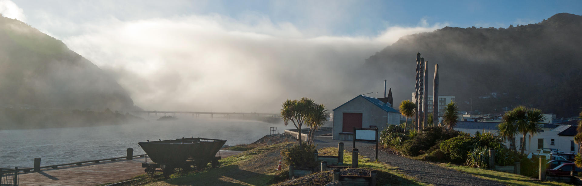
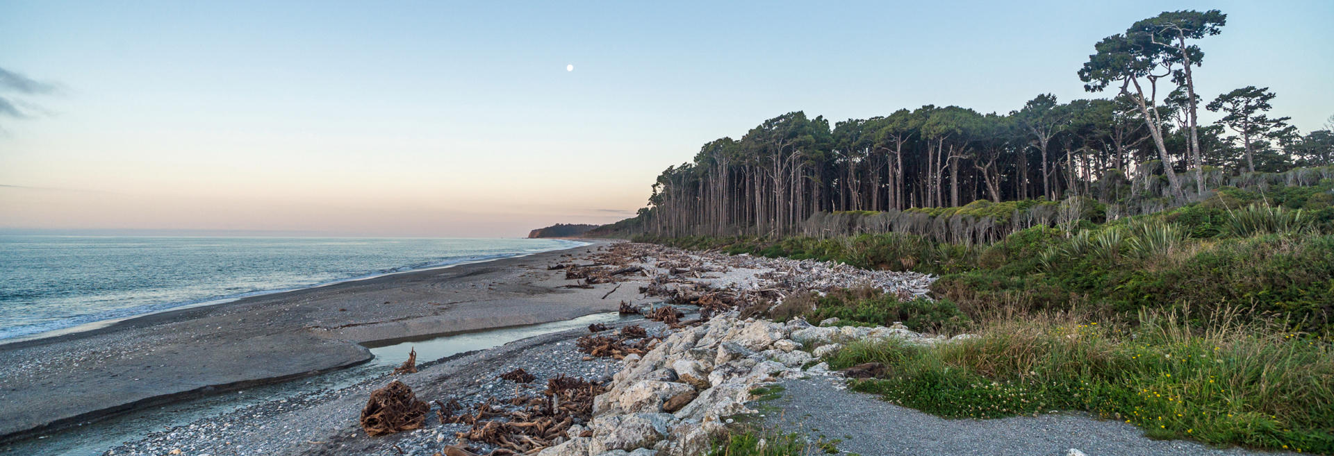
Greymouth is the West Coast region’s largest commercial centre and, as the name suggests, lies at the mouth of the Grey river on a stretch of coastline marked by long, exposed, driftwood strewn sandy beaches. Its population of approximately 10,000 accounts for almost 30% of the entire West Coast’s inhabitants. The town is located 243 km from Christchurch via the Arthur’s Pass route and is the terminus for the daily return Tranz Alpine scenic rail journey that operates between the two cities. Climate is described as oceanic with few extremes of temperature and only rare snowfall. The 2.4 m annual rainfall, while wet by national standards, is very modest for the West Coast and typical of the region’s inhabited areas. Local industries include farming, fishing, mining and tourism. The local Monteiths Brewery was established during the hive of local activity associated with the West Coast gold rush of the 1860s and continues to offer tours for those who worship craft beers. A nearby rustic recreation of the boom time settlements in the region called Shanty Town is located near the southern end of town. Being the major centre of population on the West Coast, Greymouth offers an opportunity for those with campervans to obtain fuel at reasonable prices on road trips through the otherwise sparsely populated region.
Karamea is the northern-most settlement in the West Coast region. Its location near the end of a 100 km one-way road that stretches northward from Westport ensures that it avoids all but the most dedicated of travellers with the privilege of particularly leisurely itineraries. However the relative inaccessibility combined with the scenery and activities offered by the Kahurangi National Park that surround it results in the locality often being referred to as one of the country’s best kept secrets. 16 km further north from the township, the road end marks the starting / finishing point for the popular 82 km Heaphy track that connects the West Coast and Nelson-Tasman regions. The local population of barely 400 people are dependent upon a combination of track-associated tourism and farming in their otherwise sleepy neck of the woods. Shorter walks taking in the coastal scenery, native Nikau palms and nearby Oparara Basin Arches make the area well worth considering on a laid-back visit.
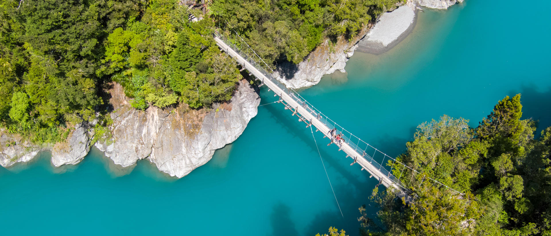
Hokitika is located on the SH6 route that travels almost the full length of the West Coast region. It is a pleasant service centre township of approximately 3600 people – a little over half of the population it had at the peak of the 1860s gold rush that swept the region. During this period in excess of 40 sailing ships could be found docked at any one time at the local wharf which rated as the country’s busiest port for both vessel movements and export values in 1867. The gold rush was eventually replaced by native timber milling which remained a major industry throughout the West Coast Region until finally being outlawed in 2002. These days the Westland Milk Products dairy factory at Hokitika processes milk from 430 farms and exports products which include the WestGold branded butter worth over half a billion dollars annually to 40 countries. Among local attractions are the deserted sandy beaches easily accessed from the short drive to the river mouth, and the vivid turquoise colours of the Hokitika River as it passes through the scenic Hokitika Gorge 30 km inland. The town is also regarded as the centre of pounamu (greenstone) carving in New Zealand and several galleries offer the opportunity to see carvers at work and marvel at this magnificent material that remains revered by Maori people. In keeping with the region’s reputation for robust independence, Hokitika hosts a very popular Wildfood Festival in early March of each year, where one can sample exotic fare ranging from lamb’s testicles to stallion’s semen. Providing adequate nourishment has been imbibed, the option presents to return in February of the following year to run, cycle and kayak the 243 km through the Southern Alps from nearby Kumara Junction to Christchurch in the country’s most celebrated endurance race, known as the Coast to Coast. If you should fail to arrive on the same day or make the mistake of crossing the finish line with the appearance of being close to death, the event’s gregarious founder may be waiting to personally ridicule you.
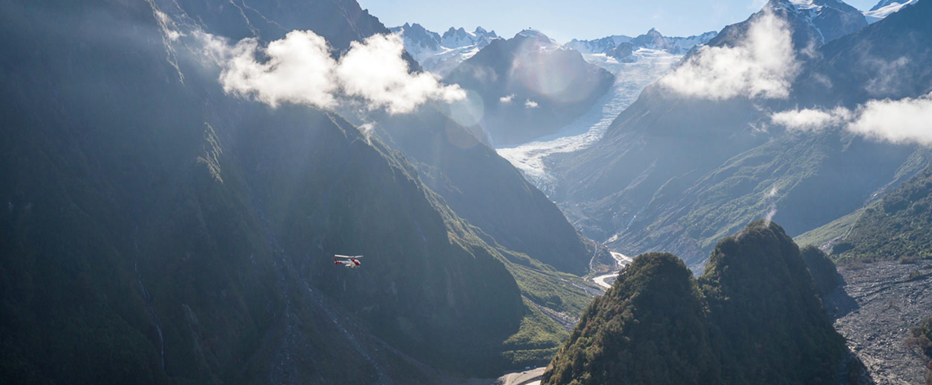
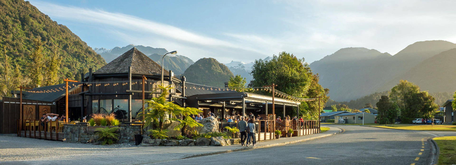
The twin townships of Franz Josef Glacier and Fox Glacier are lie barely 20 minutes apart on SH6, adjacent to a stretch of the Southern Alps where the Pacific and Australian tectonic plates meet head on to have generated an estimated 20 km of uplift - and much greater lateral movement - over the past 45 million years. Franz Josef Glacier was named after an Austrian Emperor by the prominent locally active German born pioneering geologist Julius von Haast, while Fox Glacier was named in honour of an early New Zealand Premier prior to the establishment of the title of Prime Minister. The glaciers are notable for descending to within 300 m above sea level. Despite their steep descents and high rates of snowfall in the alpine basins that feed them, both glaciers are currently in a retreat phase. Debris pushed ahead of them in past advances indicate that they have previously extended beyond the current coastline. Opportunities to view the glaciers range from easy hikes from the road ends that approach the existing terminals and can easily be negotiated in your motorhome, to helicopter sightseeing and guided ice walks among the crevasses. The townships that service these thriving attractions offer a host of bars and cafes, along with the traditional range of souvenir stores. Local walks also provide the option of enjoying the remarkable early morning and late evening splendour of this truly spectacular corner of the world. Lake Matheson, a short drive from Fox Glacier village, offers a particularly memorable walk and views of the country’s highest peaks.
Approximately 20 km north of Franz Josef Glacier lies the sleepy hamlet of Okarito, accessible via a highly recommended side trip from SH6. The village of just a few hundred people is home to both the celebrated landscape photographer Andris Apse and the Booker Prize winning author Keri Hulme. The Okarito Lagoon is the largest unmodified wetland in New Zealand and is a bird watchers’ paradise. Among the abundance of species present, tours are available to see the country’s rarest kiwi species, the Rowi and New Zealand’s only nesting sites for the kotuku (white heron). Nearby Lake Mapourika, which feeds the lagoon, is filled with tannin-rich waters that give it a dark colour typical of many West Coast lakes and resulting in serene reflections of the surrounding alpine scenery.
Drivers are advised that the sometimes breathtakingly inclement weather of the West Coast Region does result in occasional road closures, with the access roads to the glaciers and adjacent stretch of SH6 being particularly prone to damage during storms. Advice on current highway conditions throughout New Zealand can be found on the New Zealand Transport Agency’s Journey Planner website.
Jackson Bay represents another of the abundant opportunities offered by independent travels in New Zealand to experience some serious isolation. This sleepy fishing village is sandwiched between the rugged Southern Alps and the often wild and tumultuous waters of the Tasman Sea. Reached via a 51 km road stretching south from Haast on SH6, Jackson Bay is the southern-most point of road access in West Coast region. Although only a little over half way down the South Island’s west coast, from here any hint of flat land between the ocean and the mountains disappears as the coastline becomes hundreds of kilometres of steep bluffs indented only by a succession of massive fjords. Spare a moment to contemplate the lifestyles of the commercial fishing folk who make this outpost home and of those sealers and whalers who preceded them by 200 years. Superb walks are available around Jackson Head and to nearby Lake Ellery for those who appreciate spectacular scenery and fresh air in their lungs.
The Haast Pass is the southern-most of the three alpine highways that provide access through the Southern Alps to the West Coast region. It is also the lowest, with a summit of 563 m and the most recently opened, with the final stretch through the rugged area not completed until 1965. The route follows one used by the sparsely distributed Maori population in pre-European times to access the pounamu (jade) available in the West Coast’s rivers. The road is a truly magnificent drive with a total distance of 142 km between Haast and Wanaka and up to 80 km between any signs of habitation along the way. The summit sits on the fault line that forms the backbone of the Southern Alps, also referred to as the Divide, and marks the boundary between the West Coast and Otago regions. The journey provides stark witness to the climatic variation once the moist Tasman Sea airflow has passed over the Alps, with rainfall at the Divide of 4.5 m annually and only half this amount 20 km eastward. Should time permit for those privileged to be enjoying independent campervan travels, a full day or longer can easily be spent completing short walks along the way and recording photogenic gems such as Roaring Billy, Pleasant Flat, Thunder Creek Falls, the Gates of Haast, Fantail Falls and the Blue Pools. Department of Conservation campsites also provide temptation and opportunity for those on leisurely itineraries. Rainfall and stormy weather can transform the pass into a formidable spectacle capable of moving even house sized boulders, particularly on the West Coast side of the Divide. The pass and the small service centre of Haast located on the route were named after a German explorer and geologist who arrived in New Zealand 1858 in his thirties and who played an important role in the surveying of the country. He also founded Canterbury Museum in Christchurch and had an enormous 15 kg local eagle that became extinct around 1400 named after him.
Drivers are advised that the sometimes breathtakingly inclement weather of the West Coast Region does result in occasional road closures, with the Haast Pass stretch of SH6 being particularly prone to damage during storms. Advice on current highway conditions throughout New Zealand can be found on the New Zealand Transport Agency’s Journey Planner website.